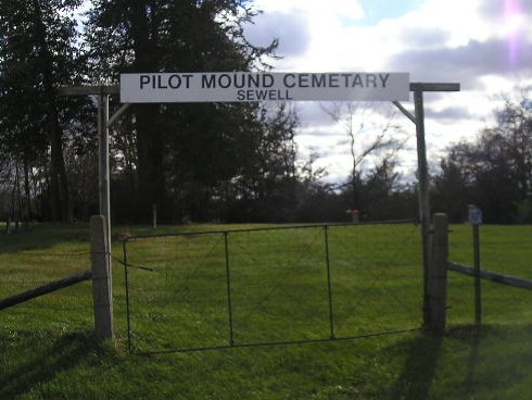
| Memorials | : | 16 |
| Location | : | Janesville, Bremer County, USA |
| Coordinate | : | 42.6856003, -92.5141983 |
frequently asked questions (FAQ):
-
Where is Pilot Mound Cemetery?
Pilot Mound Cemetery is located at 1200 250 St Janesville, Bremer County ,Iowa ,USA.
-
Pilot Mound Cemetery cemetery's updated grave count on graveviews.com?
16 memorials
-
Where are the coordinates of the Pilot Mound Cemetery?
Latitude: 42.6856003
Longitude: -92.5141983
Nearby Cemetories:
1. West Point Cemetery
Bremer County, USA
Coordinate: 42.6680984, -92.5346985
2. Harlington Cemetery
Waverly, Bremer County, USA
Coordinate: 42.7158012, -92.4721985
3. Oakland Cemetery
Janesville, Bremer County, USA
Coordinate: 42.6558930, -92.4559700
4. Newell Cemetery
Black Hawk County, USA
Coordinate: 42.6333008, -92.4903030
5. Peace United Church of Christ Cemetery
Waverly, Bremer County, USA
Coordinate: 42.7192630, -92.4543880
6. Saint Pauls Lutheran Cemetery
Waverly, Bremer County, USA
Coordinate: 42.7188988, -92.4539032
7. Saint Josephs Cemetery
Waverly, Bremer County, USA
Coordinate: 42.7200012, -92.4539032
8. Saint Marys Cemetery
Waverly, Bremer County, USA
Coordinate: 42.7275009, -92.4563980
9. Riverside Cemetery
Shell Rock, Butler County, USA
Coordinate: 42.7126600, -92.5874500
10. Finchford Cemetery
Finchford, Black Hawk County, USA
Coordinate: 42.6276400, -92.5398800
11. Town Line Cemetery
Waverly, Bremer County, USA
Coordinate: 42.7443650, -92.4353380
12. Gerholdt Cemetery
Black Hawk County, USA
Coordinate: 42.6009010, -92.5190130
13. Spring Lake Cemetery
Waverly, Bremer County, USA
Coordinate: 42.7742004, -92.5147018
14. Washington Chapel Cemetery
Cedar Falls, Black Hawk County, USA
Coordinate: 42.5991430, -92.4761210
15. Andrews Cemetery
Waverly, Bremer County, USA
Coordinate: 42.7771988, -92.4772034
16. Highland Cemetery
Black Hawk County, USA
Coordinate: 42.5889670, -92.4804850
17. Warren Evangelical Cemetery
Waverly, Bremer County, USA
Coordinate: 42.7442200, -92.3867400
18. Rude Cemetery
New Hartford, Butler County, USA
Coordinate: 42.5788080, -92.5647070
19. Lowell Cemetery
Clarksville, Butler County, USA
Coordinate: 42.7578011, -92.6346970
20. Antioch Cemetery
Clarksville, Butler County, USA
Coordinate: 42.7740100, -92.6132900
21. Cedar Valley Memorial Gardens
Cedar Falls, Black Hawk County, USA
Coordinate: 42.5802994, -92.4527969
22. Butler County Poor Farm Cemetery
Allison, Butler County, USA
Coordinate: 42.7400800, -92.6635000
23. East Janesville ME Church Cemetery
Black Hawk County, USA
Coordinate: 42.6405500, -92.3573200
24. Saint Pauls Cemetery
Black Hawk County, USA
Coordinate: 42.6288360, -92.3580370


