
| Memorials | : | 413 |
| Location | : | Corbin, Knox County, USA |
| Coordinate | : | 36.9544190, -84.0838190 |
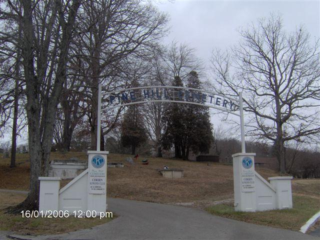
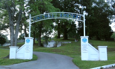
| Description | : | Pine Hill Cemetery is located on the Knox County side (east side) of Corbin. The boundary between Whitley County, Kentucky and Knox County, Kentucky runs roughly along US-25W (Laurel Ave/Skinier St/W Dixie Hwy). Pine Hill Cemetery was opened around 1900 and served as the primary burial ground for Corbin, Kentucky from 1900 to 1930 with lots of burials continuing into the 1940s and 1950s. Resthaven Cemetery, which is located on the back side of Pine Hill Cemetery, was opened in the late 1920s and was the primary burial ground after Pine Hill Cemetery started to fill. During the early years, Pine... Read More |
frequently asked questions (FAQ):
-
Where is Pine Hill Cemetery?
Pine Hill Cemetery is located at Corbin, Knox County ,Kentucky ,USA.
-
Pine Hill Cemetery cemetery's updated grave count on graveviews.com?
402 memorials
-
Where are the coordinates of the Pine Hill Cemetery?
Latitude: 36.9544190
Longitude: -84.0838190
Nearby Cemetories:
1. Rest Haven Cemetery
Corbin, Knox County, USA
Coordinate: 36.9609100, -84.0830500
2. Williams Cemetery
Corbin, Knox County, USA
Coordinate: 36.9433300, -84.0727800
3. Lynn Camp Cemetery
Corbin, Knox County, USA
Coordinate: 36.9493850, -84.0532150
4. Harts Cemetery
Corbin, Knox County, USA
Coordinate: 36.9319000, -84.0646973
5. Felts Chapel Cemetery
Laurel County, USA
Coordinate: 36.9841720, -84.0911260
6. Old Stansberry Cemetery
Hopewell, Laurel County, USA
Coordinate: 36.9874640, -84.0849890
7. Calvary Cemetery
Corbin, Knox County, USA
Coordinate: 36.9357986, -84.0438995
8. Horse Creek Baptist Church Cemetery
Corbin, Knox County, USA
Coordinate: 36.9895080, -84.0645900
9. John Colvin Helton Cemetery
Gray, Knox County, USA
Coordinate: 36.9412790, -84.0307390
10. Hart Family Cemetery
Knox County, USA
Coordinate: 36.9081420, -84.0702150
11. William Lee Cemetery
Corbin, Knox County, USA
Coordinate: 36.9863880, -84.0325080
12. Liberty Cemetery
Corbin, Knox County, USA
Coordinate: 36.9071999, -84.0543976
13. Flannelly Cemetery
Knox County, USA
Coordinate: 36.9860420, -84.0280480
14. Chappelle Cemetery
Keavy, Laurel County, USA
Coordinate: 36.9721200, -84.1506900
15. Garland Cemetery
Gray, Knox County, USA
Coordinate: 36.9695740, -84.0114670
16. Gray's Cemetery
Gray, Knox County, USA
Coordinate: 36.9480057, -84.0079041
17. Davis Cemetery
Gray, Knox County, USA
Coordinate: 36.9441795, -84.0080719
18. Cox Cemetery
Gray, Knox County, USA
Coordinate: 36.9507828, -84.0053482
19. Reeves Cemetery
Gray, Knox County, USA
Coordinate: 36.9433060, -84.0062714
20. Candle Ridge Cemetery
Gray, Knox County, USA
Coordinate: 36.9233284, -84.0152817
21. Jones Family Cemetery
Gray, Knox County, USA
Coordinate: 36.9397390, -83.9990190
22. TSGT Russell B. Martin Memorial Cemetery
Gray, Knox County, USA
Coordinate: 36.9526000, -83.9961000
23. Gambrel Cemetery
Keavy, Laurel County, USA
Coordinate: 37.0213970, -84.1170190
24. Black Cemetery
Gray, Knox County, USA
Coordinate: 36.9538994, -83.9891968