
| Memorials | : | 7 |
| Location | : | Hohenwald, Lewis County, USA |
| Coordinate | : | 35.5107994, -87.4606018 |
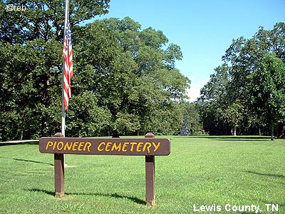
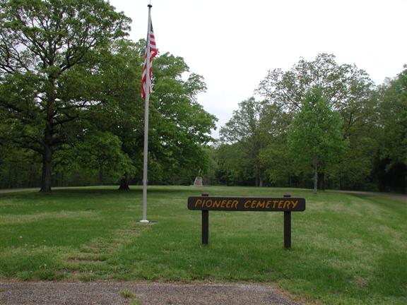
| Description | : | The Meriwether Lewis Monument was built in 1848 with funding provided by the Tennessee legislature. The legislation provided $500 "to preserve the place of internment, where the remains of General Meriwether Lewis were deposited." The most noticeable feature of the monument is the broken shaft. This was done deliberately and was a common custom in the 1800s. The broken shaft represents a life cut short by an untimely death. The Pioneer Cemetery was first started in 1856, 47 years after Meriwether Lewis died and was buried. There are roughly 100 burials in the cemetery today. The War Department... Read More |
frequently asked questions (FAQ):
-
Where is Pioneer Cemetery?
Pioneer Cemetery is located at Hohenwald, Lewis County ,Tennessee ,USA.
-
Pioneer Cemetery cemetery's updated grave count on graveviews.com?
7 memorials
-
Where are the coordinates of the Pioneer Cemetery?
Latitude: 35.5107994
Longitude: -87.4606018
Nearby Cemetories:
1. Wright Cemetery
Lewis County, USA
Coordinate: 35.5208015, -87.4803009
2. Himes Cemetery
Lewis County, USA
Coordinate: 35.4925003, -87.4443970
3. Springer Cemetery
Lewis County, USA
Coordinate: 35.5278015, -87.4888992
4. Grinders Creek Cemetery
Lewis County, USA
Coordinate: 35.5099983, -87.4963989
5. Piney Cemetery
Lewis County, USA
Coordinate: 35.5489006, -87.4807968
6. Pollock Cemetery
Lewis County, USA
Coordinate: 35.4672012, -87.5006027
7. Lewis County Memorial Gardens
Hohenwald, Lewis County, USA
Coordinate: 35.5361700, -87.5221900
8. Stoney- Lonesome Cemetery
Lewis County, USA
Coordinate: 35.5606003, -87.4199982
9. Hensley Cemetery
Lewis County, USA
Coordinate: 35.5597000, -87.4141998
10. Mount Sinai Cemetery
Lewis County, USA
Coordinate: 35.5722008, -87.4503021
11. Loveless Cemetery
Hohenwald, Lewis County, USA
Coordinate: 35.5647087, -87.5078506
12. Collier Cemetery
Lewis County, USA
Coordinate: 35.4606018, -87.5171967
13. Grinders Creek Cemetery
Lewis County, USA
Coordinate: 35.4944000, -87.5438995
14. Poore Cemetery
Lewis County, USA
Coordinate: 35.4874992, -87.5430984
15. Freedom Holy Temple Cemetery
Hohenwald, Lewis County, USA
Coordinate: 35.5015340, -87.5482810
16. Napier Cemetery
Hohenwald, Lewis County, USA
Coordinate: 35.4403000, -87.4788971
17. Blackwell Cemetery
Lewis County, USA
Coordinate: 35.5656013, -87.4011002
18. Johnson Cemetery
Lewis County, USA
Coordinate: 35.5825005, -87.4411011
19. Newtown Cemetery
Lewis County, USA
Coordinate: 35.4399986, -87.4906006
20. Napier Cemetery
Lewis County, USA
Coordinate: 35.4367000, -87.4783000
21. Gordonsburg Cemetery
Lewis County, USA
Coordinate: 35.5696983, -87.4013977
22. Himes Cemetery
Lewis County, USA
Coordinate: 35.4796982, -87.3732986
23. Swiss Cemetery
Hohenwald, Lewis County, USA
Coordinate: 35.5410995, -87.5485992
24. Saint Peters Cemetery
Hohenwald, Lewis County, USA
Coordinate: 35.5494290, -87.5439070