
| Memorials | : | 8 |
| Location | : | Piopio, Waitomo District, New Zealand |
| Coordinate | : | -38.4317400, 175.0368100 |
| Description | : | PIOPIO (commonly sounded as pew pew), is a rural King Country community, a small town in the Waitomo District. Situated on State Highway 3 approximately 23km from Te Kuiti and 100km south of Hamilton, Waikato It is thought to be named after the exrinct Native Thrush, that were, until recently, considered part of an endemic family, Turnagridae, but due to mitochondrial DNA testing they are now treated as part of the birds–of–paradise and bowerbird assemblage, perhaps most closely related to the catbirds of eastern Australia. All Streets in Piopio are named after NZ native birds the SOLDIERS ROLL OF HONOUR on the PIOPIO... Read More |
frequently asked questions (FAQ):
-
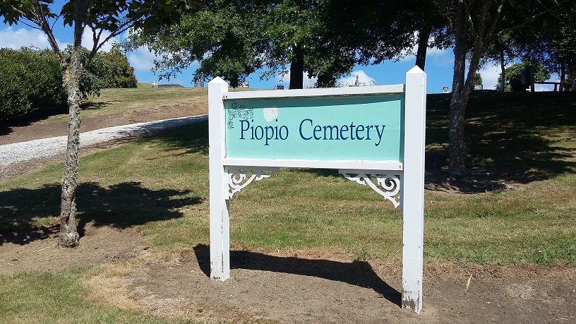
Where is Piopio Cemetery?
Piopio Cemetery is located at Mangakowhai Road Piopio, Waitomo District ,Waikato ,New Zealand.
-
Piopio Cemetery cemetery's updated grave count on graveviews.com?
7 memorials
-
Where are the coordinates of the Piopio Cemetery?
Latitude: -38.4317400
Longitude: 175.0368100
Nearby Cemetories:
1. Te Kuiti Urupā
Te Kuiti, Waitomo District, New Zealand
Coordinate: -38.3389261, 175.1680442
2. Aria Cemetery
Te Kuiti, Waitomo District, New Zealand
Coordinate: -38.5690000, 174.9859000
3. Te Kuiti Old Cemetery
Te Kuiti, Waitomo District, New Zealand
Coordinate: -38.3110400, 175.1845900
4. Te Kuiti New Cemetery
Te Kuiti, Waitomo District, New Zealand
Coordinate: -38.3109520, 175.1869800
5. Mapiu Cemetery
Mapiu, Waitomo District, New Zealand
Coordinate: -38.5861960, 175.2128920
6. Mangapehi Māori Cemetery
Kopaki, Waitomo District, New Zealand
Coordinate: -38.5091100, 175.2980200
7. Te Kotahitanga Marae Māori Cemetery
Otorohanga, Otorohanga District, New Zealand
Coordinate: -38.1968100, 175.2188100
8. Kiritehere Cemetery
Marokopa, Waitomo District, New Zealand
Coordinate: -38.3227790, 174.7103940
9. Otorohanga Public Cemetery
Otorohanga, Otorohanga District, New Zealand
Coordinate: -38.1834100, 175.2215500
10. Te Waitere Cemetery
Te Waitere, Waitomo District, New Zealand
Coordinate: -38.1466690, 174.8230130
11. Matiere Cemetery
Matiere, Ruapehu District, New Zealand
Coordinate: -38.7627300, 175.1016100
12. Ohura Cemetery
Taumarunui, Ruapehu District, New Zealand
Coordinate: -38.8410400, 174.9706700
13. Mokau Public Cemetery
Mokau, Waitomo District, New Zealand
Coordinate: -38.6942500, 174.6175400
14. Kawhia Cemetery
Kawhia, Otorohanga District, New Zealand
Coordinate: -38.0441760, 174.8274300
15. Tokanui Hospital Cemetery
Te Awamutu, Waipa District, New Zealand
Coordinate: -38.0719300, 175.3329900
16. Taringamotu Māori Cemetery
Taringamotu, Ruapehu District, New Zealand
Coordinate: -38.8275100, 175.3158200
17. Taumarunui New Cemetery
Taumarunui, Ruapehu District, New Zealand
Coordinate: -38.8601400, 175.2466100
18. Rewi Maniapoto Reserve
Kihikihi, Waipa District, New Zealand
Coordinate: -38.0389437, 175.3454567
19. Kihikihi Cemetery
Te Awamutu, Waipa District, New Zealand
Coordinate: -38.0415490, 175.3560930
20. Pirongia Cemetery
Te Awamutu, Waipa District, New Zealand
Coordinate: -37.9870310, 175.2115260
21. Taumarunui Old Cemetery
Taumarunui, Ruapehu District, New Zealand
Coordinate: -38.8754650, 175.2541640
22. St Johns Anglican Church Cemetery
Te Awamutu, Waipa District, New Zealand
Coordinate: -38.0091760, 175.3278440
23. Te Awamutu Cemetery
Te Awamutu, Waipa District, New Zealand
Coordinate: -37.9991220, 175.3426520
24. Saint Paul's Churchyard Cemetery
Te Awamutu, Waipa District, New Zealand
Coordinate: -38.0143750, 175.3767790