
| Memorials | : | 1 |
| Location | : | Cypher, Bedford County, USA |
| Coordinate | : | 40.1013031, -78.3441696 |
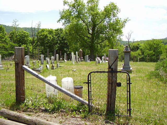
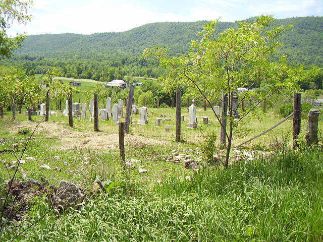
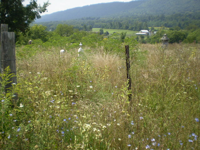
| Description | : | Piper Farm Cemetery is on a hill on Black Oak Ridge east of Route 26 and off Township Road 1020. It is on the southern end of Black Oak Ridge and west of Piper Hill Road. http://www.pa-roots.com/~bedford/history/fortpiper.html "He then began the construction of a log fort at the southern end of Black Oak Ridge, near Colonel Piper's house, and frequently was this place occupied by troops of the Revolution who were sent there to protect the settlers. Some time after this Colonel Piper erected a substantial stone house of two stories, to which many settlers at various periods fled for refuge,... Read More |
frequently asked questions (FAQ):
-
Where is Piper Cemetery?
Piper Cemetery is located at Cypher, Bedford County ,Pennsylvania ,USA.
-
Piper Cemetery cemetery's updated grave count on graveviews.com?
1 memorials
-
Where are the coordinates of the Piper Cemetery?
Latitude: 40.1013031
Longitude: -78.3441696
Nearby Cemetories:
1. Burket Cemetery
Hopewell, Bedford County, USA
Coordinate: 40.1096990, -78.3360280
2. Cypher Farm Cemetery
Hopewell, Bedford County, USA
Coordinate: 40.0889000, -78.2949000
3. Cypher Graveyard
Hopewell, Bedford County, USA
Coordinate: 40.0889400, -78.2948500
4. Hinish Family Cemetery
Hopewell Township, Bedford County, USA
Coordinate: 40.0687670, -78.3121140
5. Stayer Farm Cemetery
New Enterprise, Bedford County, USA
Coordinate: 40.1235550, -78.3989560
6. Koontz Church of the Brethren Cemetery
Loysburg, Bedford County, USA
Coordinate: 40.1400920, -78.3986360
7. Loysburg Hill Cemetery
Loysburg, Bedford County, USA
Coordinate: 40.1603370, -78.3831860
8. Hopewell Cemetery
Hopewell, Bedford County, USA
Coordinate: 40.1418991, -78.2755966
9. Saint John's Reformed Church Cemetery
Loysburg, Bedford County, USA
Coordinate: 40.1641000, -78.3778000
10. Providence Union Church Cemetery
Everett, Bedford County, USA
Coordinate: 40.0284691, -78.3327789
11. Langdondale Community Cemetery
Hopewell, Bedford County, USA
Coordinate: 40.1283302, -78.2478867
12. Morgart and Morgret Cemetery
Everett, Bedford County, USA
Coordinate: 40.0201710, -78.3202778
13. Asbury Methodist Episcopal Church Cemetery
Graceville, Bedford County, USA
Coordinate: 40.0376015, -78.2672653
14. George Michael Imler Family Cemetery
Bedford County, USA
Coordinate: 40.1202540, -78.4579400
15. New Enterprise Cemetery
New Enterprise, Bedford County, USA
Coordinate: 40.1736488, -78.4141998
16. Saint James Lutheran Cemetery
Bedford, Bedford County, USA
Coordinate: 40.0713654, -78.4558182
17. Everett Cemetery
Everett, Bedford County, USA
Coordinate: 40.0107994, -78.3593979
18. Graceville Lutheran Church Cemetery
Graceville, Bedford County, USA
Coordinate: 40.0515175, -78.2442169
19. Albright Cemetery
Dutch Corner, Bedford County, USA
Coordinate: 40.0970000, -78.4640000
20. Rays Cove Christian Church Cemetery
Breezewood, Bedford County, USA
Coordinate: 40.0247650, -78.2764969
21. Pleasant Hill Reformed Church Cemetery
Imlertown, Bedford County, USA
Coordinate: 40.0947914, -78.4669113
22. Stayer Cemetery
Dutch Corner, Bedford County, USA
Coordinate: 40.0621550, -78.4594870
23. Bald Hill Cemetery
Everett, Bedford County, USA
Coordinate: 40.0242800, -78.4258600
24. Bald Hill Cemetery
Everett, Bedford County, USA
Coordinate: 40.0254390, -78.4371490