
| Memorials | : | 0 |
| Location | : | Flowery Branch, Hall County, USA |
| Coordinate | : | 34.1280310, -83.8821600 |
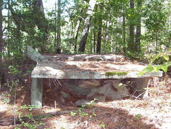
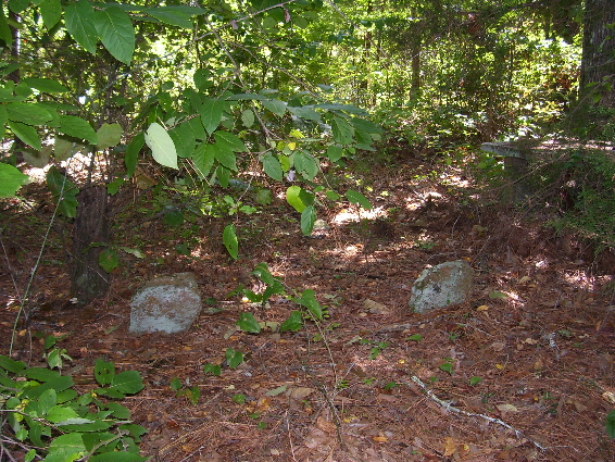
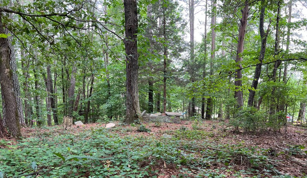
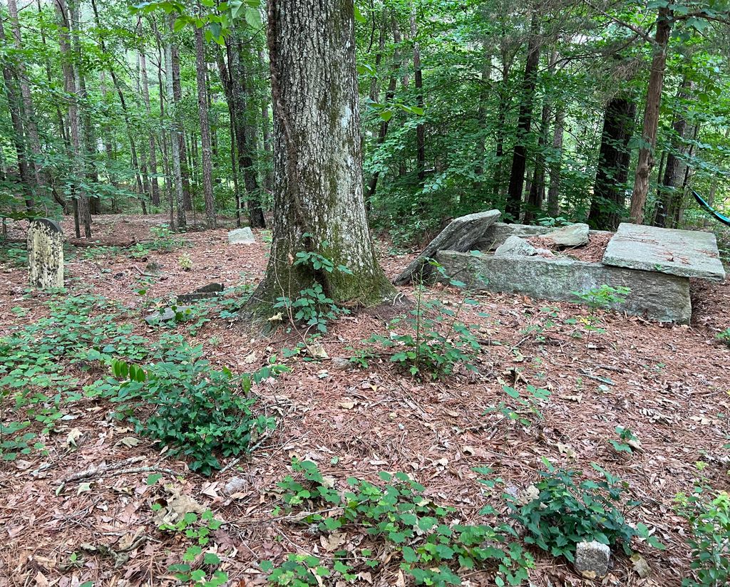
| Description | : | Directions from I-985 traveling north toward Flowery Branch, GA: Take Spouts Springs Road exit and turn right at end of ramp. Travel 4.1 miles to 7038 Spouts Spring Road, Mr. Hugh Atkinson's home (770-967-4405). Turn in the driveway and the cemetery is directly across from his garage to the left in the woods. There are approximately 20-30 graves. Only three headstones have markings. The cemetery is on private property and you should call for permission before visiting. The cemetery is directly across from Mr. Atkinson's garage to the left in the woods. The cemetery is in disrepair and needs... Read More |
frequently asked questions (FAQ):
-
Where is Pirkle Family Cemetery?
Pirkle Family Cemetery is located at 7038 Spouts Spring Road Flowery Branch, Hall County ,Georgia ,USA.
-
Pirkle Family Cemetery cemetery's updated grave count on graveviews.com?
0 memorials
-
Where are the coordinates of the Pirkle Family Cemetery?
Latitude: 34.1280310
Longitude: -83.8821600
Nearby Cemetories:
1. Pirkle Family Cemetery #2
Flowery Branch, Hall County, USA
Coordinate: 34.1276820, -83.8811960
2. Fraser Family Cemetery #2
Flowery Branch, Hall County, USA
Coordinate: 34.1232986, -83.8768997
3. Piney Grove Church Cemetery
Flowery Branch, Hall County, USA
Coordinate: 34.1499990, -83.8918460
4. Tuggle Cemetery
Hall County, USA
Coordinate: 34.1085900, -83.8646900
5. Fraser Family Cemetery #1
Flowery Branch, Hall County, USA
Coordinate: 34.1317930, -83.8500390
6. Cherokee Bluffs Park Cemetery
Flowery Branch, Hall County, USA
Coordinate: 34.1347770, -83.9137160
7. Waters Cemetery
Hall County, USA
Coordinate: 34.1184100, -83.9130600
8. Cash Cleghorn Orr Family Cemetery
Flowery Branch, Hall County, USA
Coordinate: 34.1528500, -83.8961300
9. Sardis Methodist Church Cemetery
Buford, Gwinnett County, USA
Coordinate: 34.1003990, -83.8781204
10. Union Cemetery
Flowery Branch, Hall County, USA
Coordinate: 34.1543999, -83.8630981
11. Friendship Baptist Church Cemetery #01
Buford, Hall County, USA
Coordinate: 34.1257000, -83.9202000
12. Mauldin Family Cemetery
Flowery Branch, Hall County, USA
Coordinate: 34.1033900, -83.8565100
13. Friendship Baptist Church Cemetery #02
Buford, Hall County, USA
Coordinate: 34.1272000, -83.9230000
14. Pleasant Hill Cemetery
Braselton, Hall County, USA
Coordinate: 34.1392200, -83.8424000
15. Mauldin Family Cemetery #2
Flowery Branch, Hall County, USA
Coordinate: 34.0986300, -83.8565500
16. Mulberry Baptist Church Cemetery
Gwinnett County, USA
Coordinate: 34.1143494, -83.8361435
17. Open Door Baptist Church Cemetery
Flowery Branch, Hall County, USA
Coordinate: 34.1494670, -83.9266780
18. Dobbs Family Cemetery
Gwinnett County, USA
Coordinate: 34.0860760, -83.8579130
19. Wood Family Private Cemetery
Buford, Gwinnett County, USA
Coordinate: 34.0806550, -83.8668190
20. Arise Church Cemetery
Flowery Branch, Hall County, USA
Coordinate: 34.1739590, -83.9063260
21. Rock of Christ Baptist Church Cemetery
Flowery Branch, Hall County, USA
Coordinate: 34.1704056, -83.9160222
22. Old Zion Hill Baptist Church Cemetery
Buford, Gwinnett County, USA
Coordinate: 34.0985941, -83.9338255
23. Zion Hill Baptist Church Cemetery
Buford, Gwinnett County, USA
Coordinate: 34.0995500, -83.9364330
24. Antioch Baptist Church Cemetery
Buford, Gwinnett County, USA
Coordinate: 34.0723600, -83.8970500