
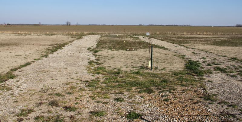
| Memorials | : | 0 |
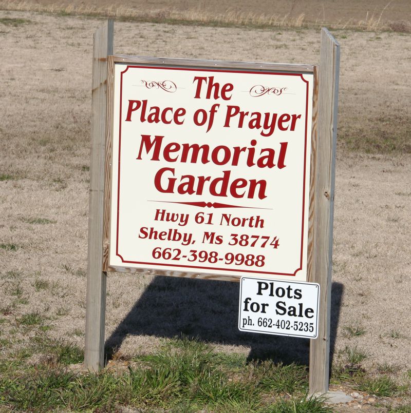
| Location | : | Shelby, Bolivar County, USA |
| Coordinate | : | 33.9622590, -90.7589380 |
| Description | : | Alongside the northbound lane of US Highway 61, north of Shelby MS. |
frequently asked questions (FAQ):
-
Where is Place of Prayer Memorial Garden?
Place of Prayer Memorial Garden is located at Shelby, Bolivar County ,Mississippi ,USA.
-
Place of Prayer Memorial Garden cemetery's updated grave count on graveviews.com?
0 memorials
-
Where are the coordinates of the Place of Prayer Memorial Garden?
Latitude: 33.9622590
Longitude: -90.7589380
Nearby Cemetories:
1. Macedonia Cemetery
Shelby, Bolivar County, USA
Coordinate: 33.9669500, -90.7741300
2. Shiloh Missionary Baptist Church Cemetery
Shelby, Bolivar County, USA
Coordinate: 33.9426900, -90.7634230
3. Zion Grove Memorial Cemetery
Shelby, Bolivar County, USA
Coordinate: 33.9382200, -90.7675400
4. Pleasant Grove OMC Cemetery
Shelby, Bolivar County, USA
Coordinate: 33.9375900, -90.7409200
5. Union Hill Church Cemetery
Shelby, Bolivar County, USA
Coordinate: 33.9597700, -90.7975200
6. Morning Star Church Cemetery
Shelby, Bolivar County, USA
Coordinate: 33.9524300, -90.7206100
7. Shelby Cemetery
Shelby, Bolivar County, USA
Coordinate: 33.9333000, -90.7806015
8. Magnolia Church Cemetery
Hushpuckena, Bolivar County, USA
Coordinate: 33.9845700, -90.7099500
9. Peters Rock Cemetery
Shelby, Bolivar County, USA
Coordinate: 33.9813995, -90.8125000
10. Sanders Cemetery
Shaw, Bolivar County, USA
Coordinate: 34.0066986, -90.7125015
11. Pilgrim Rest Cemetery
Winstonville, Bolivar County, USA
Coordinate: 33.9065200, -90.7283500
12. Saint James Cemetery
Shelby, Bolivar County, USA
Coordinate: 33.9308400, -90.8231300
13. Turners Chapel Cemetery
Bolivar County, USA
Coordinate: 33.9791985, -90.8313980
14. Union Temple Cemetery
Bolivar County, USA
Coordinate: 34.0167007, -90.7127991
15. Bradford Chapel Cemetery
Winstonville, Bolivar County, USA
Coordinate: 33.9236300, -90.6933200
16. German Lane Cemetery
Bolivar County, USA
Coordinate: 33.9519005, -90.6763992
17. Brown Temple Cemetery
Perthshire, Bolivar County, USA
Coordinate: 33.9592100, -90.8478300
18. Azion Missionary Baptist Church Cemetery
Mound Bayou, Bolivar County, USA
Coordinate: 33.9084240, -90.6977340
19. Zion Church Cemetery
Winstonville, Bolivar County, USA
Coordinate: 33.9083300, -90.6975500
20. Saint Joseph Cemetery
Bolivar County, USA
Coordinate: 34.0321999, -90.7953033
21. Spring Hill Church Cemetery
Winstonville, Bolivar County, USA
Coordinate: 33.9234400, -90.6758100
22. Mound Bayou Memorial Gardens
Mound Bayou, Bolivar County, USA
Coordinate: 33.8864300, -90.7268800
23. Pleasant Green Cemetery
Mound Bayou, Bolivar County, USA
Coordinate: 33.8796700, -90.7826500
24. Mount Olive Cemetery
Bolivar County, USA
Coordinate: 34.0147018, -90.8403015