
| Memorials | : | 26 |
| Location | : | Powhatan, Powhatan County, USA |
| Coordinate | : | 37.5917053, -77.7684234 |
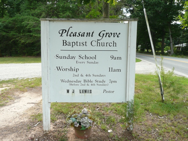
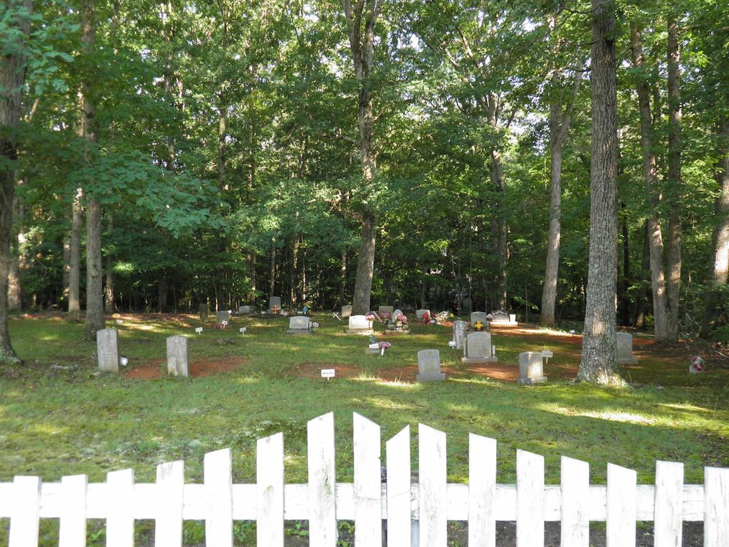
| Description | : | Pleasant Grove Baptist Church 3090 Judes Ferry Road Powhatan County, VA 23139 (804) 379-8402 The cemetery is located 1/10 mile off Route 711 on Route 614. In addition to the tombstones, there are many unmarked graves, graves marked with only stones, and graves marked with temporary funeral home markers. |
frequently asked questions (FAQ):
-
Where is Pleasant Grove Baptist Church Cemetery?
Pleasant Grove Baptist Church Cemetery is located at 3090 Judes Ferry Road Powhatan, Powhatan County ,Virginia , 23139USA.
-
Pleasant Grove Baptist Church Cemetery cemetery's updated grave count on graveviews.com?
26 memorials
-
Where are the coordinates of the Pleasant Grove Baptist Church Cemetery?
Latitude: 37.5917053
Longitude: -77.7684234

Nearby Cemetories:
1. Corinth Christian Church Cemetery
Huguenot, Powhatan County, USA
Coordinate: 37.5775970, -77.7731770
2. Saint Lukes Cemetery
Subletts, Powhatan County, USA
Coordinate: 37.5942001, -77.8007965
3. Boscobel Cemetery
Goochland County, USA
Coordinate: 37.5989330, -77.7239330
4. Subletts Cemetery
Powhatan County, USA
Coordinate: 37.5588989, -77.7928009
5. Saint James Baptist Church Cemetery
Powhatan, Powhatan County, USA
Coordinate: 37.5914680, -77.8250890
6. Willis Family Cemetery
Powhatan, Powhatan County, USA
Coordinate: 37.5477417, -77.7838469
7. Contention Estate Cemetery
Crozier, Goochland County, USA
Coordinate: 37.6196477, -77.8152671
8. Guild Field Baptist Church Cemetery
Powhatan, Powhatan County, USA
Coordinate: 37.5622600, -77.7199320
9. Hebron Presbyterian Church Cemetery
Manakin, Goochland County, USA
Coordinate: 37.6424990, -77.7561850
10. Manakin Cemetery
Powhatan County, USA
Coordinate: 37.5656170, -77.7093130
11. Dover Baptist Church Cemetery
Manakin, Goochland County, USA
Coordinate: 37.6096700, -77.7033280
12. Goat Hill Farm Cemetery
Manakin, Goochland County, USA
Coordinate: 37.5915220, -77.6942780
13. Huguenot Springs Confederate Cemetery
Subletts, Powhatan County, USA
Coordinate: 37.5592003, -77.7046967
14. Gates Cemetery
Crozier, Goochland County, USA
Coordinate: 37.6520000, -77.7536830
15. Gospel Way and Tabernacle Cemetery
Powhatan County, USA
Coordinate: 37.6054070, -77.8450160
16. Alvis Cemetery #3
Manakin, Goochland County, USA
Coordinate: 37.6506270, -77.7388630
17. Old Powhatan Baptist Church Cemetery
Powhatan, Powhatan County, USA
Coordinate: 37.5277060, -77.7793280
18. First Union Baptist Church Cemetery
Goochland County, USA
Coordinate: 37.6554000, -77.7969000
19. Cocke Cemetery #2
Cardwell, Goochland County, USA
Coordinate: 37.6588847, -77.7866205
20. Cocke Family Cemetery
Crozier, Goochland County, USA
Coordinate: 37.6598920, -77.7885140
21. Bondurant Family Cemetery
Powhatan, Powhatan County, USA
Coordinate: 37.5688300, -77.8550600
22. Alvis-Richmond Family Cemetery
Goochland County, USA
Coordinate: 37.6611111, -77.7984444
23. Watkins Cemetery
Powhatan County, USA
Coordinate: 37.5236710, -77.8115780
24. Woodson Grave Site
Cardwell, Goochland County, USA
Coordinate: 37.6681170, -77.7777167