
| Memorials | : | 2 |
| Location | : | Wesson, Union County, USA |
| Coordinate | : | 33.1025000, -92.7946000 |
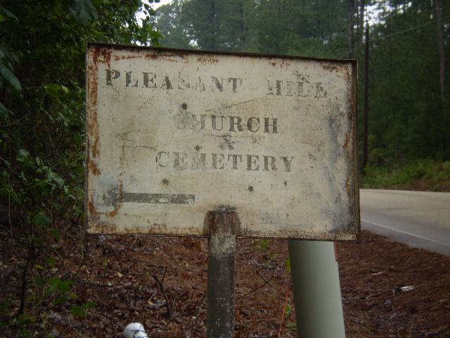
| Description | : | Cemetery has a fence and there is a sign at the main road. The Topo map shows a church on site around 1980, however, there is no church on site now. The earliest death date found was 1883 and it is still active. |
frequently asked questions (FAQ):
-
Where is Pleasant Hill Cemetery?
Pleasant Hill Cemetery is located at Pleasant Hill Road Wesson, Union County ,Arkansas , 71749USA.
-
Pleasant Hill Cemetery cemetery's updated grave count on graveviews.com?
2 memorials
-
Where are the coordinates of the Pleasant Hill Cemetery?
Latitude: 33.1025000
Longitude: -92.7946000

Nearby Cemetories:
1. Beulah Grove Wesson Cemetery
Wesson, Union County, USA
Coordinate: 33.1063995, -92.7696991
2. Pleasant Grove Cemetery
Wesson, Union County, USA
Coordinate: 33.1166000, -92.8188000
3. Wesson Cemetery
Wesson, Union County, USA
Coordinate: 33.1074300, -92.7642700
4. Rose of Sharon
Junction City, Union County, USA
Coordinate: 33.1052000, -92.8359000
5. Andrews Chapel Cemetery
Three Creeks, Union County, USA
Coordinate: 33.1007996, -92.8414001
6. Curtis Grove Cemetery
Newell, Union County, USA
Coordinate: 33.1369019, -92.8341980
7. El Bethel Cemetery
Three Creeks, Union County, USA
Coordinate: 33.0893900, -92.8581000
8. Mount Willie Cemetery
Newell, Union County, USA
Coordinate: 33.1495000, -92.8342000
9. Three Creeks Baptist Church Cemetery
Three Creeks, Union County, USA
Coordinate: 33.0825410, -92.8683150
10. Brown Cemetery
Three Creeks, Union County, USA
Coordinate: 33.0770000, -92.8669000
11. Scotland Presbyterian Cemetery
Scotland, Union County, USA
Coordinate: 33.0479200, -92.7508100
12. Jones Cemetery
Three Creeks, Union County, USA
Coordinate: 33.0705000, -92.8649000
13. Hopewell Cemetery
Lisbon, Union County, USA
Coordinate: 33.1442400, -92.8619000
14. Carroll Cemetery
Wesson, Union County, USA
Coordinate: 33.1724000, -92.8037000
15. Old Parkers Chapel Cemetery
Parkers Chapel, Union County, USA
Coordinate: 33.1470000, -92.7258300
16. Cummings Cemetery
Junction City, Union County, USA
Coordinate: 33.0989000, -92.7037800
17. Macedonia Church Cemetery
Junction City, Union County, USA
Coordinate: 33.0307800, -92.8319000
18. Shady Grove Cemetery
Parkers Chapel, Union County, USA
Coordinate: 33.1350000, -92.7093000
19. Meek-Traylor Cemetery
Parkers Chapel, Union County, USA
Coordinate: 33.1333677, -92.7002846
20. Parkers Chapel Church Cemetery
Parkers Chapel, Union County, USA
Coordinate: 33.1724500, -92.7217700
21. Cobb Cemetery
Junction City, Union County, USA
Coordinate: 33.0668000, -92.6920000
22. Harris Cemetery
El Dorado, Union County, USA
Coordinate: 33.1966600, -92.8031000
23. Meek Family Cemetery
Caledonia, Union County, USA
Coordinate: 33.0574000, -92.6938000
24. Community Cemetery
Junction City, Union County, USA
Coordinate: 33.0271000, -92.7218000