
| Memorials | : | 0 |
| Location | : | Plougoumelen, Departement du Morbihan, France |
| Coordinate | : | 47.6528100, -2.9149400 |
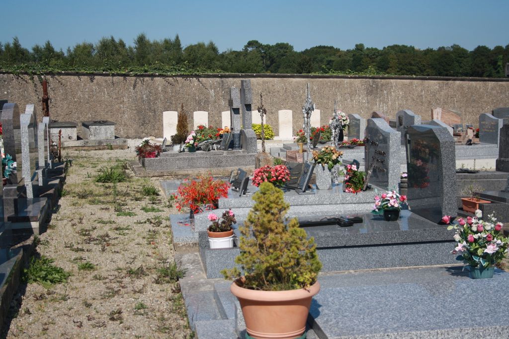
| Description | : | Plougoumelen is a village and commune 12 kilometres west of Vannes and about 3 kilometres south-west of Auray, on a by-road south of the main road from Vannes. Auray is on the Paris Le Mans-Nantes-Quimper railway line. Plougoumelen Communal Cemetery is on the eastern side of the village, north of the road to Ploeren. North-east (far right) of the entrance, against the boundary wall, is the collective grave of six airmen. |
frequently asked questions (FAQ):
-
Where is Plougoumelen Communal Cemetery?
Plougoumelen Communal Cemetery is located at Plougoumelen, Departement du Morbihan ,Bretagne ,France.
-
Plougoumelen Communal Cemetery cemetery's updated grave count on graveviews.com?
0 memorials
-
Where are the coordinates of the Plougoumelen Communal Cemetery?
Latitude: 47.6528100
Longitude: -2.9149400
Nearby Cemetories:
1. Pluneret Cimetière
Pluneret, Departement du Morbihan, France
Coordinate: 47.6759780, -2.9577430
2. Sainte-Anne d'Auray French National Cemetery
Sainte-Anne-d'Auray, Departement du Morbihan, France
Coordinate: 47.7082300, -2.9554900
3. Ile-Aux-Moines Communal Cemetery
Ile-aux-Moines, Departement du Morbihan, France
Coordinate: 47.5988800, -2.8420200
4. Berder Island Cemetery
Larmor-Baden, Departement du Morbihan, France
Coordinate: 47.5818520, -2.8852420
5. La Trinite-sur-Mer Communal Cemetery
La Trinite-sur-Mer, Departement du Morbihan, France
Coordinate: 47.5874600, -3.0307400
6. Arzon
Arzon, Departement du Morbihan, France
Coordinate: 47.5497918, -2.8929964
7. Cathédrale Saint-Pierre de Vannes
Vannes, Departement du Morbihan, France
Coordinate: 47.6579290, -2.7567400
8. Vannes Boismoreau Communal Cemetery
Vannes, Departement du Morbihan, France
Coordinate: 47.6625800, -2.7516100
9. Abbaye Saint-Michel de Kergonan
Plouharnel, Departement du Morbihan, France
Coordinate: 47.5978290, -3.1120490
10. Sarzeau Communal Cemetery
Sarzeau, Departement du Morbihan, France
Coordinate: 47.5292500, -2.7682800
11. Quiberon Communal Cemetery
Quiberon, Departement du Morbihan, France
Coordinate: 47.4876400, -3.1202400
12. Abbey de la Joie
Hennebont, Departement du Morbihan, France
Coordinate: 47.8140560, -3.2816670
13. Gavres Communal Cemetery
Gavres, Departement du Morbihan, France
Coordinate: 47.6925200, -3.3534900
14. Lanester Communal Cemetery
Lanester, Departement du Morbihan, France
Coordinate: 47.7635100, -3.3443900
15. Lorient Carnel
Lorient, Departement du Morbihan, France
Coordinate: 47.7374285, -3.3667915
16. Église de l'Abbaye Notre-Dame de Prières
Billiers, Departement du Morbihan, France
Coordinate: 47.5241670, -2.4833330
17. Lorient Kerentrech Cemetery
Lorient, Departement du Morbihan, France
Coordinate: 47.7527800, -3.3724800
18. Penestin Communal Cemetery
Penestin, Departement du Morbihan, France
Coordinate: 47.4840800, -2.4745100
19. Reguiny Communal Cemetery
Reguiny, Departement du Morbihan, France
Coordinate: 47.9793100, -2.7474200
20. Le Palais Communal Cemetery
Le Palais, Departement du Morbihan, France
Coordinate: 47.3492300, -3.1634500
21. Piriac New Communal Cemetery
Piriac-sur-Mer, Departement de la Loire-Atlantique, France
Coordinate: 47.3776040, -2.5397940
22. Cimetière Locmaria - Belle Ile
Locmaria, Departement du Morbihan, France
Coordinate: 47.2948800, -3.0850260
23. Basilique Notre Dame du Roncier
Josselin, Departement du Morbihan, France
Coordinate: 47.9535490, -2.5477540
24. Guidel Communal Cemetery
Guidel, Departement du Morbihan, France
Coordinate: 47.7925100, -3.4851900