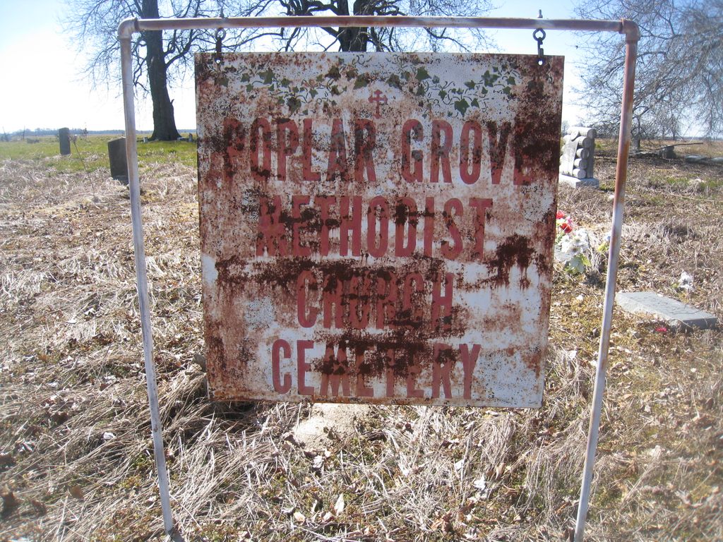
| Memorials | : | 0 |
| Location | : | Boyle, Bolivar County, USA |
| Coordinate | : | 33.6676700, -90.7060900 |
| Description | : | There is confusion on the two cemeteries on this road. THIS cemetery is located on the South side of Jones Bayou Road (aka Linn Road) 1.25 miles East of Hwy 61 South. |
frequently asked questions (FAQ):
-
Where is Poplar Grove Methodist Church Cemetery?
Poplar Grove Methodist Church Cemetery is located at Boyle, Bolivar County ,Mississippi ,USA.
-
Poplar Grove Methodist Church Cemetery cemetery's updated grave count on graveviews.com?
0 memorials
-
Where are the coordinates of the Poplar Grove Methodist Church Cemetery?
Latitude: 33.6676700
Longitude: -90.7060900
Nearby Cemetories:
1. Fairview Cemetery
Bolivar County, USA
Coordinate: 33.6713982, -90.7110977
2. Poplar Grove Church Cemetery
Boyle, Bolivar County, USA
Coordinate: 33.6748400, -90.7217100
3. O'Reilly 16th Section Cemetery
O'Reilly, Bolivar County, USA
Coordinate: 33.6730499, -90.7274172
4. Boyle South Cemetery
Bolivar County, USA
Coordinate: 33.6823300, -90.7217900
5. Interstate Baptist Church Cemetery
Cleveland, Bolivar County, USA
Coordinate: 33.6317400, -90.6983900
6. Mullins Cemetery
Cleveland, Bolivar County, USA
Coordinate: 33.7185670, -90.7247330
7. Westlawn Memorial Gardens
Cleveland, Bolivar County, USA
Coordinate: 33.7221170, -90.7201330
8. El Bethel Church Cemetery
Boyle, Bolivar County, USA
Coordinate: 33.6895200, -90.7695500
9. Pleasant Grove Cemetery
Shaw, Bolivar County, USA
Coordinate: 33.6276169, -90.7563171
10. Christ Temple Cemetery
Shaw, Bolivar County, USA
Coordinate: 33.6455800, -90.7813800
11. Williams Family Cemetery
Skene, Bolivar County, USA
Coordinate: 33.7149380, -90.7636360
12. Springhill Cemetery
Steiner, Sunflower County, USA
Coordinate: 33.6055200, -90.6686570
13. Pilgrim Green Church Cemetery
Frazier, Sunflower County, USA
Coordinate: 33.6038400, -90.7452600
14. Linn Methodist Church Cemetery
Linn, Sunflower County, USA
Coordinate: 33.6602783, -90.6197205
15. Linn Baptist Church Cemetery
Linn, Sunflower County, USA
Coordinate: 33.6637802, -90.6167755
16. Strangers Rest Cemetery
Shaw, Bolivar County, USA
Coordinate: 33.6122017, -90.7664032
17. Saint Paul Missionary Baptist Church Cemetery
Shaw, Bolivar County, USA
Coordinate: 33.6601334, -90.7964325
18. Delta Heights Memorial Gardens
Cleveland, Bolivar County, USA
Coordinate: 33.7467003, -90.6924973
19. Ray Memorial Gardens
Shaw, Bolivar County, USA
Coordinate: 33.6085730, -90.7748460
20. Northwest Shaw Memorial Gardens
Shaw, Bolivar County, USA
Coordinate: 33.6081500, -90.7753700
21. Woods Cemetery
Cleveland, Bolivar County, USA
Coordinate: 33.7508507, -90.7205200
22. Sandridge Cemetery
Linn, Sunflower County, USA
Coordinate: 33.6543503, -90.6049347
23. Chrisman Cemetery
Cleveland, Bolivar County, USA
Coordinate: 33.7477989, -90.7461014
24. Shaw Cemetery
Shaw, Bolivar County, USA
Coordinate: 33.6059830, -90.7808500

