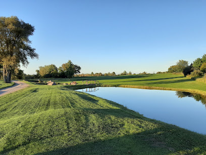
| Memorials | : | 0 |
| Location | : | Dickinson, Franklin County, USA |
| Coordinate | : | 44.6865667, -74.5234333 |
| Description | : | Also known as Daggett Cemetery DIRECTIONS: From St. Regis Falls, turn onto Duane Street for .8 miles. Then turn north onto the Conger Road for .9 miles. Continue straight at the y in the road in front of the Pot Hook Hill Hunting Club. The cemetery is just a bit further on your left. OR ... from Dickinson, go .3 miles east on the Church Road. Take the first right, and continue for 2.2 miles. The road will come to a t, right in front of the Pot Hook Hill Hunting Club. Turn left, and the cemetery is just up... Read More |
frequently asked questions (FAQ):
-
Where is Pot Hook Hill Cemetery?
Pot Hook Hill Cemetery is located at Dickinson, Franklin County ,New York ,USA.
-
Pot Hook Hill Cemetery cemetery's updated grave count on graveviews.com?
0 memorials
-
Where are the coordinates of the Pot Hook Hill Cemetery?
Latitude: 44.6865667
Longitude: -74.5234333
Nearby Cemetories:
1. Saint Ann's Cemetery
Saint Regis Falls, Franklin County, USA
Coordinate: 44.6761017, -74.5263977
2. Forest Cemetery
Saint Regis Falls, Franklin County, USA
Coordinate: 44.6749992, -74.5261002
3. Ives Cemetery
Dickinson Center, Franklin County, USA
Coordinate: 44.7164001, -74.5496979
4. Fairview Cemetery
Franklin County, USA
Coordinate: 44.7196999, -74.5599976
5. Palmer Cemetery
Dickinson, Franklin County, USA
Coordinate: 44.7118100, -74.5790900
6. Santa Clara Cemetery
Santa Clara, Franklin County, USA
Coordinate: 44.6346512, -74.4638977
7. East Dickinson Cemetery
East Dickinson, Franklin County, USA
Coordinate: 44.7710700, -74.5165200
8. North Dickinson Cemetery
Dickinson, Franklin County, USA
Coordinate: 44.7656350, -74.5701560
9. Mound Hill Cemetery
Nicholville, St. Lawrence County, USA
Coordinate: 44.6977997, -74.6505966
10. Saint Therese Cemetery
Nicholville, St. Lawrence County, USA
Coordinate: 44.7033310, -74.6590500
11. Chesterfield Cemetery
Lawrenceville, St. Lawrence County, USA
Coordinate: 44.7447014, -74.6669006
12. Holy Cross Cemetery
Hopkinton, St. Lawrence County, USA
Coordinate: 44.6777992, -74.6958008
13. West Bangor Cemetery
Bangor, Franklin County, USA
Coordinate: 44.8011100, -74.4466800
14. Develin Cemetery
Franklin County, USA
Coordinate: 44.8022003, -74.4467010
15. Fort Jackson Hopkinton Cemetery
Hopkinton, St. Lawrence County, USA
Coordinate: 44.6996994, -74.7089005
16. Hill Crest Cemetery
Lawrenceville, St. Lawrence County, USA
Coordinate: 44.7872009, -74.6477966
17. Moira Community Cemetery
Moira, Franklin County, USA
Coordinate: 44.8184900, -74.5598900
18. Saint Marys Cemetery
Brushton, Franklin County, USA
Coordinate: 44.8232994, -74.5224991
19. Saint Peters Cemetery
Brushton, Franklin County, USA
Coordinate: 44.8244019, -74.5216980
20. Stevens Cemetery
Brandon Center, Franklin County, USA
Coordinate: 44.7766000, -74.3746700
21. Brandon Cemetery
Franklin County, USA
Coordinate: 44.7778015, -74.3760986
22. Sunnyside Cemetery
Brushton, Franklin County, USA
Coordinate: 44.8272018, -74.5222015
23. Old Saint Mary's Cemetery
Brushton, Franklin County, USA
Coordinate: 44.8337000, -74.5061330
24. Haleville Cemetery
Stockholm Center, St. Lawrence County, USA
Coordinate: 44.7736015, -74.6932983

