
| Memorials | : | 0 |
| Location | : | Manhattan, New York County (Manhattan), USA |
| Coordinate | : | 40.7622100, -73.9952300 |
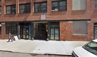
| Description | : | A public cemetery for Manhattan's poor and victims of contagious diseases, it was situated on the north side of West Forty-fifth Street, between Tenth Avenue and Eleventh Avenue. It was the successor to the Potter's Field on East 50th Street, and it served as Manhattan's Potter's Field concurrently with (but preferentially to) the Potter's Field on Randall’s Island. It was superseded by the Potter's Field at Ward's Island in June 1852). ════════════════════════════════════════ ▫ Years of use: 1845 — 1851. ▫ Cemetery disposition: Destroyed. ════════════════════════════════════════ The site is now occupied by brick tenements. |
frequently asked questions (FAQ):
-
Where is Potter's Field Forty-fifth Street?
Potter's Field Forty-fifth Street is located at West 45th Street between 10th & 11th Avenues Manhattan, New York County (Manhattan) ,New York ,USA.
-
Potter's Field Forty-fifth Street cemetery's updated grave count on graveviews.com?
0 memorials
-
Where are the coordinates of the Potter's Field Forty-fifth Street?
Latitude: 40.7622100
Longitude: -73.9952300
Nearby Cemetories:
1. Saint Luke's Lutheran Church Columbarium
New York, New York County (Manhattan), USA
Coordinate: 40.7600350, -73.9883170
2. Saint Paul the Apostle Church Vault
Manhattan, New York County (Manhattan), USA
Coordinate: 40.7693100, -73.9849400
3. Potter’s Field Bryant Park
Manhattan, New York County (Manhattan), USA
Coordinate: 40.7535000, -73.9829700
4. Saint Patrick's Cathedral
Manhattan, New York County (Manhattan), USA
Coordinate: 40.7589300, -73.9765700
5. Saint Thomas Episcopal Church Columbarium
New York County (Manhattan), USA
Coordinate: 40.7607500, -73.9759700
6. B'nai Jeshurun Cemetery
New York County (Manhattan), USA
Coordinate: 40.7484170, -73.9882270
7. Fifth Avenue Presbyterian Church Columbarium
New York, New York County (Manhattan), USA
Coordinate: 40.7619980, -73.9750550
8. Saint Bartholomew's Episcopal Church
Manhattan, New York County (Manhattan), USA
Coordinate: 40.7573600, -73.9731700
9. Potter’s Field Fiftieth Street
Manhattan, New York County (Manhattan), USA
Coordinate: 40.7562500, -73.9734500
10. Mable Collegiate Church Columbarium
Manhattan, New York County (Manhattan), USA
Coordinate: 40.7456670, -73.9870160
11. United Community Church Of NYC
Manhattan, New York County (Manhattan), USA
Coordinate: 40.7477951, -73.9816742
12. Church of the Transfiguration Columbarium
Manhattan, New York County (Manhattan), USA
Coordinate: 40.7451744, -73.9861603
13. Methodist Episcopal Churchyard and Vault
Manhattan, New York County (Manhattan), USA
Coordinate: 40.7436210, -74.0008550
14. Saint Matthews Cemetery
Manhattan, New York County (Manhattan), USA
Coordinate: 40.7549900, -73.9709910
15. Worth Square
Manhattan, New York County (Manhattan), USA
Coordinate: 40.7426600, -73.9889900
16. Eternal Light Monument
Manhattan, New York County (Manhattan), USA
Coordinate: 40.7425000, -73.9886100
17. Third Cemetery of Congregation Shearith Israel
Manhattan, New York County (Manhattan), USA
Coordinate: 40.7417780, -73.9942990
18. Macedonia Baptist Church Cemetery #1
Odenville, St. Clair County, USA
Coordinate: 40.7418950, -73.9893080
19. Potter's Field Madison Square Park
Manhattan, New York County (Manhattan), USA
Coordinate: 40.7421300, -73.9880400
20. Sixteenth Street Baptist Church Vaults
Manhattan, New York County (Manhattan), USA
Coordinate: 40.7409710, -74.0008260
21. Calvary Episcopal Church Columbarium
New York, New York County (Manhattan), USA
Coordinate: 40.7389140, -73.9867200
22. Saint James Episcopal Church Columbarium
Manhattan, New York County (Manhattan), USA
Coordinate: 40.7712326, -73.9656067
23. American Museum Of Natural History
Manhattan, New York County (Manhattan), USA
Coordinate: 40.7808700, -73.9728700
24. Madison Avenue Presbyterian Church Columbarium
New York, New York County (Manhattan), USA
Coordinate: 40.7724900, -73.9645740