
| Memorials | : | 0 |
| Location | : | Anderson, Anderson County, USA |
| Coordinate | : | 34.4908330, -82.6336110 |
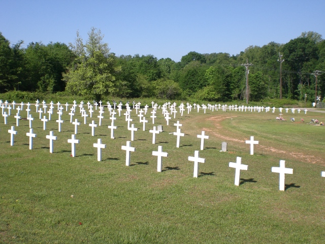
| Description | : | On US Hwy 29. The cemetery is directly behind, and also accessible through, (old) Silver Brook Cemetery; it's about 1/3 mile to New Silver Brook Cemetery, also on US 29. Potters Field is owned and maintained by the City of Anderson and has been in existence since about the mid 1890's. It was intended to provide burial space to those families who cannot afford a grave site or the cost of burial. Most graves are marked by a simple white cross without indentification; however, all interments are said to be known and available from the office at Silver Brook Cemetery. Note that not... Read More |
frequently asked questions (FAQ):
-
Where is Potters Field?
Potters Field is located at US Hwy 29 Anderson, Anderson County ,South Carolina ,USA.
-
Potters Field cemetery's updated grave count on graveviews.com?
0 memorials
-
Where are the coordinates of the Potters Field?
Latitude: 34.4908330
Longitude: -82.6336110
Nearby Cemetories:
1. Silver Brook Cemetery
Anderson, Anderson County, USA
Coordinate: 34.4928017, -82.6361008
2. New Silver Brook Cemetery
Anderson, Anderson County, USA
Coordinate: 34.4860992, -82.6331024
3. Grace Episcopal Church
Anderson, Anderson County, USA
Coordinate: 34.4993050, -82.6470300
4. Saint Johns United Methodist Church Columbarium
Anderson, Anderson County, USA
Coordinate: 34.5007640, -82.6475280
5. First Baptist Church Cemetery
Anderson County, USA
Coordinate: 34.5030750, -82.6464940
6. Orr Mill Cemetery
Anderson, Anderson County, USA
Coordinate: 34.4906006, -82.6544037
7. Old Mount Tabor Baptist Church Cemetery
Anderson, Anderson County, USA
Coordinate: 34.4826590, -82.6523020
8. Saint Joseph's Catholic Church Cemetery (Defunct)
Anderson County, USA
Coordinate: 34.5050354, -82.6486661
9. Westview Cemetery
Anderson, Anderson County, USA
Coordinate: 34.4921989, -82.6575012
10. First Presbyterian Church Cemetery
Anderson, Anderson County, USA
Coordinate: 34.5042800, -82.6542000
11. Nevitt Family Cemetery
Anderson County, USA
Coordinate: 34.4837870, -82.6064050
12. Boulevard Baptist Church Columbarium
Anderson, Anderson County, USA
Coordinate: 34.5155690, -82.6449670
13. Holy Trinity Lutheran Church Columbarium
Anderson, Anderson County, USA
Coordinate: 34.5166600, -82.6519400
14. Burke Family Cemetery
Anderson, Anderson County, USA
Coordinate: 34.4859560, -82.5976550
15. Hammond Family Cemetery
Anderson, Anderson County, USA
Coordinate: 34.5082830, -82.6010490
16. Norris Hill Presbyterian Church Cemetery
Anderson County, USA
Coordinate: 34.4577950, -82.6303180
17. LaBoon Family Cemetery
Anderson County, USA
Coordinate: 34.4991989, -82.6735992
18. Eureka Baptist Church Cemetery
Anderson, Anderson County, USA
Coordinate: 34.5119019, -82.5963974
19. Mary Smith Family Cemetery
Anderson, Anderson County, USA
Coordinate: 34.4699140, -82.5919430
20. Bennett Family Cemetery
Anderson County, USA
Coordinate: 34.4776000, -82.5816500
21. M J Dolly Cooper Veterans Cemetery
Anderson, Anderson County, USA
Coordinate: 34.4820099, -82.5783081
22. Peter Keys Family Cemetery
Anderson, Anderson County, USA
Coordinate: 34.4878500, -82.6911500
23. Davenport Family Cemetery
Anderson, Anderson County, USA
Coordinate: 34.4422890, -82.6479530
24. Welfare Baptist Church Cemetery
Anderson, Anderson County, USA
Coordinate: 34.4895050, -82.5707210