
| Memorials | : | 0 |
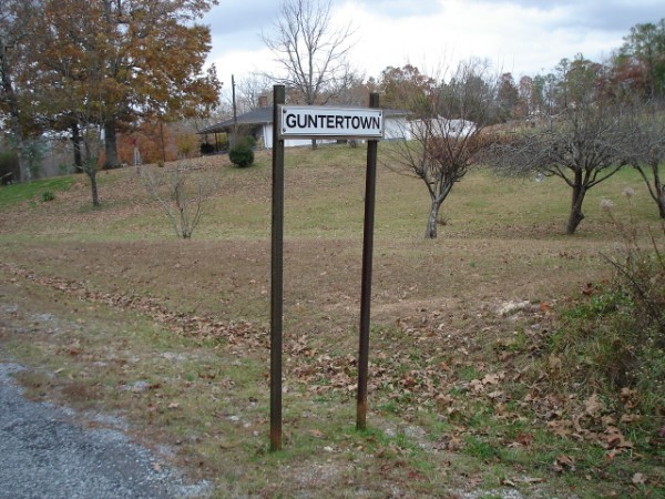
| Location | : | Gunthertown, Clay County, USA |
| Coordinate | : | 33.3767014, -85.9533005 |
frequently asked questions (FAQ):
-
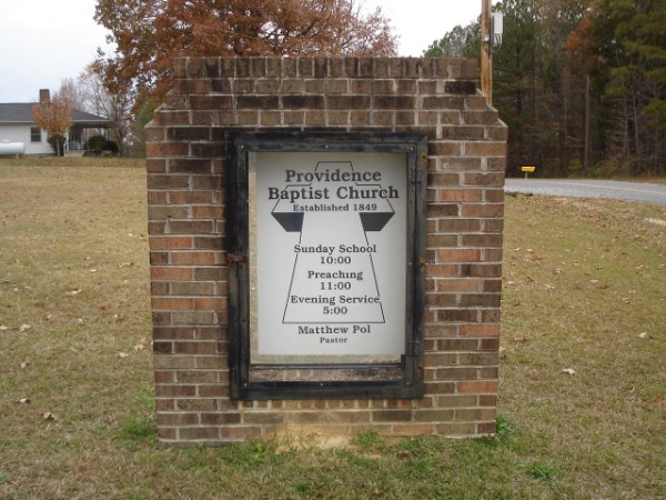
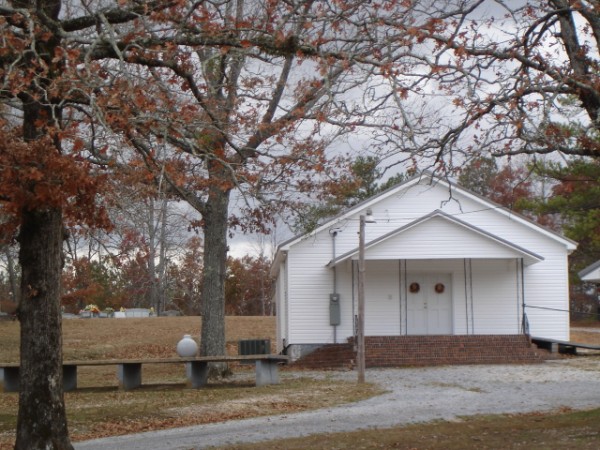
Where is Providence Baptist Church Cemetery?
Providence Baptist Church Cemetery is located at Gunthertown, Clay County ,Alabama ,USA.
-
Providence Baptist Church Cemetery cemetery's updated grave count on graveviews.com?
0 memorials
-
Where are the coordinates of the Providence Baptist Church Cemetery?
Latitude: 33.3767014
Longitude: -85.9533005

Nearby Cemetories:
1. Union T Baptist Church Cemetery
Talladega County, USA
Coordinate: 33.3758060, -85.9811720
2. Clairmont Springs Cemetery
Clay County, USA
Coordinate: 33.3563995, -85.9269028
3. Burgess Cemetery
Talladega County, USA
Coordinate: 33.3577995, -85.9813995
4. Mountain Cemetery
Ironaton, Talladega County, USA
Coordinate: 33.4095450, -85.9820500
5. Mountain Cemetery
Ironaton, Talladega County, USA
Coordinate: 33.4095470, -85.9825230
6. Mountain Cemetery
Munford, Talladega County, USA
Coordinate: 33.4100706, -85.9816691
7. Seay Chapel Cemetery
Talladega County, USA
Coordinate: 33.4141998, -85.9869003
8. Sardis Methodist Cemetery
Clay County, USA
Coordinate: 33.3328018, -85.9206009
9. Horse Creek Cemetery
Watts Crossroads, Clay County, USA
Coordinate: 33.4221992, -85.9178009
10. Mineral Springs Methodist Church Cemetery
Clay County, USA
Coordinate: 33.3703003, -85.8768997
11. Chandler Springs Cemetery
Talladega County, USA
Coordinate: 33.3217810, -85.9983410
12. Spring Hill Baptist Church Cemetery
Clay County, USA
Coordinate: 33.3142014, -85.9214020
13. Pleasant Grove Cemetery
Ashland, Clay County, USA
Coordinate: 33.3232994, -85.9019012
14. Lackey Cemetery
Talladega County, USA
Coordinate: 33.4458008, -85.9527969
15. Poplar Springs Cemetery
Ashland, Clay County, USA
Coordinate: 33.3328018, -85.8827972
16. Ironaton Church of Christ Cemetery
Talladega, Talladega County, USA
Coordinate: 33.4377520, -86.0092210
17. Stockdale Baptist Church Cemetery
Stockdale, Talladega County, USA
Coordinate: 33.4236890, -86.0263890
18. Blankenship Family Cemetery
Munford, Talladega County, USA
Coordinate: 33.4539180, -85.9681500
19. Campbell Springs Cemetery
Clay County, USA
Coordinate: 33.3689003, -85.8600006
20. Boswell Community Cemetery
Stockdale, Talladega County, USA
Coordinate: 33.4313800, -86.0257000
21. Porter Cemetery
Talladega, Talladega County, USA
Coordinate: 33.4125910, -86.0417420
22. Lane Chapel CME Church Cemetery
Talladega County, USA
Coordinate: 33.4000900, -86.0488100
23. Smith Chapel United Methodist Church Cemetery
Munford, Talladega County, USA
Coordinate: 33.4631370, -85.9841710
24. Estes-Pitts Family Cemetery
Talladega County, USA
Coordinate: 33.2934380, -86.0035700