
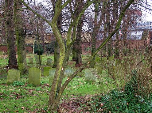
| Memorials | : | 39 |
| Location | : | Norwich, City of Norwich, England |
| Coordinate | : | 52.6361120, 1.2914810 |
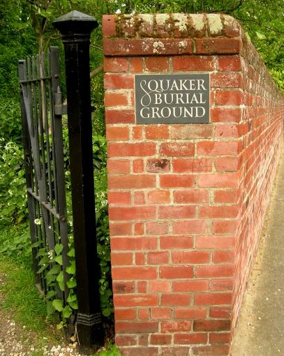
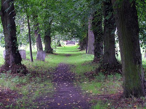
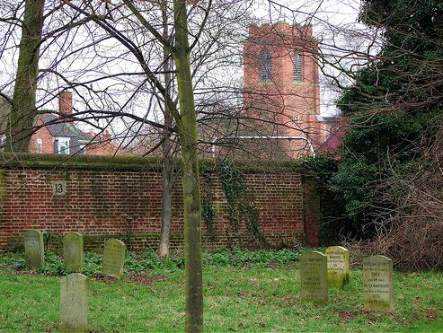
| Description | : | History: There were no public cemeteries those who were not baptised in the established Church had to make their own arrangements, so in March 1670 the Norwich congregation of the Society of Friends (Quakers) bought an acre of land in the south-west quarter of the Gildencroft for use as a burial ground. Bring the coffins into the cemetery was a problem. The coffins had to be carried on the shoulders of bearers along the very narrow Gildencroft Lane (now known as Quakers Lane) from St Martin's Lane or via the even narrower Jenkins Lane from St Martin's... Read More |
frequently asked questions (FAQ):
-
Where is Quaker Burial Ground?
Quaker Burial Ground is located at Chatham Street Norwich, City of Norwich ,Norfolk ,England.
-
Quaker Burial Ground cemetery's updated grave count on graveviews.com?
39 memorials
-
Where are the coordinates of the Quaker Burial Ground?
Latitude: 52.6361120
Longitude: 1.2914810
Nearby Cemetories:
1. St. Augustine's Churchyard
Norwich, City of Norwich, England
Coordinate: 52.6371000, 1.2925960
2. St. Martin at Oak Church
Norwich, City of Norwich, England
Coordinate: 52.6348420, 1.2901930
3. St Mary Coslany Churchyard
Norwich, City of Norwich, England
Coordinate: 52.6341180, 1.2914040
4. St. Michael of Closany Churchyard
Norwich, City of Norwich, England
Coordinate: 52.6329950, 1.2914510
5. Saint Michael Coslany Parish Churchyard
Norwich, City of Norwich, England
Coordinate: 52.6329420, 1.2914110
6. St George Colegate Church
Norwich, City of Norwich, England
Coordinate: 52.6332060, 1.2940200
7. Old Meeting House
Norwich, City of Norwich, England
Coordinate: 52.6338830, 1.2956790
8. St. Saviour Churchyard
Norwich, City of Norwich, England
Coordinate: 52.6351710, 1.2968890
9. St. Clement the Martyr Churchyard
Norwich, City of Norwich, England
Coordinate: 52.6332670, 1.2966570
10. St. Edmund's Churchyard
Norwich, City of Norwich, England
Coordinate: 52.6342780, 1.2989640
11. St. Swithin Churchyard
Norwich, City of Norwich, England
Coordinate: 52.6316140, 1.2877760
12. St Margaret de Westwick Parish Church
Norwich, City of Norwich, England
Coordinate: 52.6313610, 1.2887497
13. Saint Margaret's Churchyard
Norwich, City of Norwich, England
Coordinate: 52.6313370, 1.2886400
14. St. Laurence's Churchyard
Norwich, City of Norwich, England
Coordinate: 52.6310440, 1.2901140
15. St. Margaret's Churchyard
Norwich, City of Norwich, England
Coordinate: 52.6312260, 1.2886730
16. St James with Pockthorpe Churchyard
Norwich, City of Norwich, England
Coordinate: 52.6359070, 1.3001060
17. St Simon & St Jude Church Cemetery
Norwich, City of Norwich, England
Coordinate: 52.6320630, 1.2976390
18. Black Friars
Norwich, City of Norwich, England
Coordinate: 52.6311800, 1.2959050
19. Whitefriars
Norwich, City of Norwich, England
Coordinate: 52.6351750, 1.3006400
20. St. Gregory's Churchyard
Norwich, City of Norwich, England
Coordinate: 52.6304430, 1.2914150
21. St. Benedict's Churchyard
Norwich, City of Norwich, England
Coordinate: 52.6311700, 1.2860580
22. St. Peter's Hungate Churchyard
Norwich, City of Norwich, England
Coordinate: 52.6311100, 1.2970000
23. St. Andrew's Churchyard
Norwich, City of Norwich, England
Coordinate: 52.6304640, 1.2953880
24. St. John Maddermarket Church
Norwich, City of Norwich, England
Coordinate: 52.6300230, 1.2927980