
| Memorials | : | 0 |
| Location | : | Belle Vernon, Wyandot County, USA |
| Coordinate | : | 40.9352989, -83.1936035 |
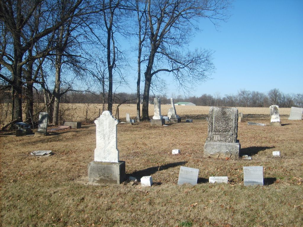
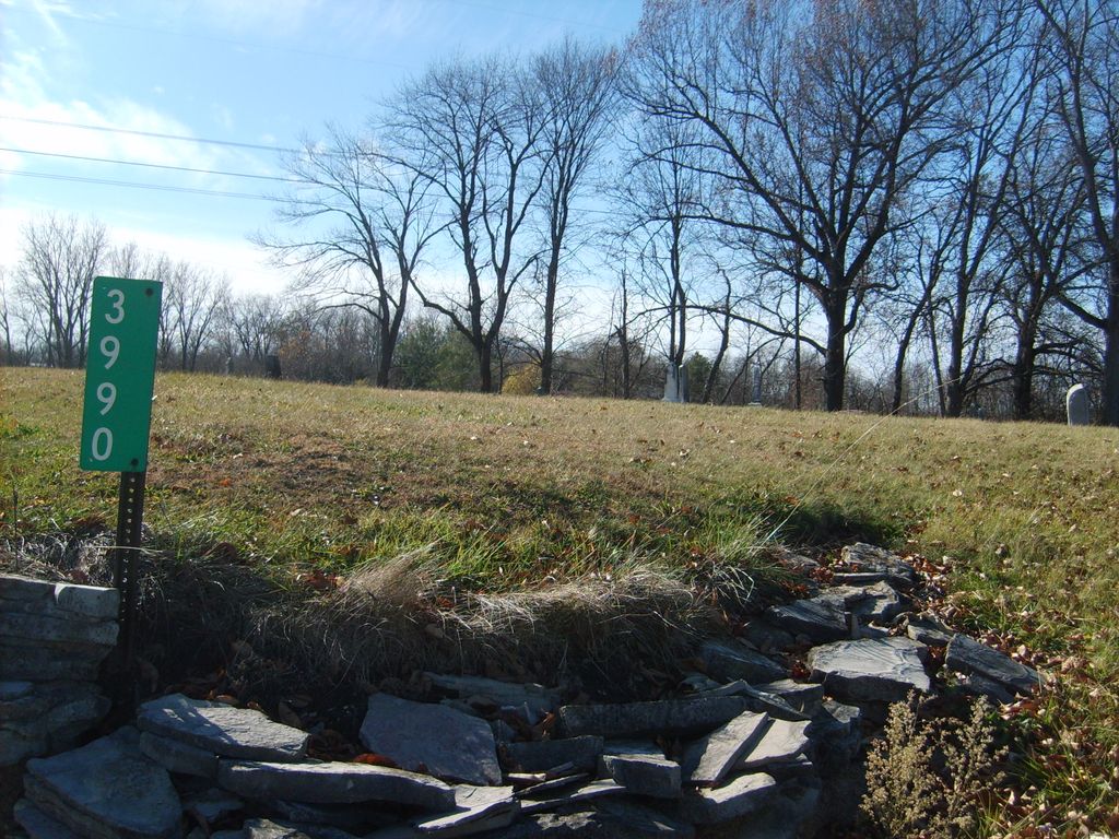
| Description | : | The cemetery is located on the northwest corner of the intersection of Bloom Road (Township Road 30) and Tarhee Trail (Ohio State Route 67). The cemetery is located in Tymochtee Township, Wyandot County, Ohio, and is # 13016 (Quaker Cemetery / Friends Cemetery / Quaker Hill Cemetery) in “Ohio Cemeteries 1803-2003”, compiled by the Ohio Genealogical Society. The U.S. Geological Survey (USGS) Geographic Names Information System (GNIS) feature ID for the cemetery is 1044815 (Quaker Hill Cemetery / Quaker Cemetery). |
frequently asked questions (FAQ):
-
Where is Quaker Hill Cemetery?
Quaker Hill Cemetery is located at Bloom Road (Township Road 30) and Tarhee Trail (Ohio State Route 67) Belle Vernon, Wyandot County ,Ohio , 44882USA.
-
Quaker Hill Cemetery cemetery's updated grave count on graveviews.com?
0 memorials
-
Where are the coordinates of the Quaker Hill Cemetery?
Latitude: 40.9352989
Longitude: -83.1936035
Nearby Cemetories:
1. Belle Vernon Cemetery
Belle Vernon, Wyandot County, USA
Coordinate: 40.9267200, -83.2004700
2. Curlis Cemetery
Sycamore, Wyandot County, USA
Coordinate: 40.9281586, -83.1698947
3. Pleasant Ridge Cemetery
Tymochtee, Wyandot County, USA
Coordinate: 40.9486008, -83.2268982
4. Bretz Cemetery
Sycamore, Wyandot County, USA
Coordinate: 40.9592200, -83.1707500
5. Old Sycamore Cemetery
Sycamore, Wyandot County, USA
Coordinate: 40.9595795, -83.1708832
6. Pleasant View Cemetery
Sycamore, Wyandot County, USA
Coordinate: 40.9613991, -83.1688995
7. Bretz Farm Cemetery (Defunct)
Sycamore, Wyandot County, USA
Coordinate: 40.9639510, -83.1706253
8. Bibler Cemetery
Wyandot County, USA
Coordinate: 40.9639015, -83.2285995
9. Stalter Cemetery
Belle Vernon, Wyandot County, USA
Coordinate: 40.9203260, -83.2415822
10. Cutting Cemetery
Wyandot County, USA
Coordinate: 40.9225561, -83.2435309
11. Badger Cemetery (Defunct)
Sycamore, Wyandot County, USA
Coordinate: 40.9852843, -83.1880430
12. Mexico Cemetery
Wyandot County, USA
Coordinate: 40.9870796, -83.1919708
13. Smithville Cemetery
Smithville, Wyandot County, USA
Coordinate: 40.8914500, -83.2368600
14. Union Church Cemetery
Upper Sandusky, Wyandot County, USA
Coordinate: 40.8774185, -83.1894226
15. South Bend Cemetery
Seneca Township, Seneca County, USA
Coordinate: 40.9986000, -83.2277985
16. Pipetown Cemetery
Sycamore, Wyandot County, USA
Coordinate: 40.9681015, -83.1136017
17. Benton Cemetery
Benton, Crawford County, USA
Coordinate: 40.9270009, -83.0985258
18. Old Lutheran Cemetery
McCutchenville, Wyandot County, USA
Coordinate: 40.9907550, -83.2576460
19. Dunn Cemetery
Wyandot County, USA
Coordinate: 40.9766998, -83.2742004
20. Kear Cemetery
Tymochtee, Wyandot County, USA
Coordinate: 40.9528300, -83.2888100
21. Gibson Cemetery
Tymochtee, Wyandot County, USA
Coordinate: 40.9328520, -83.2934010
22. Saint John Cemetery
McCutchenville, Wyandot County, USA
Coordinate: 40.9895000, -83.2635300
23. Methodist Cemetery
Seneca County, USA
Coordinate: 40.9970330, -83.2534270
24. Baugher Cemetery
Seneca County, USA
Coordinate: 41.0153008, -83.1900024