
| Memorials | : | 22 |
| Location | : | Queen, Eddy County, USA |
| Coordinate | : | 32.2000008, -104.7332993 |
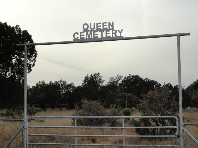
| Description | : | The Queen Cemetery is located in the Guadalupe Mountains of the Lincoln National Forrest. This is a remote, mountainous area that is in southern Eddy County, New Mexico. To get to this cemetery, begin on Highway 285 at the Carlsbad, NM north City Limits and go 12.1 miles to the Queen Highway intersection (highway 137) and turn Left (south). Continue on for 35.7 miles up into the mountains and turn right on Christian Camp Road (County Road 411). The cemetery is just down this dirt road to the left. The road to and through this area was once a stage coach... Read More |
frequently asked questions (FAQ):
-
Where is Queen Cemetery?
Queen Cemetery is located at Queen, Eddy County ,New Mexico ,USA.
-
Queen Cemetery cemetery's updated grave count on graveviews.com?
22 memorials
-
Where are the coordinates of the Queen Cemetery?
Latitude: 32.2000008
Longitude: -104.7332993
Nearby Cemetories:
1. X-Bar Ranch Cemetery
Eddy County, USA
Coordinate: 32.1916670, -104.6188890
2. J O Watkins Gravesite
Eddy County, USA
Coordinate: 32.1013890, -104.7661100
3. DeMoss Cemetery
Loving, Eddy County, USA
Coordinate: 32.0497030, -104.8410780
4. Rattlesnake Springs Cemetery
Black River Village, Eddy County, USA
Coordinate: 32.1080560, -104.4597220
5. Miller Family Cemetery
Eddy County, USA
Coordinate: 32.1157639, -104.4556945
6. Cienega Cemetery
Otero County, USA
Coordinate: 32.0505981, -105.1033020
7. Rocky Arroyo Cemetery
Carlsbad, Eddy County, USA
Coordinate: 32.4606018, -104.4563980
8. Thayer Cemetery
Eddy County, USA
Coordinate: 32.4752800, -104.4302800
9. Edwards Gravesite
Eddy County, USA
Coordinate: 32.4870310, -104.4099430
10. Smith Family Cemetery
Black River Village, Eddy County, USA
Coordinate: 32.2004000, -104.2612000
11. South Cemetery
Eddy County, USA
Coordinate: 32.2002983, -104.2602997
12. Bounds Family Cemetery
Black River Village, Eddy County, USA
Coordinate: 32.2079660, -104.2450890
13. McDonald Cemetery
Eddy County, USA
Coordinate: 32.5881004, -104.5066986
14. Spolton Family Cemetery
Eddy County, USA
Coordinate: 32.5595474, -104.4003296
15. Santa Catarina Cemetery
Carlsbad, Eddy County, USA
Coordinate: 32.4033000, -104.2373000
16. Carlsbad Cemetery
Carlsbad, Eddy County, USA
Coordinate: 32.4066200, -104.2367500
17. Old Santa Teresa Cemetery
Carlsbad, Eddy County, USA
Coordinate: 32.4036440, -104.2348980
18. Epworth United Methodist Church
Carlsbad, Eddy County, USA
Coordinate: 32.4330820, -104.2437030
19. Grace Episcopal Church Columbarium
Carlsbad, Eddy County, USA
Coordinate: 32.4193000, -104.2318000
20. First United Methodist Church Columbarium
Eddy County, USA
Coordinate: 32.4220000, -104.2304000
21. First Presbyterian Church Memorial Garden
Carlsbad, Eddy County, USA
Coordinate: 32.4224260, -104.2299770
22. Seven Rivers Cemetery
Eddy County, USA
Coordinate: 32.5821991, -104.3852997
23. Cuba Cemetery
Eddy County, USA
Coordinate: 32.2984250, -104.1575130
24. Cowden Family Ranch Cemetery
Kent, Culberson County, USA
Coordinate: 31.7127990, -104.5904250