
| Memorials | : | 5 |
| Location | : | Monticello, Fairfield County, USA |
| Coordinate | : | 34.3409730, -81.2507630 |
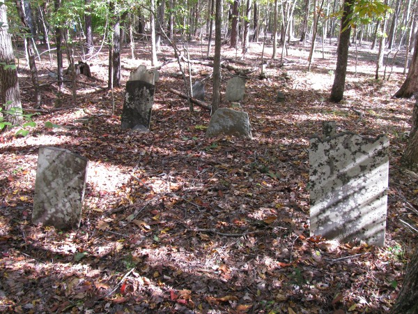
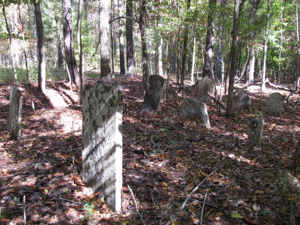
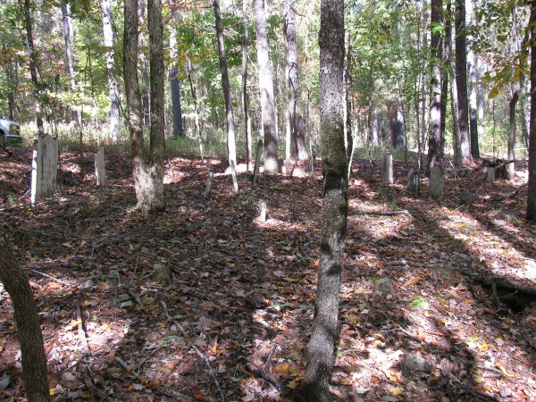
| Description | : | Cemetery is located near Monticello in Fairfield County, SC, 3 miles from Clark Bridge Road, approximately 400 yards off of Cricket Tree Road, an abandoned, dead end, unpaved county road, on a gated, posted and heavily hunted tract of land. Cemetery is on East-facing hillside, approximately 300 yards West of Little River. Four-wheel drive vehicle is required except during dry spells, due to to the poor condition of the road as a result of logging in the area. Don't venture there on your own during hunting season, which is nearly year-round. Cemetery is approximately 25 feet by 50... Read More |
frequently asked questions (FAQ):
-
Where is Rabb Family Cemetery?
Rabb Family Cemetery is located at Monticello, Fairfield County ,South Carolina ,USA.
-
Rabb Family Cemetery cemetery's updated grave count on graveviews.com?
5 memorials
-
Where are the coordinates of the Rabb Family Cemetery?
Latitude: 34.3409730
Longitude: -81.2507630
Nearby Cemetories:
1. Rabb Family Cemetery #2
Monticello, Fairfield County, USA
Coordinate: 34.3367740, -81.2538530
2. Old Brick Church Cemetery
Monticello, Fairfield County, USA
Coordinate: 34.3189011, -81.2611008
3. Brown Chapel Cemetery
Fairfield County, USA
Coordinate: 34.3231480, -81.2831610
4. Little River Cemetery
Jenkinsville, Fairfield County, USA
Coordinate: 34.3102989, -81.2746964
5. Jonathan Harrison Family Cemetery
Fairfield County, USA
Coordinate: 34.3819500, -81.2477170
6. Monticello Cemetery
Fairfield County, USA
Coordinate: 34.3493996, -81.2996979
7. Saint Barnabas Episcopal Church Cemetery
Jenkinsville, Fairfield County, USA
Coordinate: 34.2967680, -81.2661390
8. General Thomas McMeeken
Monticello, Fairfield County, USA
Coordinate: 34.2967860, -81.2670490
9. Gladney Cemetery
Lebanon, Fairfield County, USA
Coordinate: 34.3727989, -81.2078018
10. Pearson Cemetery
Fairfield County, USA
Coordinate: 34.3502998, -81.3135986
11. Milling Crossroad Cemetery
Fairfield County, USA
Coordinate: 34.3567009, -81.1781006
12. White Hall A.M.E. Church Cemetery
Jenkinsville, Fairfield County, USA
Coordinate: 34.2864870, -81.2886650
13. Jacob McMeekin Cemetery
Jenkinsville, Fairfield County, USA
Coordinate: 34.2860600, -81.2924500
14. Martin - Aiken Burial Ground
Lebanon, Fairfield County, USA
Coordinate: 34.3690500, -81.1785170
15. Cork-Murphy Cemetery
Jenkinsville, Fairfield County, USA
Coordinate: 34.2877780, -81.1958520
16. Friendship AME Cemetery
Fairfield County, USA
Coordinate: 34.3521100, -81.3407500
17. Saint Matthews Baptist Church II Cemetery
Blair, Fairfield County, USA
Coordinate: 34.3628540, -81.3390390
18. Old Lebanon Presbyterian Cemetery
Lebanon, Fairfield County, USA
Coordinate: 34.3897000, -81.1797000
19. Free Cemetery
Dawkins, Fairfield County, USA
Coordinate: 34.3586200, -81.3419700
20. Old Friendship AME Cemetery
Fairfield County, USA
Coordinate: 34.3233100, -81.3422900
21. Zion Hopewell Baptist Church Cemetery
Blair, Fairfield County, USA
Coordinate: 34.4160100, -81.2781500
22. Lebanon Presbyterian Church Cemetery
Lebanon, Fairfield County, USA
Coordinate: 34.4122009, -81.2052994
23. Shiloh Church Cemetery Old
Jenkinsville, Fairfield County, USA
Coordinate: 34.2658005, -81.2863998
24. Mount Moriah Baptist Church Cemetery
Jenkinsville, Fairfield County, USA
Coordinate: 34.2613960, -81.2723010