
| Memorials | : | 0 |
| Location | : | Arvel, Lee County, USA |
| Coordinate | : | 37.5588330, -83.8774670 |
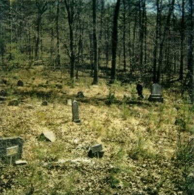
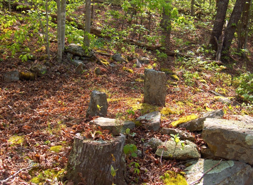
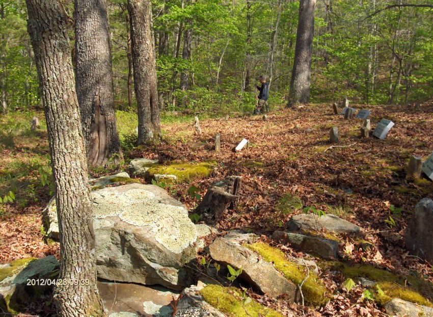
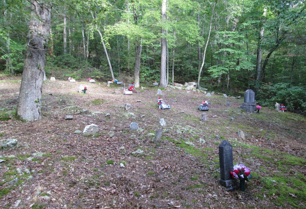
| Description | : | Located about 3.2 miles down Rader Ridge Road (CR-1241) off of state highway 1209. This cemetery is located at Ross Creek, which is northwest of Old Orchard, Kentucky. Old Orchard is northwest of Arvel. The GPS location below is the approximate one for the cemetery. This was taken at the entrance of the cemetery on 04-28-2012. If anyone has knowledge of their family members being buried here, but their names are not this Findagrave list; could you please get in touch with me? Please write to: [email protected] |
frequently asked questions (FAQ):
-
Where is Rader Family Cemetery?
Rader Family Cemetery is located at Ross Creek Arvel, Lee County ,Kentucky ,USA.
-
Rader Family Cemetery cemetery's updated grave count on graveviews.com?
0 memorials
-
Where are the coordinates of the Rader Family Cemetery?
Latitude: 37.5588330
Longitude: -83.8774670
Nearby Cemetories:
1. Mays Cemetery
Arvel, Lee County, USA
Coordinate: 37.5279920, -83.8805510
2. Double Oak Cemetery
Estill County, USA
Coordinate: 37.5752983, -83.9107971
3. Rader Family Cemetery
Arvel, Lee County, USA
Coordinate: 37.5277040, -83.8805490
4. John Reece Cemetery
Leighton, Estill County, USA
Coordinate: 37.5917430, -83.8877400
5. Isaacs Cemetery
Arvel, Lee County, USA
Coordinate: 37.5271460, -83.8928240
6. Sparks Cemetery #1
Leighton, Estill County, USA
Coordinate: 37.5957985, -83.8886032
7. McKinney Cemetery
Lee County, USA
Coordinate: 37.5969009, -83.8499985
8. William Morris Cemetery
Irvine, Estill County, USA
Coordinate: 37.6021670, -83.8984830
9. Cane Springs Cemetery
Leighton, Estill County, USA
Coordinate: 37.6064500, -83.8763330
10. McKinney Cemetery
Leighton, Estill County, USA
Coordinate: 37.6068878, -83.8796082
11. Moress Cemetery
Lee County, USA
Coordinate: 37.5508003, -83.8167038
12. Hoover Cemetery #1
Estill County, USA
Coordinate: 37.5891991, -83.9257965
13. J.J. Estes Cemetery
Estill County, USA
Coordinate: 37.6057300, -83.9018000
14. Hiram Estes - Bobby Green Cemetery
Irvine, Estill County, USA
Coordinate: 37.6061150, -83.9032048
15. Estes Cemetery
Irvine, Estill County, USA
Coordinate: 37.6063995, -83.9024963
16. Durbin Cemetery
Estill County, USA
Coordinate: 37.6027985, -83.9132996
17. Mayse Cemetery
Lee County, USA
Coordinate: 37.5858002, -83.8191986
18. Webb Cemetery
Cressmont, Lee County, USA
Coordinate: 37.5511100, -83.8080500
19. Watson Cemetery
Evelyn, Estill County, USA
Coordinate: 37.6143990, -83.8628006
20. Plowman Cemetery
Lee County, USA
Coordinate: 37.5285988, -83.8153000
21. Sparks Cemetery #4
Alumbaugh, Estill County, USA
Coordinate: 37.5945000, -83.9363000
22. Sparks Cemetery
Heidelberg, Lee County, USA
Coordinate: 37.5560000, -83.8011700
23. Smith Cemetery
Lee County, USA
Coordinate: 37.5182991, -83.8197021
24. Brandenburg Cemetery
Cressmont, Lee County, USA
Coordinate: 37.5231018, -83.8146973