
| Memorials | : | 2 |
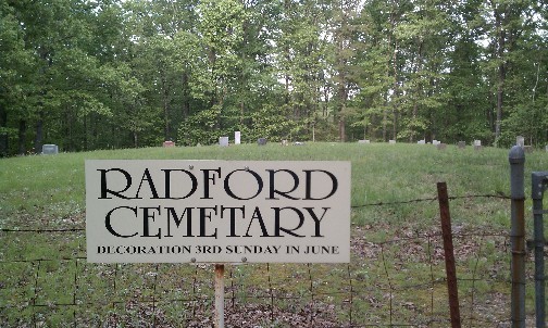
| Location | : | Bunker, Reynolds County, USA |
| Coordinate | : | 37.5633011, -91.2450027 |
| Description | : | The easiest way to reach this cemetery is from Salem. From Salem take Highway 32/72 east about 8 miles. Then take Highway 72 South about 5 miles to the Marcoot Lookout Tower. Turn left at the tower and travel on 903 about 4 miles to 936. Turn right. There is a sign that says Radford Cemetery at the turn. Follow the road about 3 miles (which will take you in a u-shape) until you reach the cemetery. The cemetery is on the left and is very well marked. It is on private property but you are allowed to open the... Read More |
frequently asked questions (FAQ):
-
Where is Radford Cemetery?
Radford Cemetery is located at Bunker, Reynolds County ,Missouri , 63629USA.
-
Radford Cemetery cemetery's updated grave count on graveviews.com?
2 memorials
-
Where are the coordinates of the Radford Cemetery?
Latitude: 37.5633011
Longitude: -91.2450027
Nearby Cemetories:
1. Parker Cemetery
Reynolds County, USA
Coordinate: 37.5903015, -91.2621994
2. Crossville Cemetery
Bunker, Reynolds County, USA
Coordinate: 37.5254800, -91.2341400
3. Camden Cemetery
Dent County, USA
Coordinate: 37.5957985, -91.1761017
4. Greeley Cemetery
Bunker, Reynolds County, USA
Coordinate: 37.5145600, -91.1871800
5. Hughes Cemetery
Dent County, USA
Coordinate: 37.6366997, -91.2619019
6. Stone Hill Cemetery
Salem, Dent County, USA
Coordinate: 37.6044805, -91.3332369
7. Jane Callahan Cemetery
Reynolds County, USA
Coordinate: 37.5093994, -91.1656036
8. Scotia Cemetery
Dent County, USA
Coordinate: 37.5200005, -91.3368988
9. Boss Cemetery
Boss, Dent County, USA
Coordinate: 37.6444470, -91.1912010
10. Barton Cemetery
Reynolds County, USA
Coordinate: 37.5819016, -91.1306000
11. Brook Cemetery
Dent County, USA
Coordinate: 37.5177994, -91.3531036
12. Chatman Cemetery
Dent County, USA
Coordinate: 37.4655991, -91.2525024
13. Parks Cemetery
Bunker, Reynolds County, USA
Coordinate: 37.4735985, -91.1881027
14. Bowers Cemetery
Dent County, USA
Coordinate: 37.6563988, -91.3094025
15. Estep Cemetery
Reynolds County, USA
Coordinate: 37.4803009, -91.1541977
16. Smith Cemetery
Oates, Reynolds County, USA
Coordinate: 37.5642014, -91.1018982
17. Bunker Cemetery
Bunker, Reynolds County, USA
Coordinate: 37.4543120, -91.2030890
18. Lower Bee Fork Cemetery
Bunker, Reynolds County, USA
Coordinate: 37.4544180, -91.2024880
19. Hanning Cemetery
Dent County, USA
Coordinate: 37.4528008, -91.2825012
20. Rocky Ford Cemetery
Dent County, USA
Coordinate: 37.6788600, -91.2319300
21. Kittenger Cemetery
Dent County, USA
Coordinate: 37.6547012, -91.3392029
22. Mounce Cemetery
Dent County, USA
Coordinate: 37.6589012, -91.3431015
23. West Fork Cemetery
West Fork, Reynolds County, USA
Coordinate: 37.4925003, -91.1022034
24. Hedrick Cemetery
Iron County, USA
Coordinate: 37.6805992, -91.1457977