
| Memorials | : | 0 |
| Location | : | Brownsville Township, Union County, USA |
| Coordinate | : | 39.7148399, -85.0344162 |
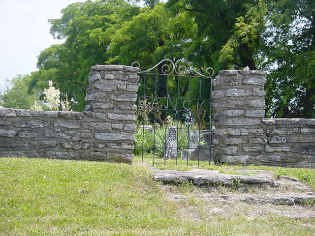
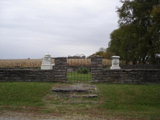
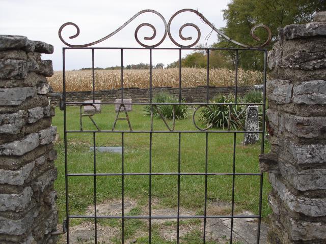
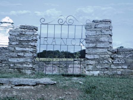
| Description | : | The cemetery is located in Brownsville Township (SW quadrant of the SW quadrant of the SW quadrant of Section 25, Township 15N, Range 13E) on the east side of Willow Grove Road at its intersection with E County Road 500 N. Indiana Cemetery Locations, Volume 1, published by the Indiana Genealogical Society (02 April 2005), gives the primary cemetery name as Ranck Cemetery. The cemetery is listed in the Cemetery and Burial Grounds Registry of the Indiana Department of Natural Resources (DNR) and in the State Historical Architectural and Archaeological Research Database (SHAARD) with Cemetery Record Number CR-81-8... Read More |
frequently asked questions (FAQ):
-
Where is Ranck Cemetery?
Ranck Cemetery is located at Willow Grove Road Brownsville Township, Union County ,Indiana , 47325USA.
-
Ranck Cemetery cemetery's updated grave count on graveviews.com?
0 memorials
-
Where are the coordinates of the Ranck Cemetery?
Latitude: 39.7148399
Longitude: -85.0344162
Nearby Cemetories:
1. Philomath Cemetery
Brownsville, Union County, USA
Coordinate: 39.7202780, -85.0291670
2. Cedar Grove Cemetery
Brownsville, Union County, USA
Coordinate: 39.7001340, -85.0343680
3. Robinson Chapel Cemetery
Waterloo Township, Fayette County, USA
Coordinate: 39.6988300, -85.0534240
4. Woods Chapel Cemetery
Brownsville, Union County, USA
Coordinate: 39.7072490, -84.9912110
5. Doddridge Chapel Cemetery
Centerville, Wayne County, USA
Coordinate: 39.7508011, -85.0560989
6. Black Cemetery
Yankee Town, Union County, USA
Coordinate: 39.7007000, -84.9852000
7. Stevens Family Cemetery
Abington, Wayne County, USA
Coordinate: 39.7500191, -84.9964905
8. Sutcliff Cemetery
Springersville, Fayette County, USA
Coordinate: 39.6682710, -85.0660560
9. Smoker Family Cemetery
Brownsville, Union County, USA
Coordinate: 39.7259830, -84.9673000
10. Locust Grove Methodist Episcopal Cemetery
Locust Grove, Wayne County, USA
Coordinate: 39.7411003, -84.9736023
11. Green Cemetery
Waterloo, Fayette County, USA
Coordinate: 39.7061550, -85.1055320
12. Abington Cemetery
Abington, Wayne County, USA
Coordinate: 39.7349472, -84.9666519
13. Knott Cemetery
Clifton, Union County, USA
Coordinate: 39.6758000, -84.9820000
14. Fosher Cemetery
Liberty, Union County, USA
Coordinate: 39.7135710, -84.9606280
15. Brownsville City Cemetery
Brownsville, Union County, USA
Coordinate: 39.6612015, -85.0065002
16. Christian Union Cemetery
Brownsville, Union County, USA
Coordinate: 39.6621094, -85.0030212
17. Springersville Cemetery
Connersville, Fayette County, USA
Coordinate: 39.6578102, -85.0541534
18. Simpson Cemetery
Fayette County, USA
Coordinate: 39.6561130, -85.0435840
19. Union Cemetery
Lyonsville, Fayette County, USA
Coordinate: 39.6492990, -85.0548080
20. Methodist Farm Cemetery
Connersville, Fayette County, USA
Coordinate: 39.7067000, -85.1364000
21. Bryan Cemetery
Centerville, Wayne County, USA
Coordinate: 39.7942000, -85.0253000
22. Valley Grove Cemetery
Milton, Wayne County, USA
Coordinate: 39.7312508, -85.1375809
23. Richland Cemetery
Liberty, Union County, USA
Coordinate: 39.6900410, -84.9291230
24. Franklin Cemetery
Milton, Wayne County, USA
Coordinate: 39.7789001, -85.1091995