
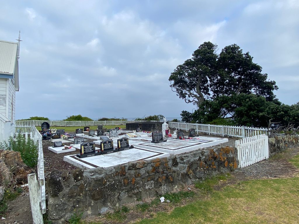
| Memorials | : | 3 |
| Location | : | Raukokore, Ōpōtiki District, New Zealand |
| Coordinate | : | -37.6389240, 177.8785240 |
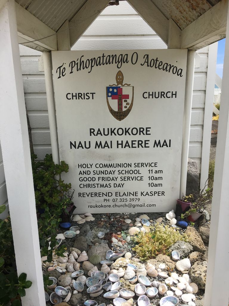
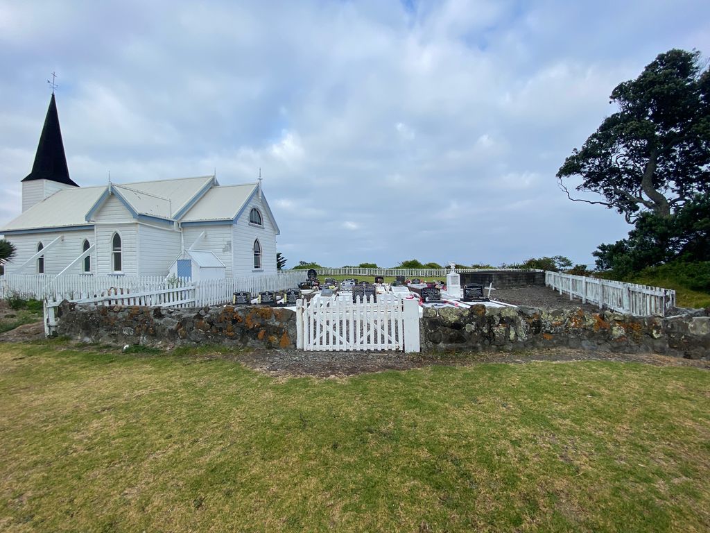
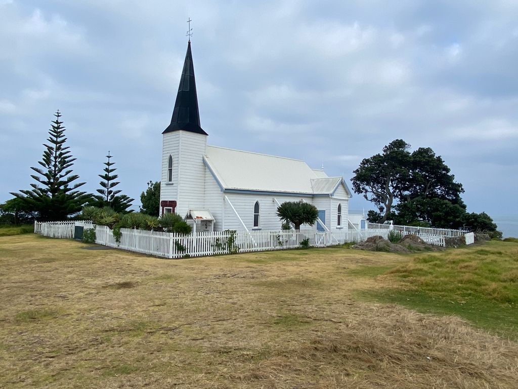
| Description | : | Located on State Highway 35, the cemetery is located directly behind the church building. |
frequently asked questions (FAQ):
-
Where is Raukokore Anglican Church Cemetery?
Raukokore Anglican Church Cemetery is located at Raukokore, Ōpōtiki District ,Bay of Plenty ,New Zealand.
-
Raukokore Anglican Church Cemetery cemetery's updated grave count on graveviews.com?
3 memorials
-
Where are the coordinates of the Raukokore Anglican Church Cemetery?
Latitude: -37.6389240
Longitude: 177.8785240
Nearby Cemetories:
1. Waihau Bay Cemetery
Waihau Bay, Ōpōtiki District, New Zealand
Coordinate: -37.6194100, 177.9149360
2. Howie Family Cemetery
Te Kaha, Ōpōtiki District, New Zealand
Coordinate: -37.7171680, 177.7103060
3. Te Kaha Māori Cemetery
Te Kaha, Ōpōtiki District, New Zealand
Coordinate: -37.7262100, 177.6930600
4. Maraenui Māori Cemetery
Houpoto, Ōpōtiki District, New Zealand
Coordinate: -37.8694900, 177.5849900
5. Rahui Urupā
Hicks Bay, Gisborne District, New Zealand
Coordinate: -37.6009364, 178.3023404
6. Te Koau Urupā
Hicks Bay, Gisborne District, New Zealand
Coordinate: -37.5934290, 178.3222500
7. Tokata Cemetery
Te Araroa, Gisborne District, New Zealand
Coordinate: -37.6213677, 178.3291896
8. Pukehou Memorial Cemetery
Te Araroa, Gisborne District, New Zealand
Coordinate: -37.6218340, 178.3299510
9. Marangairoa Urupā
Te Araroa, Gisborne District, New Zealand
Coordinate: -37.6782490, 178.3561500
10. Te Aowera Marae Cemetery
Waipiro, Gisborne District, New Zealand
Coordinate: -37.9077306, 178.2433691
11. Pukemanuka Cemetery
Gisborne District, New Zealand
Coordinate: -37.7883246, 178.3403532
12. Matahiia Cemetery
Ruatoria, Gisborne District, New Zealand
Coordinate: -37.9243300, 178.2298700
13. Taumataomihi Urupā
Gisborne, Gisborne District, New Zealand
Coordinate: -37.8976200, 178.3002000
14. Mangatarewa Cemetery
Ruatoria, Gisborne District, New Zealand
Coordinate: -37.8321773, 178.3685249
15. Orutua Māori Cemetery
Te Araroa, Gisborne District, New Zealand
Coordinate: -37.6461100, 178.4440600
16. Porourangi Marae Urupā
Ruatoria, Gisborne District, New Zealand
Coordinate: -37.8156640, 178.3993750
17. Ruatoria Cemetery
Ruatoria, Gisborne District, New Zealand
Coordinate: -37.8956070, 178.3574100
18. Hinekopeka Urupā
Port Awanui, Gisborne District, New Zealand
Coordinate: -37.8000340, 178.4427170
19. Okaroro Urupā
Rangitukia, Gisborne District, New Zealand
Coordinate: -37.7716419, 178.4587136
20. Mataharia Station Urupā
Te Araroa, Gisborne District, New Zealand
Coordinate: -37.6485734, 178.4830001
21. Taumata Urupa
Port Awanui, Gisborne District, New Zealand
Coordinate: -37.8003278, 178.4581738
22. St. Matthew's Churchyard
Tuparoa, Gisborne District, New Zealand
Coordinate: -37.9167140, 178.3871320
23. Opape Urupā
Ōpōtiki, Ōpōtiki District, New Zealand
Coordinate: -37.9746540, 177.4244230
24. East Cape Lighthouse Cemetery
Gisborne District, New Zealand
Coordinate: -37.6889140, 178.5480850