
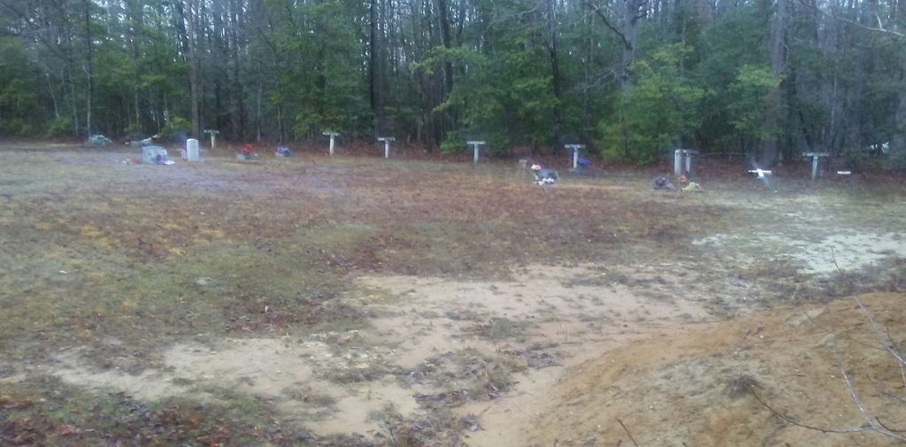
| Memorials | : | 10 |
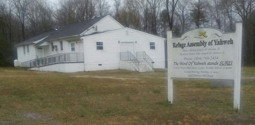
| Location | : | Manquin, King William County, USA |
| Phone | : | 804-769-2434 |
| Coordinate | : | 37.7285020, -77.2340780 |
| Description | : | King William County, VA GIS Parcel ID: 26-43A And Parcel ID: 26-43B Owner: REFUGE OF OUR LORD CHURCH Acreage: 1 |
frequently asked questions (FAQ):
-
Where is Refuge Assembly of Yahweh Church Cemetery?
Refuge Assembly of Yahweh Church Cemetery is located at 5258 Dabneys Mill Road (Rt. 604) Manquin, King William County ,Virginia , 23106USA.
-
Refuge Assembly of Yahweh Church Cemetery cemetery's updated grave count on graveviews.com?
10 memorials
-
Where are the coordinates of the Refuge Assembly of Yahweh Church Cemetery?
Latitude: 37.7285020
Longitude: -77.2340780
Nearby Cemetories:
1. McKendree United Methodist Church Cemetery
Manquin, King William County, USA
Coordinate: 37.7447340, -77.2068240
2. Rock Spring Baptist Church Cemetery
Manquin, King William County, USA
Coordinate: 37.7451000, -77.2020910
3. Mount Columbia
King William County, USA
Coordinate: 37.7127700, -77.1916790
4. Oak Grove Baptist Church Cemetery
King William, King William County, USA
Coordinate: 37.7528250, -77.2718100
5. Corinth Christian Church Cemetery
Enfield, King William County, USA
Coordinate: 37.7732490, -77.2479560
6. Fleet Street Cemetery
Etna Mills, King William County, USA
Coordinate: 37.7816610, -77.2535850
7. Chestnut Grove Baptist Church Cemetery
Hanover County, USA
Coordinate: 37.6935005, -77.3012009
8. Epworth United Methodist Church Cemetery
Epworth, King William County, USA
Coordinate: 37.7915250, -77.2130400
9. Horn Quarter
King William County, USA
Coordinate: 37.7696970, -77.3100610
10. Hebron Baptist Church Cemetery
Mangohick, King William County, USA
Coordinate: 37.8008700, -77.2600800
11. Sharon Baptist Church Cemetery
King William, King William County, USA
Coordinate: 37.7416992, -77.1324005
12. Alexander-Tomlin Cemetery
Cold Harbor, Hanover County, USA
Coordinate: 37.6522710, -77.1939750
13. Ferry Farm Cemetery
King William County, USA
Coordinate: 37.7657350, -77.3285970
14. Mount Sinai Baptist Church Cemetery
Aylett, King William County, USA
Coordinate: 37.7597000, -77.1359150
15. The Messner Tract
King William County, USA
Coordinate: 37.8121310, -77.2257690
16. Mangohick Baptist Church Cemetery
Mangohick, King William County, USA
Coordinate: 37.8078220, -77.2727980
17. Saint Paul Baptist Church Cemetery
Aylett, King William County, USA
Coordinate: 37.8140300, -77.2027740
18. New Chestnut Baptist Church Cemetery
Hanover, Hanover County, USA
Coordinate: 37.7119690, -77.3495330
19. Indian View Baptist Church Cemetery
King William, King William County, USA
Coordinate: 37.7346981, -77.1156640
20. Gethsemane Baptist Church Cemetery
King William, King William County, USA
Coordinate: 37.7094920, -77.1178440
21. Signal Hill Memorial Park
Hanover, Hanover County, USA
Coordinate: 37.7435989, -77.3578033
22. Greater Nazarene Baptist Church Cemetery
Hanover County, USA
Coordinate: 37.7183990, -77.3639984
23. Aylett Graves at Fairfield Plantation
Aylett, King William County, USA
Coordinate: 37.7606970, -77.1027050
24. Hilliard Family Cemetery
King William County, USA
Coordinate: 37.7045610, -77.0987950