
| Memorials | : | 959 |
| Location | : | Lovington, Lea County, USA |
| Coordinate | : | 32.9858017, -103.3169022 |
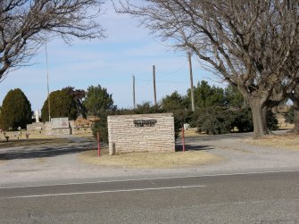
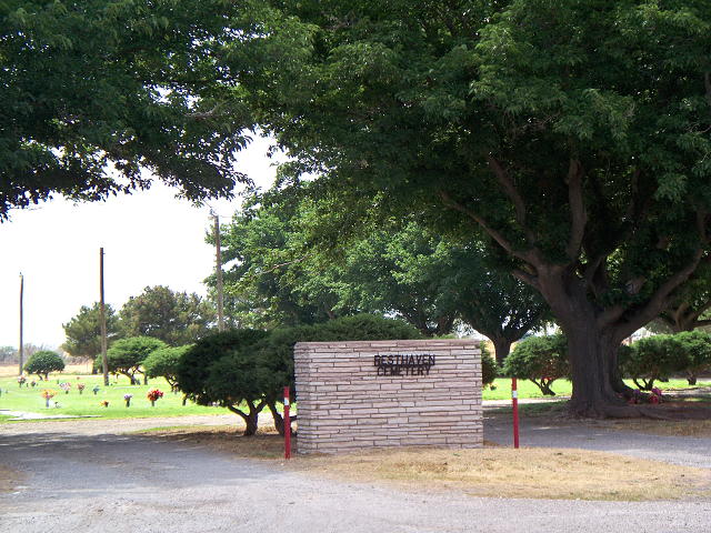
| Description | : | Resthaven Cemetery is located on the Tatum Highway 18 about 1/2 mile north of the underpass. The cemetery is located on the West Side of the highway. The cemetery was transferred to the City of Lovington in the 1980's. |
frequently asked questions (FAQ):
-
Where is Resthaven Cemetery?
Resthaven Cemetery is located at Lovington, Lea County ,New Mexico ,USA.
-
Resthaven Cemetery cemetery's updated grave count on graveviews.com?
1 memorials
-
Where are the coordinates of the Resthaven Cemetery?
Latitude: 32.9858017
Longitude: -103.3169022
Nearby Cemetories:
1. Lovington Cemetery
Lovington, Lea County, USA
Coordinate: 32.9682999, -103.3563995
2. Plainview Cemetery
Lea County, USA
Coordinate: 33.0752983, -103.2983017
3. Cox Cemetery
Lea County, USA
Coordinate: 33.0755790, -103.2995720
4. Old Plainview Cemetery
Lea County, USA
Coordinate: 33.0856018, -103.3158035
5. King Cemetery
McDonald, Lea County, USA
Coordinate: 33.1547012, -103.2311020
6. Knowles Cemetery
Knowles, Lea County, USA
Coordinate: 32.8633003, -103.1444016
7. Antioch Baptist Church Cemetery
Lea County, USA
Coordinate: 33.0671997, -103.0999985
8. Tatum Cemetery
Tatum, Lea County, USA
Coordinate: 33.2517000, -103.3010000
9. Murphys Chapel Cemetery
Lea County, USA
Coordinate: 33.1991997, -103.1106033
10. Memory Gardens
Hobbs, Lea County, USA
Coordinate: 32.7337180, -103.1288440
11. Boone Cemetery
Hobbs, Lea County, USA
Coordinate: 32.7268000, -103.1285000
12. Morgan Cemetery
Lea County, USA
Coordinate: 32.6570280, -103.4367920
13. Field Cemetery
Lea County, USA
Coordinate: 33.2565430, -103.0601490
14. Prairie Haven Memorial Park
Hobbs, Lea County, USA
Coordinate: 32.6822700, -103.1125370
15. Everglades Cemetery
Hobbs, Lea County, USA
Coordinate: 32.6741982, -103.1157990
16. Crockett Cemetery
Lea County, USA
Coordinate: 32.6302986, -103.4424973
17. Monument Cemetery
Lea County, USA
Coordinate: 32.6142006, -103.2380981
18. Soldier Hill Cemetery
Caprock, Lea County, USA
Coordinate: 33.3205986, -103.7097015
19. Jenkins Cemetery
Crossroads, Lea County, USA
Coordinate: 33.5122000, -103.3400000
20. Eunice Cemetery
Eunice, Lea County, USA
Coordinate: 32.4710400, -103.1605830
21. Deck Cemetery
Eunice, Lea County, USA
Coordinate: 32.4434080, -103.1257460
22. Brunson Memorial Cemetery
Eunice, Lea County, USA
Coordinate: 32.4251000, -103.1598000
23. Gaines County Memorial Cemetery
Seminole, Gaines County, USA
Coordinate: 32.7536570, -102.6406560
24. Gaines County Cemetery
Seminole, Gaines County, USA
Coordinate: 32.6971370, -102.6571300