| Memorials | : | 0 |
| Location | : | Republic, Greene County, USA |
| Coordinate | : | 37.1610300, -93.5254760 |
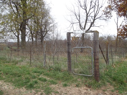
| Description | : | NOTE: THERE ARE COWS IN THE FIELDS. ALL GATES MUST BE CLOSED IMMEDIATELY UPON PASSING THROUGH. From Republic, go west on HWY 174 to HWY PP. Go right/north on PP to TT. Turn right/east on TT. After passing FR 55, go up a hill and locate the abandoned house on the left. The property across the highway is number 11176. The cemetery is in the field behind the abandoned house, a little over a quarter of a mile back. |
frequently asked questions (FAQ):
-
Where is Reynolds Cemetery?
Reynolds Cemetery is located at Republic, Greene County ,Missouri ,USA.
-
Reynolds Cemetery cemetery's updated grave count on graveviews.com?
0 memorials
-
Where are the coordinates of the Reynolds Cemetery?
Latitude: 37.1610300
Longitude: -93.5254760
Nearby Cemetories:
1. Batson Family Cemetery
Greene County, USA
Coordinate: 37.1651100, -93.5392100
2. Wade Chapel Cemetery
Republic, Greene County, USA
Coordinate: 37.1352806, -93.5107422
3. Garoutte Cemetery
Republic, Greene County, USA
Coordinate: 37.1567001, -93.5746994
4. Yeakley Chapel Cemetery
Springfield, Greene County, USA
Coordinate: 37.2030487, -93.5101929
5. Blades Chapel Cemetery
Republic, Greene County, USA
Coordinate: 37.1120700, -93.5400800
6. Evergreen Cemetery
Republic, Greene County, USA
Coordinate: 37.1267014, -93.4738998
7. Prospect Cemetery
Bois D'Arc, Greene County, USA
Coordinate: 37.2214584, -93.5498734
8. Laney Cemetery
Greene County, USA
Coordinate: 37.1086006, -93.5749969
9. Batson Cemetery
Greene County, USA
Coordinate: 37.1925011, -93.5980988
10. Squibb Cemetery
Springfield, Greene County, USA
Coordinate: 37.2275009, -93.5136032
11. Lindsey Chapel Cemetery
Republic, Greene County, USA
Coordinate: 37.1098800, -93.4620200
12. Ruckman Cemetery
Chesapeake, Lawrence County, USA
Coordinate: 37.1292000, -93.6168976
13. Harrington Cemetery
Republic, Greene County, USA
Coordinate: 37.1260986, -93.4353027
14. Rose Hill Cemetery
Billings, Christian County, USA
Coordinate: 37.0834312, -93.5536880
15. Rock Prairie Cemetery
Halltown, Lawrence County, USA
Coordinate: 37.1861000, -93.6252975
16. Kerr Springs Cemetery
Republic, Greene County, USA
Coordinate: 37.1018190, -93.6053990
17. Brookline Cemetery
Brookline, Greene County, USA
Coordinate: 37.1702995, -93.4141998
18. Rose Hill West Cemetery
Billings, Christian County, USA
Coordinate: 37.0828100, -93.5819100
19. Saint Joseph's Cemetery
Billings, Christian County, USA
Coordinate: 37.0758018, -93.5721970
20. Merrick Grave Yard
Halltown, Lawrence County, USA
Coordinate: 37.2170677, -93.6282349
21. Johns Chapel Cemetery
Ash Grove, Greene County, USA
Coordinate: 37.2510414, -93.5864334
22. Brashers Cemetery
McKinley, Lawrence County, USA
Coordinate: 37.0950012, -93.6247025
23. Saint Peters Evangelical Cemetery
Billings, Christian County, USA
Coordinate: 37.0616989, -93.5681000
24. County Poor Farm Cemetery
Ozark Township, Lawrence County, USA
Coordinate: 37.1994410, -93.6517010

