
| Memorials | : | 0 |
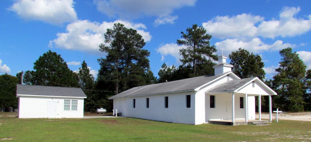
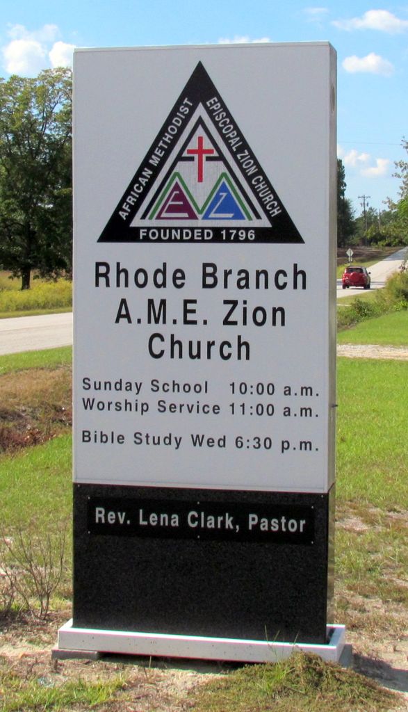
| Location | : | Mount Croghan, Chesterfield County, USA |
| Coordinate | : | 34.6740540, -80.3184990 |
frequently asked questions (FAQ):
-
Where is Rhode Branch A.M.E. Zion Church Cemetery?
Rhode Branch A.M.E. Zion Church Cemetery is located at 253 Landfill Road Mount Croghan, Chesterfield County ,South Carolina , 29727USA.
-
Rhode Branch A.M.E. Zion Church Cemetery cemetery's updated grave count on graveviews.com?
0 memorials
-
Where are the coordinates of the Rhode Branch A.M.E. Zion Church Cemetery?
Latitude: 34.6740540
Longitude: -80.3184990
Nearby Cemetories:
1. Twin Pines Freewill Baptist Church Cemetery
Jefferson, Chesterfield County, USA
Coordinate: 34.6564380, -80.3314310
2. Black Creek Baptist Church Cemetery
Jefferson, Chesterfield County, USA
Coordinate: 34.6934710, -80.3078040
3. Long Branch Baptist Church Cemetery
Jefferson, Chesterfield County, USA
Coordinate: 34.6539001, -80.3419037
4. Nicey Grove Baptist Church Cemetery
Jefferson, Chesterfield County, USA
Coordinate: 34.7001320, -80.3373860
5. Cross of Calvary Freewill Baptist Church
Mount Croghan, Chesterfield County, USA
Coordinate: 34.6518540, -80.2893920
6. Rocky Creek Baptist Church Cemetery
Chesterfield County, USA
Coordinate: 34.6439610, -80.2950450
7. McCaskill Family Cemetery
Jefferson, Chesterfield County, USA
Coordinate: 34.6374730, -80.3253680
8. Calvary Baptist Church Cemetery
Jefferson, Chesterfield County, USA
Coordinate: 34.6497290, -80.3613470
9. Fairview Baptist Church Cemetery
Mount Croghan, Chesterfield County, USA
Coordinate: 34.7000008, -80.2750015
10. Old Mount Olive Cemetery
Chesterfield County, USA
Coordinate: 34.7182999, -80.3060989
11. Old Antioch Baptist Church Cemetery
Jefferson, Chesterfield County, USA
Coordinate: 34.6294290, -80.2991530
12. Hopewell Cemetery
Jefferson, Chesterfield County, USA
Coordinate: 34.6707993, -80.3811035
13. New Life For Jesus Center Cemetery
Jefferson, Chesterfield County, USA
Coordinate: 34.6742300, -80.3825170
14. Oak Grove Baptist Church Cemetery
Jefferson, Chesterfield County, USA
Coordinate: 34.6332092, -80.3597870
15. Bethlehem Baptist Church Cemetery
Pageland, Chesterfield County, USA
Coordinate: 34.7270490, -80.3357220
16. Baker-Kirkley Family Cemetery
Jefferson, Chesterfield County, USA
Coordinate: 34.6394320, -80.3712550
17. Antioch Baptist Church Cemetery
Jefferson, Chesterfield County, USA
Coordinate: 34.6199120, -80.3032130
18. Rocky Creek Presbyterian Church Cemetery
Chesterfield County, USA
Coordinate: 34.6195700, -80.3393860
19. Almetta Baptist Church Cemetery
Jefferson, Chesterfield County, USA
Coordinate: 34.6495380, -80.3839030
20. Miller-Lowry Cemetery
Jefferson, Chesterfield County, USA
Coordinate: 34.6594009, -80.3886032
21. Fork Creek United Methodist Church Cemetery
Jefferson, Chesterfield County, USA
Coordinate: 34.6338997, -80.3743973
22. Lighthouse Baptist Church Cemetery
Pageland, Chesterfield County, USA
Coordinate: 34.7343780, -80.3417320
23. Jefferson Town Cemetery
Jefferson, Chesterfield County, USA
Coordinate: 34.6582985, -80.3977966
24. Evans Family Cemetery
Pageland, Chesterfield County, USA
Coordinate: 34.7182530, -80.3829380