| Memorials | : | 0 |
| Location | : | Helmsburg, Brown County, USA |
| Coordinate | : | 39.2686990, -86.3141470 |
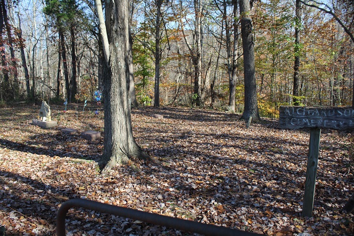
| Description | : | Jackson Township SE 1/4 of Section 28;Township 10N; Range 2E From its junction with Lick Creek Road at Helmsburg drive west on State Road 45 for one mile. This small family plot is about 200 feet north of the highway in a thicket. It is approx. 40 by 50 feet in size, fenced-in but neglected. Indiana Cemetery Locations, Volume 2, published by the Indiana Genealogical Society (01 April 2006), gives the primary cemetery name as Richardson Cemetery. The cemetery is listed in the Cemetery and Burial Grounds Registry of the Indiana Department of Natural Resources (DNR) and in the State Historical... Read More |
frequently asked questions (FAQ):
-
Where is Richardson Cemetery?
Richardson Cemetery is located at 5150 W Lost Branch Road Helmsburg, Brown County ,Indiana , 47448USA.
-
Richardson Cemetery cemetery's updated grave count on graveviews.com?
0 memorials
-
Where are the coordinates of the Richardson Cemetery?
Latitude: 39.2686990
Longitude: -86.3141470
Nearby Cemetories:
1. Gessey Cemetery
Helmsburg, Brown County, USA
Coordinate: 39.2859000, -86.3021000
2. Myers Cemetery
Helmsburg, Brown County, USA
Coordinate: 39.2808300, -86.2900500
3. Carmel Ridge Cemetery
Helmsburg, Brown County, USA
Coordinate: 39.2925880, -86.3171960
4. Oak Ridge Cemetery
Jackson Township, Brown County, USA
Coordinate: 39.2846718, -86.2882767
5. Needmore Cemetery
Needmore, Brown County, USA
Coordinate: 39.2525902, -86.3408890
6. Bear Creek Cemetery
Trevlac, Brown County, USA
Coordinate: 39.2925339, -86.3453369
7. Snider Cemetery
Beanblossom, Brown County, USA
Coordinate: 39.2678560, -86.2688750
8. Lanam Ridge Cemetery
Needmore, Brown County, USA
Coordinate: 39.2322807, -86.3141403
9. Fleener-Richardson Cemetery
Trevlac, Brown County, USA
Coordinate: 39.2668820, -86.3690190
10. Cornelius McCoy Home Farm Burial Ground
Needmore, Brown County, USA
Coordinate: 39.2672730, -86.3792029
11. Weeping Willow Cemetery
Beanblossom, Brown County, USA
Coordinate: 39.2679863, -86.2469788
12. Dubois Cemetery
Brown County, USA
Coordinate: 39.2119000, -86.3161000
13. Pogue Cemetery
Nashville, Brown County, USA
Coordinate: 39.2157820, -86.3448330
14. Shipley Cemetery
Nashville, Brown County, USA
Coordinate: 39.2189450, -86.2609870
15. Fleener Cemetery
Fruitdale, Brown County, USA
Coordinate: 39.3295097, -86.2849731
16. Bethel Cemetery
Spearsville, Brown County, USA
Coordinate: 39.2896500, -86.2236099
17. Brock Cemetery
Unionville, Monroe County, USA
Coordinate: 39.2475833, -86.4056944
18. Dupree Cemetery
Nashville, Brown County, USA
Coordinate: 39.1951645, -86.3269189
19. Unity Baptist Church Cemetery
Beanblossom, Brown County, USA
Coordinate: 39.3021698, -86.2264862
20. Rogers Cemetery
Belmont, Brown County, USA
Coordinate: 39.1970900, -86.3472800
21. Chitwood Cemetery
Unionville, Monroe County, USA
Coordinate: 39.2307110, -86.4000990
22. Southview Cemetery
Nashville, Brown County, USA
Coordinate: 39.2097015, -86.2506027
23. Percifield Cemetery
Nashville, Brown County, USA
Coordinate: 39.1967800, -86.2787500
24. Hoover Cemetery
Nashville, Brown County, USA
Coordinate: 39.1909010, -86.2896090


