
| Memorials | : | 0 |
| Location | : | Bentonville, Benton County, USA |
| Coordinate | : | 36.4069410, -94.1759350 |
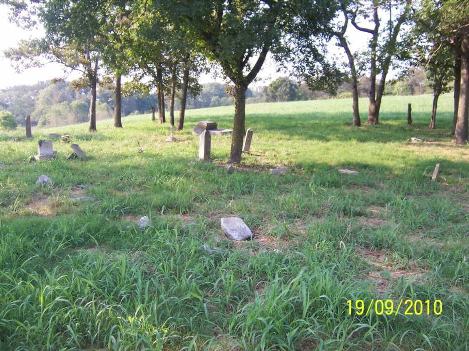
| Description | : | Ricketts Cemetery is located on private property with no access to the cemetery by public road. ALSO KNOWN AS VALLEY VIEW CEMETERY. LOCATED EAST OF THE BENTONVILLE COURTHOUSE. TAKE CENTRAL STREET GOING EAST 3.9 MILES ON HWY. 72. TURN LEFT JUST BEFORE CROSSING THE SUGAR CREEK BRIDGE AND GO 9/10TH MILES NORTH ON PRICE-COFFEE ROAD. THE CEMETERY IS LOCATED ON EAST SIDE OFF ROAD ON PRIVATE PROPERTY ABOUT 3/10TH MILE IN A SMALL GROVE OF TREES ON A HILLSIDE. WE HAD TO CROSS SUGAR CREEK ROCK BED TO GET INTO THE FIELD. THE CEMETERY WAS IN AN OPEN FIELD AND... Read More |
frequently asked questions (FAQ):
-
Where is Ricketts Cemetery?
Ricketts Cemetery is located at Price Coffee Road Bentonville, Benton County ,Arkansas ,USA.
-
Ricketts Cemetery cemetery's updated grave count on graveviews.com?
0 memorials
-
Where are the coordinates of the Ricketts Cemetery?
Latitude: 36.4069410
Longitude: -94.1759350
Nearby Cemetories:
1. Kindley Cemetery
Little Flock, Benton County, USA
Coordinate: 36.3981018, -94.1572037
2. Post Oak Cemetery
Bentonville, Benton County, USA
Coordinate: 36.4238760, -94.1831220
3. Saint Stephens Columbarium
Bentonville, Benton County, USA
Coordinate: 36.3867800, -94.1954100
4. Poor Farm Cemetery
Bentonville, Benton County, USA
Coordinate: 36.3906200, -94.2005400
5. Oakes Cemetery
Benton County, USA
Coordinate: 36.4164009, -94.2071991
6. Robbins Cemetery
Benton County, USA
Coordinate: 36.3795334, -94.1897594
7. First Presbyterian Church Columbarium
Bentonville, Benton County, USA
Coordinate: 36.3813160, -94.1976120
8. Jefferson Cemetery
Bentonville, Benton County, USA
Coordinate: 36.3744011, -94.1742020
9. Bates Cemetery
Bentonville, Benton County, USA
Coordinate: 36.3696570, -94.1915260
10. Little Flock Cemetery
Little Flock, Benton County, USA
Coordinate: 36.3758011, -94.1444016
11. Mount Eden Cemetery
Bentonville, Benton County, USA
Coordinate: 36.3670000, -94.1696000
12. Hickman Cemetery
Pea Ridge, Benton County, USA
Coordinate: 36.4317017, -94.1324997
13. Alley Cemetery
Siloam Springs, Benton County, USA
Coordinate: 36.3708960, -94.1463570
14. New Home Cemetery
Bella Vista, Benton County, USA
Coordinate: 36.4146996, -94.2288971
15. Woods Cemetery
Little Flock, Benton County, USA
Coordinate: 36.3685989, -94.1493988
16. Bentonville Cemetery
Bentonville, Benton County, USA
Coordinate: 36.3683014, -94.2174988
17. Mills Cemetery
Bella Vista, Benton County, USA
Coordinate: 36.4411970, -94.2279980
18. Summit Cemetery
Bella Vista, Benton County, USA
Coordinate: 36.4613650, -94.1904300
19. Foster Cemetery
Benton County, USA
Coordinate: 36.4611015, -94.1577988
20. Tucks Chapel Cemetery
Rogers, Benton County, USA
Coordinate: 36.4043999, -94.1046982
21. Etris Cemetery
Rogers, Benton County, USA
Coordinate: 36.3760986, -94.1152344
22. Saint Theodores Episcopal Columbarium
Bella Vista, Benton County, USA
Coordinate: 36.4524350, -94.2281480
23. Pea Ridge Cemetery
Pea Ridge, Benton County, USA
Coordinate: 36.4536018, -94.1200027
24. Wilson Family Cemetery
Bentonville, Benton County, USA
Coordinate: 36.4065820, -94.2580110