
| Memorials | : | 40 |
| Location | : | Blackfoot, Bingham County, USA |
| Coordinate | : | 43.1972008, -112.4839020 |
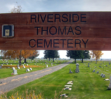
| Description | : | Riverside-Thomas Cemetery is located six miles west of Blackfoot on Highway 39. Alphes Parsons donated five acres of land to be used as a cemetery. His father, James Parsons, had died in 1887 and was the first person to be buried there. In 1897 an additional five acres was purchased from Mr. Parsons for $10 an acre. In 1984 five additional acres was purchased from Jennie Williams for $2,000 an acre. The cemetery has changed from an area covered with sagebrush, weeds and rocks to a beautiful garden due to the efforts of many local... Read More |
frequently asked questions (FAQ):
-
Where is Riverside-Thomas Cemetery?
Riverside-Thomas Cemetery is located at Blackfoot, Bingham County ,Idaho ,USA.
-
Riverside-Thomas Cemetery cemetery's updated grave count on graveviews.com?
31 memorials
-
Where are the coordinates of the Riverside-Thomas Cemetery?
Latitude: 43.1972008
Longitude: -112.4839020
Nearby Cemetories:
1. Moreland Cemetery
Moreland, Bingham County, USA
Coordinate: 43.2271996, -112.4692001
2. Groveland Cemetery
Blackfoot, Bingham County, USA
Coordinate: 43.2271996, -112.3806000
3. Gibson Cemetery
Fort Hall, Bingham County, USA
Coordinate: 43.1267014, -112.3818970
4. Grove City Cemetery
Blackfoot, Bingham County, USA
Coordinate: 43.2005997, -112.3272018
5. State Hospital South Cemetery
Blackfoot, Bingham County, USA
Coordinate: 43.1820490, -112.3277300
6. Idaho State Veterans Cemetery
Blackfoot, Bingham County, USA
Coordinate: 43.1825390, -112.3177910
7. Sand Hill Cemetery
Fort Hall, Bingham County, USA
Coordinate: 43.0499600, -112.4653200
8. Good Shepherd Cemetery
Fort Hall, Bingham County, USA
Coordinate: 43.0260500, -112.4269000
9. Springfield-Sterling Cemetery
Springfield, Bingham County, USA
Coordinate: 43.0807991, -112.6712036
10. Kutch Family Cemetery
Fort Hall, Bingham County, USA
Coordinate: 43.0240000, -112.3845000
11. Lincoln Creek Cemetery
Fort Hall, Bingham County, USA
Coordinate: 43.1889300, -112.2038100
12. Ross Fork Cemeteries
Fort Hall, Bingham County, USA
Coordinate: 43.0475006, -112.2746964
13. Cedar Cemetery
Bannock County, USA
Coordinate: 42.9675000, -112.5525000
14. Cedars Cemetery
Fort Hall, Bingham County, USA
Coordinate: 42.9664800, -112.5528900
15. Riverview Cemetery
Firth, Bingham County, USA
Coordinate: 43.3149986, -112.1856003
16. Firth Cemetery
Firth, Bingham County, USA
Coordinate: 43.3041687, -112.1753082
17. Basalt Cemetery
Basalt, Bingham County, USA
Coordinate: 43.3333015, -112.1607971
18. Just Family Cemetery
Goshen, Bingham County, USA
Coordinate: 43.2656000, -112.0992000
19. Hillcrest Cemetery
Shelley, Bingham County, USA
Coordinate: 43.3666992, -112.1264038
20. Goshen Cemetery
Goshen, Bingham County, USA
Coordinate: 43.3114204, -112.0718384
21. Family Life Center Cemetery
Bannock County, USA
Coordinate: 42.8926100, -112.6411500
22. Bannock Creek Cemetery
Power County, USA
Coordinate: 42.8806000, -112.6316986
23. Chief Pocatello Burial Site
American Falls, Power County, USA
Coordinate: 42.9177150, -112.7375790
24. Woodville Cemetery
Bonneville County, USA
Coordinate: 43.4321400, -112.1475700