
| Memorials | : | 0 |
| Location | : | Carmel, DeSoto Parish, USA |
| Coordinate | : | 32.0901900, -93.6100000 |
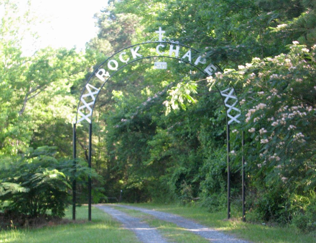
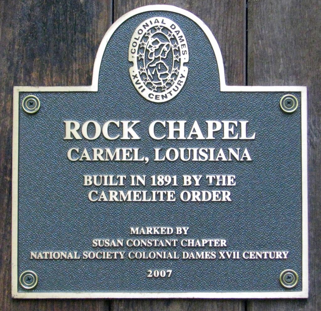
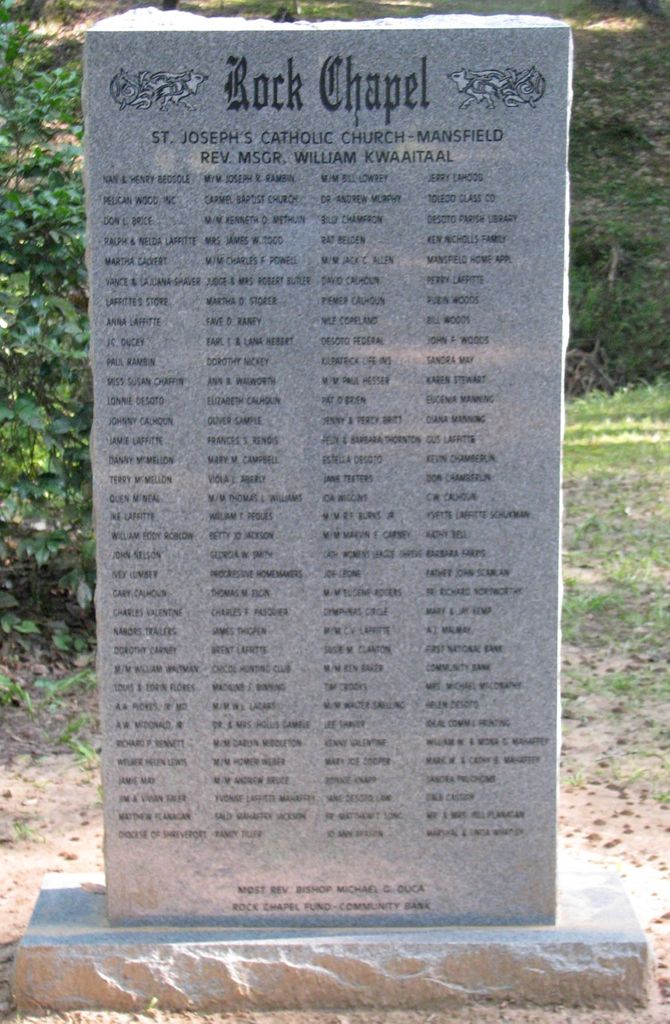
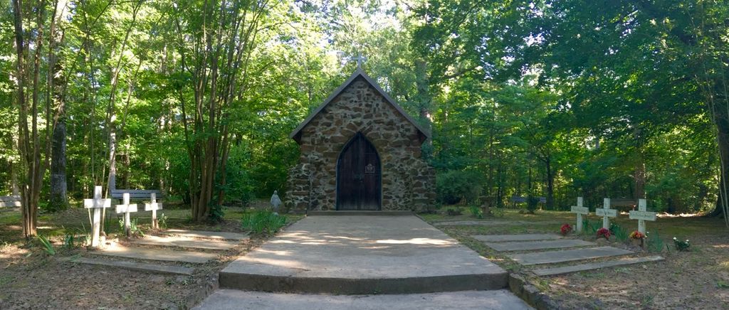
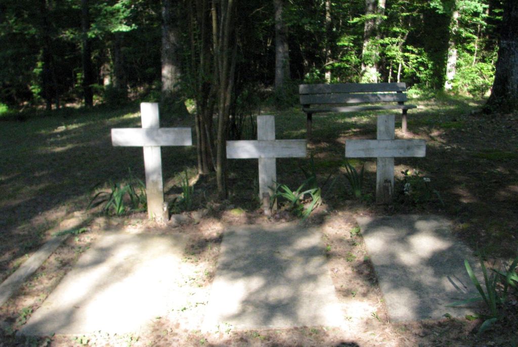
| Description | : | Rock Chapel, and cemetery was built by the Carmelite monks in 1891 as a retreat for monks of the Carmelite Monastery. On November 14, 1904, fire destroyed the larger church and Carmelite monastery. The Rock Chapel and its marked graves are all that remain of the original Carmelite Monastery. Cemetery entrance arched sign is visible from roadside on the right side of the Immaculate Conception Catholic Church & Cemetery. Proceed past locked vehicle gate 864 steps along gravel road to view chapel and six graves nestled among the trees, high on a bluff. |
frequently asked questions (FAQ):
-
Where is Rock Chapel Cemetery?
Rock Chapel Cemetery is located at 1822 Smithport Rd Carmel, DeSoto Parish ,Louisiana , 71052USA.
-
Rock Chapel Cemetery cemetery's updated grave count on graveviews.com?
0 memorials
-
Where are the coordinates of the Rock Chapel Cemetery?
Latitude: 32.0901900
Longitude: -93.6100000
Nearby Cemetories:
1. Carmel Cemetery
Carmel, DeSoto Parish, USA
Coordinate: 32.0902400, -93.6101000
2. Flores Cemetery
Carmel, DeSoto Parish, USA
Coordinate: 32.0964012, -93.6258011
3. New Hope Baptist Church Cemetery
DeSoto Parish, USA
Coordinate: 32.0788200, -93.6495720
4. Dill Cemetery
Carmel, DeSoto Parish, USA
Coordinate: 32.1102982, -93.5706024
5. Elizabeth Baptist Church Cemetery
Mansfield, DeSoto Parish, USA
Coordinate: 32.0530600, -93.6275000
6. Rockdale Cemetery
New Rockdale, DeSoto Parish, USA
Coordinate: 32.0513000, -93.6352800
7. Woodvine Cemetery
Naborton, DeSoto Parish, USA
Coordinate: 32.0434500, -93.6011000
8. Slone Cemetery
Holly, DeSoto Parish, USA
Coordinate: 32.1317000, -93.6450000
9. Shaw Family Cemetery
Mansfield, DeSoto Parish, USA
Coordinate: 32.1221600, -93.6587400
10. Bonchest Cemetery
Slone, DeSoto Parish, USA
Coordinate: 32.1226000, -93.6589700
11. Bethlehem Cemetery
Naborton, DeSoto Parish, USA
Coordinate: 32.0526700, -93.5604800
12. Huel Jones Cemetery
Mansfield, DeSoto Parish, USA
Coordinate: 32.0310520, -93.6315260
13. Allen Cemetery
Mansfield, DeSoto Parish, USA
Coordinate: 32.0267000, -93.6432000
14. Creswell Cemetery
Mansfield, DeSoto Parish, USA
Coordinate: 32.0471992, -93.6750031
15. Truevine Cemetery
Naborton, DeSoto Parish, USA
Coordinate: 32.0156000, -93.6189000
16. Saint Marks Cemetery
Holly, DeSoto Parish, USA
Coordinate: 32.1375400, -93.6871700
17. Gethsemane Baptist Church Cemetery
Mansfield, DeSoto Parish, USA
Coordinate: 32.0130400, -93.6694000
18. Highland Cemetery
Mansfield, DeSoto Parish, USA
Coordinate: 32.0302000, -93.6932000
19. Union Cemetery
Mansfield, DeSoto Parish, USA
Coordinate: 32.0337000, -93.6971400
20. Antioch Cemetery
Mansfield, DeSoto Parish, USA
Coordinate: 32.0017000, -93.6449000
21. Mansfield Cemetery
Mansfield, DeSoto Parish, USA
Coordinate: 32.0406000, -93.7058000
22. Saint Elizabeth Cemetery
Grand Cane, DeSoto Parish, USA
Coordinate: 32.1035000, -93.7222000
23. New Friendship Cemetery
DeSoto Parish, USA
Coordinate: 32.1875000, -93.6132965
24. Henry Coleman Thweatt Burial Site
Mansfield, DeSoto Parish, USA
Coordinate: 32.0366430, -93.7064750