
| Memorials | : | 0 |
| Location | : | Miller County, USA |
| Coordinate | : | 38.4668400, -92.5170700 |
frequently asked questions (FAQ):
-
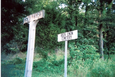
Where is Rock Enon Cemetery?
Rock Enon Cemetery is located at Hwy V Miller County ,Missouri ,USA.
-
Rock Enon Cemetery cemetery's updated grave count on graveviews.com?
0 memorials
-
Where are the coordinates of the Rock Enon Cemetery?
Latitude: 38.4668400
Longitude: -92.5170700
Nearby Cemetories:
1. Bruce-Lewis-McGahan Cemetery
Enon, Moniteau County, USA
Coordinate: 38.4667500, -92.5172100
2. Jackson Chapel Methodist Church Cemetery
California, Moniteau County, USA
Coordinate: 38.4447900, -92.5286500
3. Gray Cemetery
Moniteau County, USA
Coordinate: 38.4536018, -92.5456009
4. Farris Cemetery
Moniteau County, USA
Coordinate: 38.4369900, -92.5380000
5. Karnes-Carney-Henderson Cemetery
Burris Fork, Moniteau County, USA
Coordinate: 38.4992100, -92.5007510
6. Enon Cemetery
Russellville, Cole County, USA
Coordinate: 38.4888992, -92.4730988
7. Walker Cemetery
Moniteau County, USA
Coordinate: 38.4338989, -92.5522003
8. Etter-Walker Cemetery
Burris Fork, Moniteau County, USA
Coordinate: 38.4333700, -92.5525400
9. Karnes Cemetery
Corticelli, Moniteau County, USA
Coordinate: 38.5099700, -92.5247900
10. High Point Cemetery
High Point, Moniteau County, USA
Coordinate: 38.4817009, -92.5757980
11. Belleville Cemetery
Russellville, Cole County, USA
Coordinate: 38.4970490, -92.4667150
12. Depp Cemetery
High Point, Moniteau County, USA
Coordinate: 38.4776400, -92.5818500
13. Enloe Cemetery
Moniteau County, USA
Coordinate: 38.5074997, -92.4741974
14. Allen Cemetery
Olean, Miller County, USA
Coordinate: 38.4150009, -92.5008011
15. Matheis Cemetery
Russellville, Cole County, USA
Coordinate: 38.4571800, -92.4491600
16. Olean Cemetery
Olean, Miller County, USA
Coordinate: 38.4131012, -92.5413971
17. United Baptist Church Cemetery
High Point, Moniteau County, USA
Coordinate: 38.4962200, -92.5856800
18. Green Ridge Baptist Church Cemetery
Eldon, Miller County, USA
Coordinate: 38.4116200, -92.5645700
19. Yarnell Cemetery
California, Moniteau County, USA
Coordinate: 38.5189018, -92.5708008
20. Campbell Cemetery
Cole County, USA
Coordinate: 38.4810982, -92.4297028
21. Roark Cemetery
Russellville, Cole County, USA
Coordinate: 38.4696999, -92.4255981
22. Saint Michael Cemetery
Russellville, Cole County, USA
Coordinate: 38.5109300, -92.4429100
23. DeFoe Cemetery
California, Moniteau County, USA
Coordinate: 38.5416985, -92.5250015
24. Trinity Lutheran Cemetery
Russellville, Cole County, USA
Coordinate: 38.5028000, -92.4317017