
| Memorials | : | 2 |
| Location | : | Owsley County, USA |
| Coordinate | : | 37.4091150, -83.8261560 |
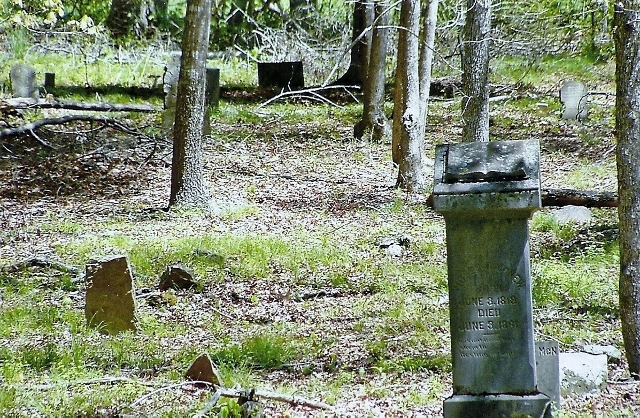
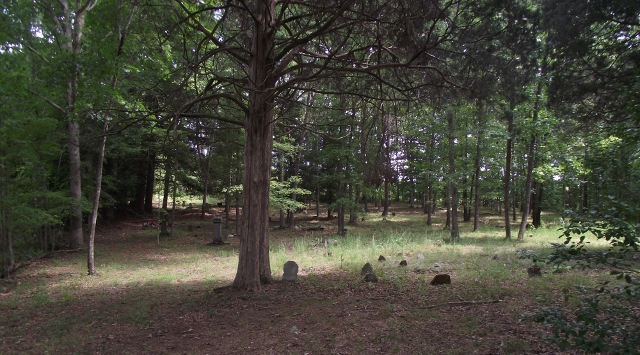
| Description | : | "Primitive" Baptist. From the road (Rte 30), up the hill to the right side of the church. Going through the 179 pages of minutes transcribed by James L Clark, this church was est Sept,1843 as the Predestinarian Baptist Church of Christ & didn't start using the Primitive Baptist Church of Christ (from the minutes) until Dec, 1922. The minutes run through June of 1954. It's first pastor was William Anderson. Many of the members of the church are buried in this cemetery. There are many field & unreadable stones at this cemetery. The oldest legible stone is Moses McNew -d-1861 |
frequently asked questions (FAQ):
-
Where is Rock Springs Primative Baptist Church Cemetery?
Rock Springs Primative Baptist Church Cemetery is located at Rte 30 & 1071 1/2 mile from Jackson Co line Owsley County ,Kentucky ,USA.
-
Rock Springs Primative Baptist Church Cemetery cemetery's updated grave count on graveviews.com?
2 memorials
-
Where are the coordinates of the Rock Springs Primative Baptist Church Cemetery?
Latitude: 37.4091150
Longitude: -83.8261560
Nearby Cemetories:
1. King Cemetery
Sturgeon, Owsley County, USA
Coordinate: 37.4047670, -83.8165170
2. Strong Cemetery
Sturgeon, Owsley County, USA
Coordinate: 37.4185440, -83.8227490
3. John Hartsock Cemetery
Owsley County, USA
Coordinate: 37.4224670, -83.8045560
4. Samuel Pierson Cemetery
Owsley County, USA
Coordinate: 37.4106450, -83.7985900
5. Cook Family Cemetery
Sturgeon, Owsley County, USA
Coordinate: 37.4127170, -83.7988330
6. Ernest Farmer Cemetery
Sturgeon, Owsley County, USA
Coordinate: 37.4252670, -83.8051830
7. Irvine Spence Cemetery
Sturgeon, Owsley County, USA
Coordinate: 37.4299830, -83.8098830
8. Sizemore Cemetery
Island City, Owsley County, USA
Coordinate: 37.3853830, -83.8092670
9. Hardin-Wilson Cemetery
Sturgeon, Owsley County, USA
Coordinate: 37.3976320, -83.7941010
10. Taylor and Shepherd Cemetery
Sturgeon, Owsley County, USA
Coordinate: 37.3976390, -83.7940800
11. Jean Hartsock Cemetery
Sturgeon, Owsley County, USA
Coordinate: 37.4376360, -83.8303420
12. Hartsock Family Cemetery
Travellers Rest, Owsley County, USA
Coordinate: 37.4377500, -83.8302830
13. Peters Cemetery
Sturgeon, Owsley County, USA
Coordinate: 37.3902670, -83.7946000
14. Robert Strong Wilson Cemetery
Cow Creek, Owsley County, USA
Coordinate: 37.4137370, -83.7870950
15. Spence Cemetery
Owsley County, USA
Coordinate: 37.4242333, -83.7909167
16. Brown and Strong Cemetery
Sturgeon, Owsley County, USA
Coordinate: 37.4332390, -83.7983570
17. Wilson-Holbrook Cemetery
Sturgeon, Owsley County, USA
Coordinate: 37.4121680, -83.7840990
18. Wilson Strong and Smith Cemetery
Booneville, Owsley County, USA
Coordinate: 37.4168040, -83.7843610
19. Strong Cemetery
Sturgeon, Owsley County, USA
Coordinate: 37.4322690, -83.7917750
20. Smith Family Cemetery
Sturgeon, Owsley County, USA
Coordinate: 37.4159500, -83.7815330
21. Neeley Family Cemetery
Sturgeon, Owsley County, USA
Coordinate: 37.4112778, -83.7801056
22. Botner-Bowman Cemetery
Sturgeon, Owsley County, USA
Coordinate: 37.4149860, -83.7803730
23. Owsley County Rural Cemetery
Travellers Rest, Owsley County, USA
Coordinate: 37.4437431, -83.8453069
24. Valentine Brewer Cemetery
Sturgeon, Owsley County, USA
Coordinate: 37.4143200, -83.7783100