
| Memorials | : | 0 |
| Location | : | Dilsen-Stokkem, Arrondissement Maaseik, Belgium |
| Coordinate | : | 51.0540600, 5.7364100 |
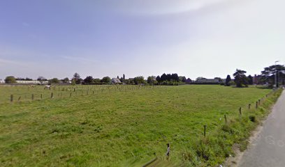
| Description | : | The village of Rotem is located south of the town of Maaseik on the N78. From the motorway E314 which runs between Aken (Aachen) and Antwerpen turn off at junction 33 Maas-Mechelen and onto the N78 direction Eisden/Dilsen. Follow the N78 to the village of Rotem and at the junction with the N757 turn left onto the N757. Go past the church round the right hand bend and take the first turn on the right, the cemetery is along on the right. The graves are located through the entrance, follow the path to the third path on the right and... Read More |
frequently asked questions (FAQ):
-
Where is Rotem Communal Cemetery?
Rotem Communal Cemetery is located at Dilsen-Stokkem, Arrondissement Maaseik ,Limburg ,Belgium.
-
Rotem Communal Cemetery cemetery's updated grave count on graveviews.com?
0 memorials
-
Where are the coordinates of the Rotem Communal Cemetery?
Latitude: 51.0540600
Longitude: 5.7364100
Nearby Cemetories:
1. Dilsen Communal Cemetery
Dilsen-Stokkem, Arrondissement Maaseik, Belgium
Coordinate: 51.0376900, 5.7230800
2. Elen Cemetery
Dilsen-Stokkem, Arrondissement Maaseik, Belgium
Coordinate: 51.0673900, 5.7599200
3. Grevenbicht Protestant Churchyard
Grevenbicht, Sittard-Geleen Municipality, Netherlands
Coordinate: 51.0393100, 5.7697200
4. Joodse Begraafplaats
Grevenbicht, Sittard-Geleen Municipality, Netherlands
Coordinate: 51.0355570, 5.7733330
5. Stokkem New Cemetery
Dilsen-Stokkem, Arrondissement Maaseik, Belgium
Coordinate: 51.0204200, 5.7368200
6. Stokkem Old Cemetery
Dilsen-Stokkem, Arrondissement Maaseik, Belgium
Coordinate: 51.0191200, 5.7368200
7. Lanklaar Old Communal Cemetery
Dilsen-Stokkem, Arrondissement Maaseik, Belgium
Coordinate: 51.0194900, 5.7278600
8. Neeroeteren Cemetery
Maaseik, Arrondissement Maaseik, Belgium
Coordinate: 51.0935100, 5.7008100
9. Born Roman Catholic Cemetery
Born, Sittard-Geleen Municipality, Netherlands
Coordinate: 51.0309700, 5.8049500
10. Maaseik Old Cemetery
Maaseik, Arrondissement Maaseik, Belgium
Coordinate: 51.0997700, 5.7764300
11. Holtum Churchyard
Holtum, Sittard-Geleen Municipality, Netherlands
Coordinate: 51.0487200, 5.8230300
12. Opoeteren Cemetery
Opoeteren, Arrondissement Maaseik, Belgium
Coordinate: 51.0699500, 5.6497500
13. Maaseik Egelsveld Cemetery
Maaseik, Arrondissement Maaseik, Belgium
Coordinate: 51.1078500, 5.7731100
14. Aldeneik Cemetery
Maaseik, Arrondissement Maaseik, Belgium
Coordinate: 51.0984475, 5.8027711
15. Leut Old Cemetery
Maasmechelen, Arrondissement Tongeren, Belgium
Coordinate: 50.9914700, 5.7366500
16. Joodse Begraafplaats
Urmond, Stein Municipality, Netherlands
Coordinate: 50.9935100, 5.7665080
17. Leut New Cemetery
Maasmechelen, Arrondissement Tongeren, Belgium
Coordinate: 50.9907200, 5.7429200
18. Roosteren Begraafplaats
Roosteren, Echt-Susteren Municipality, Netherlands
Coordinate: 51.0799350, 5.8308374
19. Urmond Molenweg Cemetery
Urmond, Stein Municipality, Netherlands
Coordinate: 50.9917500, 5.7723100
20. Dieteren Cemetery
Susteren, Echt-Susteren Municipality, Netherlands
Coordinate: 51.0766609, 5.8440000
21. St. Amelberga Roman Catholic Churchyard
Susteren, Echt-Susteren Municipality, Netherlands
Coordinate: 51.0610500, 5.8505700
22. Limbricht Cemetery
Limbricht, Sittard-Geleen Municipality, Netherlands
Coordinate: 51.0156959, 5.8383580
23. Stein Kerensheide cemetery
Stein, Stein Municipality, Netherlands
Coordinate: 50.9759400, 5.7696100
24. Vucht Cemetery
Maasmechelen, Arrondissement Tongeren, Belgium
Coordinate: 50.9742600, 5.7111600