| Memorials | : | 0 |
| Location | : | Hermanville, Claiborne County, USA |
| Coordinate | : | 31.9316230, -90.7447530 |
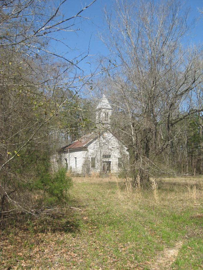
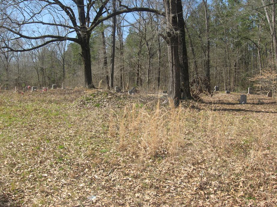
| Description | : | This seems to be a cemetery associated with the falling down church in the photo. Although some graves are maintained, overall the cemetery could use some work. It is located on Route 548 in Hermanville, MS about 1.5 miles east of Pattone Cemetery (Freedman Hill Rd, Hermanville) on Route 548. If someone knows what this church/cemetery was/is called, please don't hesitate to contact me. #47401038 |
frequently asked questions (FAQ):
-
Where is Route 548?
Route 548 is located at Route 548 Hermanville, Claiborne County ,Mississippi ,USA.
-
Route 548 cemetery's updated grave count on graveviews.com?
0 memorials
-
Where are the coordinates of the Route 548?
Latitude: 31.9316230
Longitude: -90.7447530
Nearby Cemetories:
1. Saint Phillips Cemetery
Hermanville, Claiborne County, USA
Coordinate: 31.9317800, -90.7448000
2. Pisgah Cemetery
Hermanville, Claiborne County, USA
Coordinate: 31.9169006, -90.7406006
3. Freedman Hall M. B. Church Cemetery
Claiborne County, USA
Coordinate: 31.9336780, -90.7661780
4. Beech Grove Cemetery
Claiborne County, USA
Coordinate: 31.9132996, -90.7485962
5. Pattona Cemetery
Hermanville, Claiborne County, USA
Coordinate: 31.9393997, -90.7656021
6. Hulburt Cemetery
Claiborne County, USA
Coordinate: 31.9267006, -90.7202988
7. Hulburt Cemetery
Claiborne County, USA
Coordinate: 31.9242001, -90.7182999
8. Trimm Cemetery
Copiah County, USA
Coordinate: 31.9358006, -90.7069016
9. Old Mount Tro Grove Cemetery
Claiborne County, USA
Coordinate: 31.9613991, -90.7778015
10. Mountro Grove M B Church Cemetery
Hermanville, Claiborne County, USA
Coordinate: 31.9512400, -90.7879100
11. Howard Cemetery
Claiborne County, USA
Coordinate: 31.9699993, -90.7230988
12. Greenlee Cemetery
Copiah County, USA
Coordinate: 31.9197006, -90.6913986
13. Patton Graveyard
Carlisle, Claiborne County, USA
Coordinate: 31.9834400, -90.7599600
14. Nelson Cemetery
Copiah County, USA
Coordinate: 31.8908005, -90.6913986
15. Barnes Cemetery on Patton Road
Carlisle, Claiborne County, USA
Coordinate: 31.9914600, -90.7627600
16. Sarepta Cemetery
Hermanville, Claiborne County, USA
Coordinate: 31.8724995, -90.7660980
17. Grant Cemetery
Copiah County, USA
Coordinate: 31.9557991, -90.6703033
18. Jones Chapel Cemetery
Carlisle, Claiborne County, USA
Coordinate: 31.9965900, -90.7731300
19. French Cemetery
Hermanville, Claiborne County, USA
Coordinate: 31.9540470, -90.8239910
20. Shelby Cemetery
Claiborne County, USA
Coordinate: 31.9538994, -90.8242035
21. Black Hermanville Cemetery
Hermanville, Claiborne County, USA
Coordinate: 31.9549170, -90.8277160
22. Shields Cemetery
Claiborne County, USA
Coordinate: 31.9689007, -90.8233032
23. Jones Cemetery
Claiborne County, USA
Coordinate: 31.9944000, -90.7964020
24. Cherry Farm Cemetery
Claiborne County, USA
Coordinate: 31.9221992, -90.8358002


