
| Memorials | : | 3 |
| Location | : | Mount Sterling, Madison County, USA |
| Coordinate | : | 39.6728700, -83.2179900 |
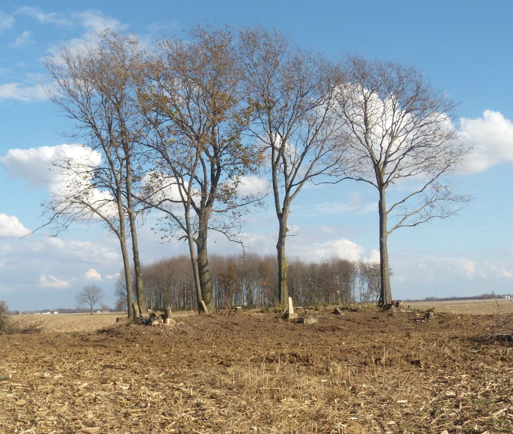
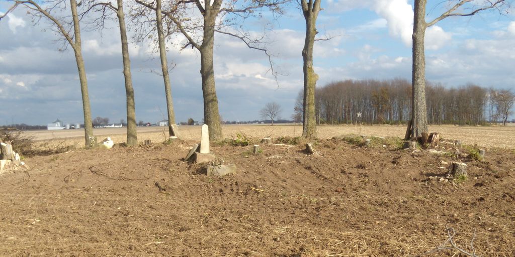
| Description | : | ROWLEN CEMETERY LOCATED 0.2 MILES SOUTH OF CALL ROAD (T- 183) AND 0.5 MILES WEST OF WHITESIDE ROAD (T- 176) This cemetery is located on the Call Farm (14643 Call Road) and acess is through his property. The cemetery is located in a clump of trees, surrounded by an almost completely broken down wooded fence, 0.2 miles directly East of Call's Farm barn buildings. Very few stones remain and those remaining are all broken. See map below. |
frequently asked questions (FAQ):
-
Where is Rowlen Cemetery?
Rowlen Cemetery is located at Mount Sterling, Madison County ,Ohio ,USA.
-
Rowlen Cemetery cemetery's updated grave count on graveviews.com?
2 memorials
-
Where are the coordinates of the Rowlen Cemetery?
Latitude: 39.6728700
Longitude: -83.2179900
Nearby Cemetories:
1. Rowlen Cemetery
Five Points, Pickaway County, USA
Coordinate: 39.6728900, -83.2179000
2. Lewis Farm Cemetery
Grange Hall, Pickaway County, USA
Coordinate: 39.6512670, -83.2358830
3. Shiloh Cemetery
Pickaway County, USA
Coordinate: 39.6582985, -83.1808014
4. Yankeetown Cemetery
Yankeetown, Fayette County, USA
Coordinate: 39.6586723, -83.2560272
5. Greenland Cemetery
Pickaway County, USA
Coordinate: 39.6991997, -83.1931000
6. Thomas Cemetery
Pickaway County, USA
Coordinate: 39.6307983, -83.2080994
7. Bostwick-Loofbourrow Cemetery
Madison Township, Fayette County, USA
Coordinate: 39.6926100, -83.2709680
8. Hebron Cemetery
Crownover Mill, Pickaway County, USA
Coordinate: 39.6258965, -83.1910248
9. Leavell Cemetery
Madison Township, Fayette County, USA
Coordinate: 39.6557999, -83.2814026
10. Methodist Church Cemetery
Mount Sterling, Madison County, USA
Coordinate: 39.7178400, -83.2635300
11. Tanner Cemetery
Five Points, Pickaway County, USA
Coordinate: 39.7275611, -83.2438032
12. Messmore Cemetery
Madison Township, Fayette County, USA
Coordinate: 39.6232986, -83.2583008
13. Waterloo Cemetery
Pancoastburg, Fayette County, USA
Coordinate: 39.6272011, -83.2675018
14. Hinton Farm Cemetery
Pickaway County, USA
Coordinate: 39.6138992, -83.1744003
15. Pleasant Cemetery
Mount Sterling, Madison County, USA
Coordinate: 39.7393990, -83.2510986
16. Arron Kellar Farm Cemetery
Perry Township, Pickaway County, USA
Coordinate: 39.6030998, -83.2371979
17. Palestine Church Cemetery
Pickaway County, USA
Coordinate: 39.7431260, -83.2430670
18. McKinley Cemetery
Darbyville, Pickaway County, USA
Coordinate: 39.7120060, -83.1326880
19. Arthur Dunlap Farm Cemetery
Monroe Township, Pickaway County, USA
Coordinate: 39.6178017, -83.1430969
20. Muhlenberg Township Cemetery
Darbyville, Pickaway County, USA
Coordinate: 39.6919518, -83.1125183
21. Ernie Hill Cemetery
Darbyville, Pickaway County, USA
Coordinate: 39.7336220, -83.1414250
22. Old Ridge Way Farm Cemetery
Derby, Pickaway County, USA
Coordinate: 39.7533130, -83.1803510
23. Lewis Farm Cemetery
Perry Township, Pickaway County, USA
Coordinate: 39.5903015, -83.1797028
24. Shockley Cemetery
Darby Township, Pickaway County, USA
Coordinate: 39.7531834, -83.1720180