
| Memorials | : | 3 |
| Location | : | Panama, Le Flore County, USA |
| Coordinate | : | 35.1763800, -94.6058300 |
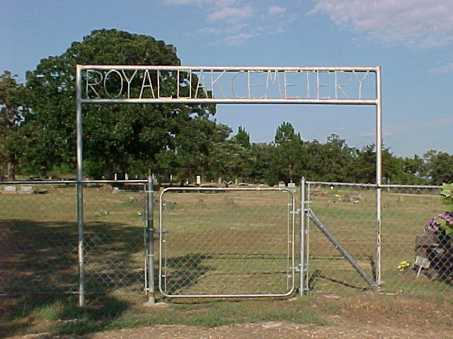
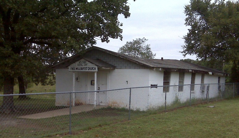
| Description | : | Royal Oak Cemetery is located 4 miles east of Panama, Ok in the community of Poker Bend. Turn left out of Greenhill Cemetery. Go to the Fire Station and turn left. That is Poker Bend Road. There is a right corner, then a left corner, then two miles farther on is the Royal Oak Missionary Baptist Church. Take a right there the cemetery is on your right. |
frequently asked questions (FAQ):
-
Where is Royal Oak Cemetery?
Royal Oak Cemetery is located at Panama, Le Flore County ,Oklahoma ,USA.
-
Royal Oak Cemetery cemetery's updated grave count on graveviews.com?
2 memorials
-
Where are the coordinates of the Royal Oak Cemetery?
Latitude: 35.1763800
Longitude: -94.6058300
Nearby Cemetories:
1. French Cemetery
Le Flore County, USA
Coordinate: 35.1747017, -94.5556030
2. Fairview Cemetery
Panama, Le Flore County, USA
Coordinate: 35.2019100, -94.6493700
3. Fairhill Cemetery
Le Flore County, USA
Coordinate: 35.1302700, -94.5951000
4. Tom George Cemetery
Le Flore County, USA
Coordinate: 35.2107912, -94.5475048
5. Lindsey Cemetery
Poteau, Le Flore County, USA
Coordinate: 35.1163600, -94.6200700
6. Shady Point Cemetery
Shady Point, Le Flore County, USA
Coordinate: 35.1291667, -94.6558333
7. Spiro City Cemetery
Spiro, Le Flore County, USA
Coordinate: 35.2425003, -94.6306000
8. Greenhill Cemetery
Cameron, Le Flore County, USA
Coordinate: 35.1560000, -94.5240000
9. Skullyville Cemetery
Skullyville, Le Flore County, USA
Coordinate: 35.2508200, -94.5944800
10. Roselawn Cemetery
Skullyville, Le Flore County, USA
Coordinate: 35.2511200, -94.5932900
11. Wards Cemetery
Le Flore County, USA
Coordinate: 35.2444000, -94.5646973
12. New Hope Garden of Memories
Spiro, Le Flore County, USA
Coordinate: 35.2496986, -94.5817032
13. Stapp-Zoe Cemetery
Le Flore County, USA
Coordinate: 35.0779494, -94.6388277
14. Macedonia Cemetery
Pocola, Le Flore County, USA
Coordinate: 35.2385340, -94.4994380
15. Nubbin Ridge Cemetery
Bokoshe, Le Flore County, USA
Coordinate: 35.1974983, -94.7425003
16. Fort Coffee Cemetery
Spiro, Le Flore County, USA
Coordinate: 35.2915300, -94.5842200
17. Hall Cemetery
Poteau, Le Flore County, USA
Coordinate: 35.0950012, -94.4993973
18. Calhoun Cemetery
Le Flore County, USA
Coordinate: 35.0944600, -94.7196500
19. Redland Cemetery
Muldrow, Sequoyah County, USA
Coordinate: 35.3039900, -94.6263800
20. Page Cemetery
Pocola, Le Flore County, USA
Coordinate: 35.2506100, -94.4766700
21. Powell Cemetery
Bokoshe, Le Flore County, USA
Coordinate: 35.2052994, -94.7602997
22. Cedar Grove Cemetery
Poteau, Le Flore County, USA
Coordinate: 35.0457993, -94.6464005
23. Oakland Cemetery
Poteau, Le Flore County, USA
Coordinate: 35.0410995, -94.6307983
24. Brazil Cemetery
Shady Point, Le Flore County, USA
Coordinate: 35.1347008, -94.7668991