
| Memorials | : | 0 |
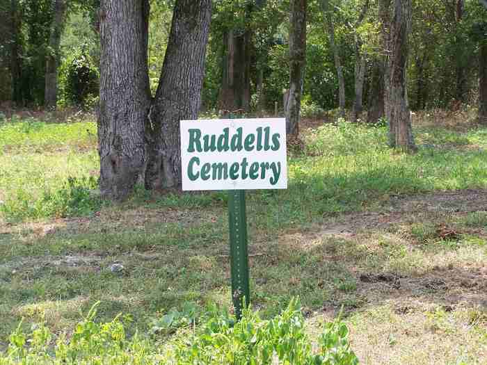
| Location | : | Izard County, USA |
| Coordinate | : | 35.9300003, -92.0980988 |
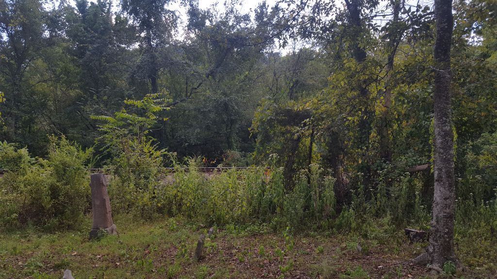
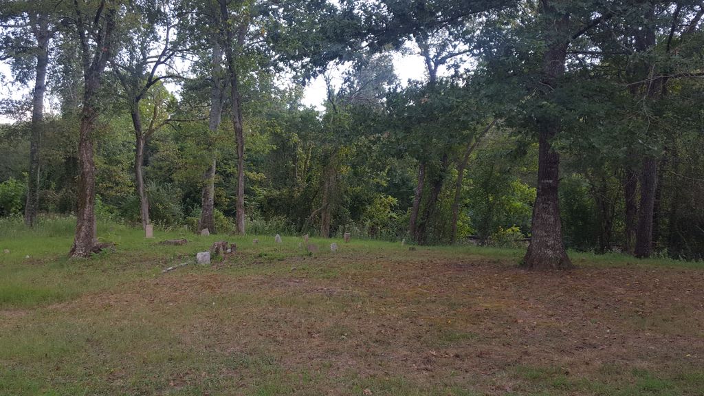
| Description | : | This cemetery was historically a black cemetery without a name for the burial of slaves owned by the local families farming the White River bottoms. Post civil war it continued to be a black cemetery until the railroad was put in 1900. During this time it was used as a burial site for Greek, Italian and black workers laying the track. After the rail road became functional 1902 it became known as Ruddell Cemetery due to the Ruddell Train Depot serving the river bottoms and Livesay Flats. A lime company began business operating until the 1930s when it moved to... Read More |
frequently asked questions (FAQ):
-
Where is Ruddells Cemetery?
Ruddells Cemetery is located at Ruddell Izard County ,Arkansas ,USA.
-
Ruddells Cemetery cemetery's updated grave count on graveviews.com?
0 memorials
-
Where are the coordinates of the Ruddells Cemetery?
Latitude: 35.9300003
Longitude: -92.0980988


Nearby Cemetories:
1. Sylamore Creek Cemetery
Fiftysix, Stone County, USA
Coordinate: 35.9477430, -92.1031570
2. Sylamore Cemetery
Sylamore, Izard County, USA
Coordinate: 35.9477997, -92.1031036
3. Levisy Flat Cemetery
Levisy Flat, Stone County, USA
Coordinate: 35.9049988, -92.1022034
4. Harris Cemetery
Stone County, USA
Coordinate: 35.9599991, -92.1038971
5. Polk Mountain Cemetery
Izard County, USA
Coordinate: 35.9603004, -92.0681000
6. Pryor Cemetery
Stone County, USA
Coordinate: 35.9263470, -92.1473340
7. Haney Hollow Cemetery
Mountain View, Stone County, USA
Coordinate: 35.9704361, -92.1006165
8. Gayler Cemetery
Mountain View, Stone County, USA
Coordinate: 35.9258003, -92.1624985
9. Round Bottom Cemetery
Stone County, USA
Coordinate: 35.9306285, -92.0329285
10. Jeffery Cemetery
Stone County, USA
Coordinate: 35.9818993, -92.0860977
11. Beckman Cemetery
Stone County, USA
Coordinate: 35.9305992, -92.0327988
12. Middleton Cemetery
Mountain View, Stone County, USA
Coordinate: 35.9840508, -92.1017075
13. Livingston Creek Cemetery
Stone County, USA
Coordinate: 35.9844017, -92.0978012
14. Burgess Cemetery
Izard County, USA
Coordinate: 35.9647700, -92.0376600
15. McMurtry Cemetery
Mountain View, Stone County, USA
Coordinate: 35.8694382, -92.1119537
16. Herpel Cemetery
Stone County, USA
Coordinate: 35.9082330, -92.0263150
17. Historic Cemetery of Mountain View
Mountain View, Stone County, USA
Coordinate: 35.8662376, -92.1233673
18. Brewer Cemetery
Mountain View, Stone County, USA
Coordinate: 35.8602220, -92.1065960
19. Farber Cemetery
Izard County, USA
Coordinate: 35.9749985, -92.0297012
20. Flat Rocks Cemetery
Mount Olive, Izard County, USA
Coordinate: 36.0043260, -92.0946980
21. Upper Twin Creek Cemetery
Izard County, USA
Coordinate: 35.9850006, -92.0342026
22. Flatwoods Cemetery
Mountain View, Stone County, USA
Coordinate: 35.8544006, -92.0708008
23. Mount Olive Cemetery
Mount Olive, Izard County, USA
Coordinate: 36.0080986, -92.0830994
24. McCarn-Ramsey Cemetery
Fiftysix, Stone County, USA
Coordinate: 35.9340439, -92.1960449