
| Memorials | : | 0 |
| Location | : | South Bend, St. Joseph County, USA |
| Coordinate | : | 41.6303000, -86.2712000 |
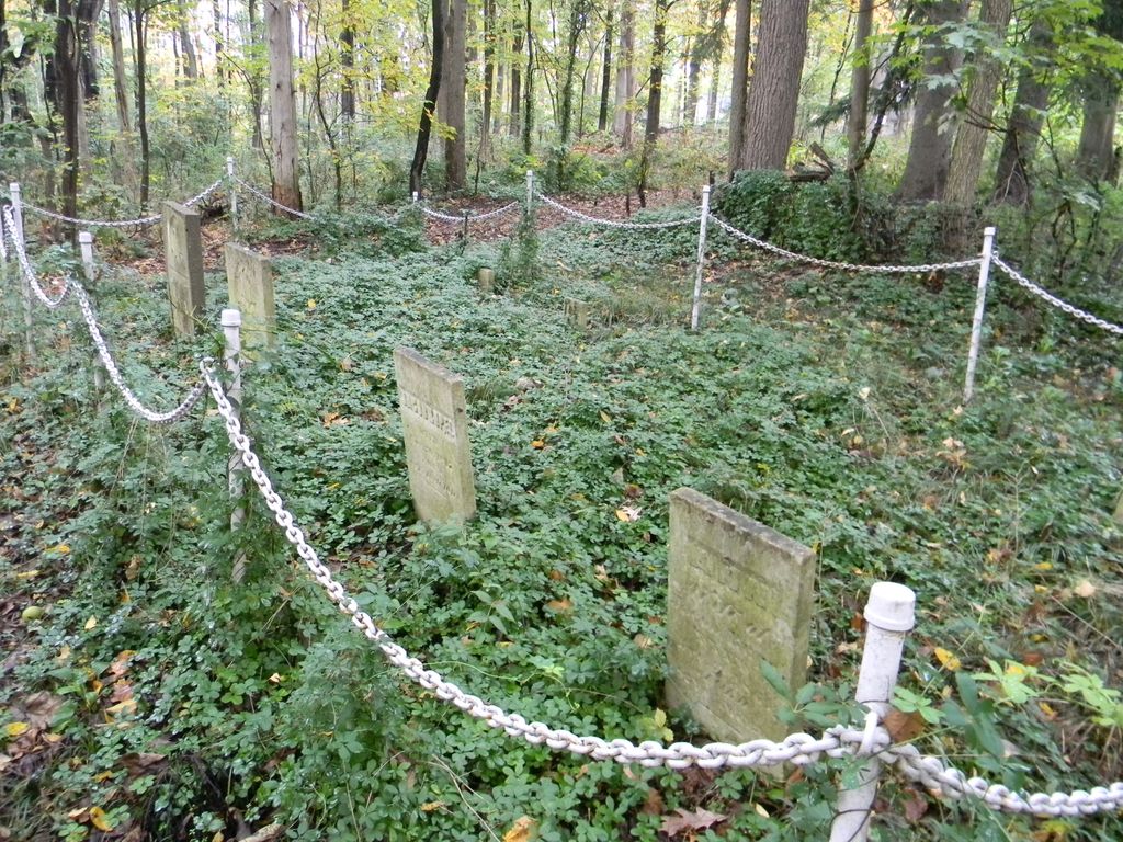
| Description | : | The cemetery is located in Centre Township (SW quadrant of the SW quadrant of the NW quadrant of Section 26 Township 37N Range 2E) about 450 feet west of Keria Trail about 0.1 miles north of its intersection with W Ireland Road. Indiana Cemetery Locations, Volume 3, published by the Indiana Genealogical Society (April 2007), gives the primary cemetery name as Rupel Cemetery. The cemetery is listed in the Cemetery and Burial Grounds Registry of the Indiana Department of Natural Resources (DNR) and in the State Historical Architectural and Archaeological Research Database (SHAARD) with Cemetery Record Number CR-71-4 (Rupel). The Indiana Historic Sites... Read More |
frequently asked questions (FAQ):
-
Where is Rupel Cemetery?
Rupel Cemetery is located at 59449 Keria Trail South Bend, St. Joseph County ,Indiana , 46614USA.
-
Rupel Cemetery cemetery's updated grave count on graveviews.com?
0 memorials
-
Where are the coordinates of the Rupel Cemetery?
Latitude: 41.6303000
Longitude: -86.2712000
Nearby Cemetories:
1. Rohrer Cemetery
St. Joseph County, USA
Coordinate: 41.6290588, -86.2406387
2. Southlawn Cemetery
South Bend, St. Joseph County, USA
Coordinate: 41.6051407, -86.2551575
3. Bowman Cemetery
South Bend, St. Joseph County, USA
Coordinate: 41.6567993, -86.2348099
4. Rose Hill Cemetery
South Bend, St. Joseph County, USA
Coordinate: 41.6575890, -86.2348404
5. Henson Cemetery
South Bend, St. Joseph County, USA
Coordinate: 41.5868650, -86.2599980
6. Cathedral of Saint James Columbarium
South Bend, St. Joseph County, USA
Coordinate: 41.6770630, -86.2537918
7. City Cemetery
South Bend, St. Joseph County, USA
Coordinate: 41.6793400, -86.2685000
8. First Presbyterian Church Memorial Garden
South Bend, St. Joseph County, USA
Coordinate: 41.6779690, -86.2549180
9. Sumption Prairie Cemetery
South Bend, St. Joseph County, USA
Coordinate: 41.6086006, -86.3305969
10. Zion United Church of Christ Cremation Garden
South Bend, St. Joseph County, USA
Coordinate: 41.6740640, -86.2401870
11. Van Buskirk Cemetery
St. Joseph County, USA
Coordinate: 41.5932400, -86.2156770
12. Old Jewish Cemetery (Defunct)
South Bend, St. Joseph County, USA
Coordinate: 41.6826310, -86.2447640
13. Sisters of Saint Francis Convent Cemetery
Mishawaka, St. Joseph County, USA
Coordinate: 41.6419300, -86.1962600
14. Mount Calvary Cemetery
Portage Township, St. Joseph County, USA
Coordinate: 41.5721580, -86.2637310
15. Smith Cemetery
Penn Township, St. Joseph County, USA
Coordinate: 41.6432910, -86.1844040
16. Saint Joseph Cemetery
South Bend, St. Joseph County, USA
Coordinate: 41.6645622, -86.3485260
17. McCartney Family Cemetery
St. Joseph County, USA
Coordinate: 41.6974869, -86.2688980
18. Cedar Grove Cemetery
Notre Dame, St. Joseph County, USA
Coordinate: 41.6944008, -86.2406006
19. Hebrew Orthodox Cemetery
Mishawaka, St. Joseph County, USA
Coordinate: 41.6721840, -86.1963882
20. Saint Josephs Cemetery of the Brothers
Notre Dame, St. Joseph County, USA
Coordinate: 41.6999435, -86.2502747
21. Hungarian Sacred Heart Cemetery
South Bend, St. Joseph County, USA
Coordinate: 41.6719017, -86.3497009
22. Mount Pleasant Cemetery
South Bend, St. Joseph County, USA
Coordinate: 41.6937130, -86.3198700
23. Ferrisville Cemetery
Penn Township, St. Joseph County, USA
Coordinate: 41.6080220, -86.1774020
24. Notre Dame Log Chapel Crypt
Notre Dame, St. Joseph County, USA
Coordinate: 41.7015350, -86.2425600