
| Memorials | : | 23 |
| Location | : | Russell, Far North District, New Zealand |
| Coordinate | : | -35.2579350, 174.1290430 |
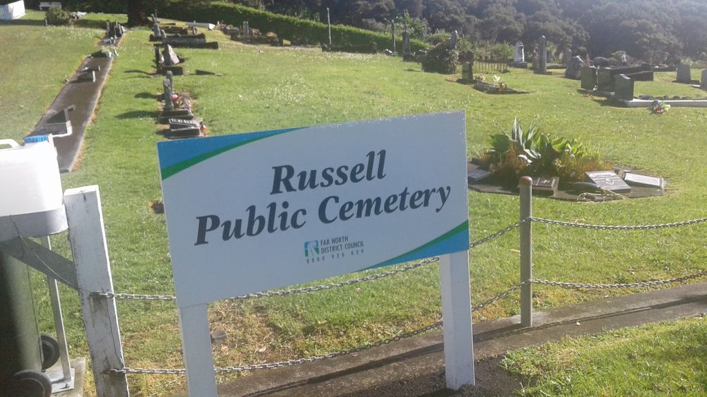
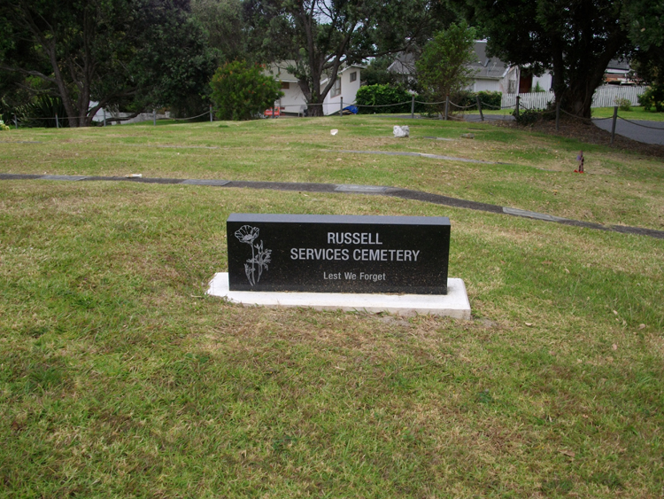
| Description | : | Russell, formerly known as Kororareka, was the first permanent European settlement and sea port in New Zealand It is situated in the Bay of Islands in the far north of the North Island Kororareka was part of the Port of Russell and after Russell (Okiato) became virtually deserted, Kororareka gradually became known as Russell also. In January 1844 Governor Robert FitzRoy officially designated Kororareka as part of the township of Russell. Today the name Russell applies only to Kororareka while the former capital is known either by its original name of Okiato or as Old Russell Location Map of graves at RUSSELL Cemetery The... Read More |
frequently asked questions (FAQ):
-
Where is Russell Cemetery?
Russell Cemetery is located at Long Beach Road Russell, Far North District ,Northland ,New Zealand.
-
Russell Cemetery cemetery's updated grave count on graveviews.com?
23 memorials
-
Where are the coordinates of the Russell Cemetery?
Latitude: -35.2579350
Longitude: 174.1290430
Nearby Cemetories:
1. Christ Church Cemetery
Russell, Far North District, New Zealand
Coordinate: -35.2632500, 174.1234890
2. Saint Paul's Churchyard Cemetery
Paihia, Far North District, New Zealand
Coordinate: -35.2840827, 174.0937155
3. Paihia Cemetery
Paihia, Far North District, New Zealand
Coordinate: -35.2906700, 174.0958400
4. Oihi Mission Settlement
Rangiahua, Far North District, New Zealand
Coordinate: -35.1687100, 174.0956200
5. Kawakawa Cemetery
Kawakawa, Far North District, New Zealand
Coordinate: -35.3761350, 174.0787080
6. Otarawa Urupā
Far North District, New Zealand
Coordinate: -35.4065515, 174.0785476
7. Wairere Cemetery
Far North District, New Zealand
Coordinate: -35.4065515, 174.0785476
8. Holy Trinity Anglican Church Cemetery
Pakaraka, Far North District, New Zealand
Coordinate: -35.3608502, 173.9467814
9. Kerikeri Cemetery
Kerikeri, Far North District, New Zealand
Coordinate: -35.2645040, 173.8956300
10. Maungarangi Urupā
Moerewa, Far North District, New Zealand
Coordinate: -35.4116110, 173.9487910
11. Saint John the Baptist Church Cemetery
Waimate North, Far North District, New Zealand
Coordinate: -35.3166169, 173.8752265
12. Mokau Marae Urupā
Helena Bay, Whangārei District, New Zealand
Coordinate: -35.4085962, 174.3445399
13. Pungaere Cemetery
Waipapa, Far North District, New Zealand
Coordinate: -35.1839520, 173.8520890
14. Towai Cemetery
Towai, Far North District, New Zealand
Coordinate: -35.4990330, 174.1259310
15. Takapuna Urupā
Motatau, Far North District, New Zealand
Coordinate: -35.4983550, 174.0347320
16. Saint Michael's Anglician Church Cemetery
Ohaeawai, Far North District, New Zealand
Coordinate: -35.3790140, 173.8561520
17. Tumutumu Urupā
Whangārei District, New Zealand
Coordinate: -35.5148040, 174.0493450
18. Hukerenui Cemetery
Whangārei, Whangārei District, New Zealand
Coordinate: -35.5210700, 174.2010900
19. Kaikohe Public Cemetery
Kaikohe, Far North District, New Zealand
Coordinate: -35.3948540, 173.8336960
20. St. Catherine's Churchyard
Okaihau, Far North District, New Zealand
Coordinate: -35.3263889, 173.7597222
21. Kaikohe Māori Cemetery
Kaikohe, Far North District, New Zealand
Coordinate: -35.4200700, 173.7899300
22. Reihana Taukawau Tuarua Cemetery
Tautoro, Far North District, New Zealand
Coordinate: -35.4795110, 173.8372770
23. Okaihau Cemetery
Whangārei, Whangārei District, New Zealand
Coordinate: -35.3323900, 173.7377500
24. Kaeo Cemetery
Kaeo, Far North District, New Zealand
Coordinate: -35.1029010, 173.7746230