
| Memorials | : | 0 |
| Location | : | Douglas, Coffee County, USA |
| Coordinate | : | 31.5077000, -82.8465300 |
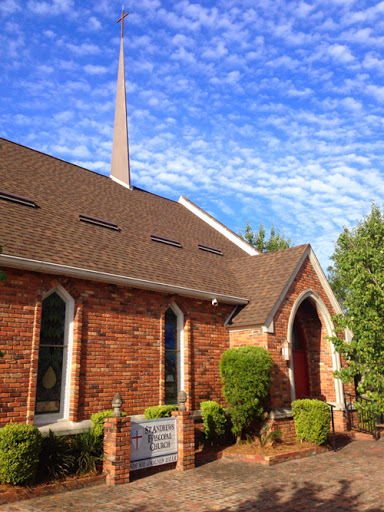
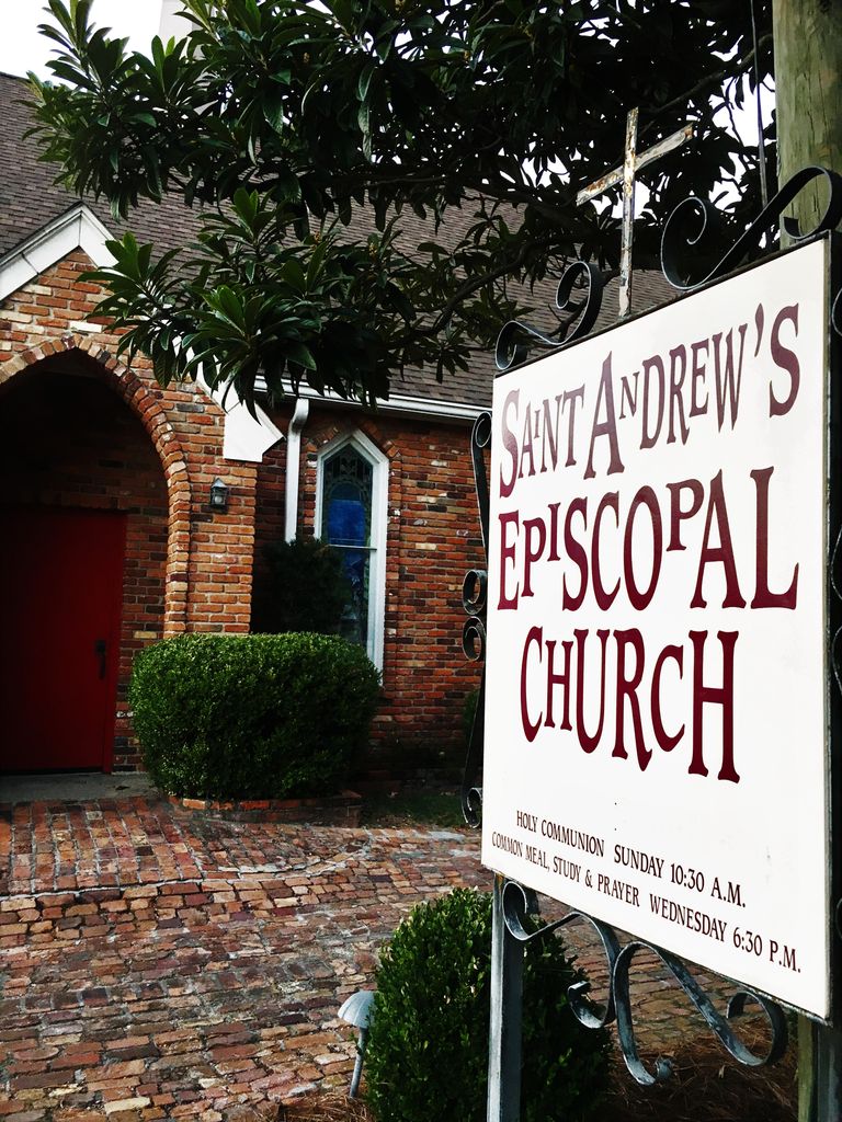
| Description | : | Saint Andrew's Episcopal Church 204 S. Coffee Avenue Douglas, GA 31533 http://www.standrewsdouglas.georgiaepiscopal.org/ "In the summer of 1899, T.B. Marshall of St. Illa Vineyard near Willacoochee researched the possibility of establishing a mission or church in Douglas. His anticipation of approximately fifteen members along with his persistence are thought to have made his dream a reality. A meeting was held August 14, 1899, for the purpose of organizing an Episcopal Church in Douglas. The Rev. J.W. Turner was elected chairman and J. W. Quincy secretary. A building committee was also appointed at that meeting. The first service of The Episcopal Church in Douglas was held on... Read More |
frequently asked questions (FAQ):
-
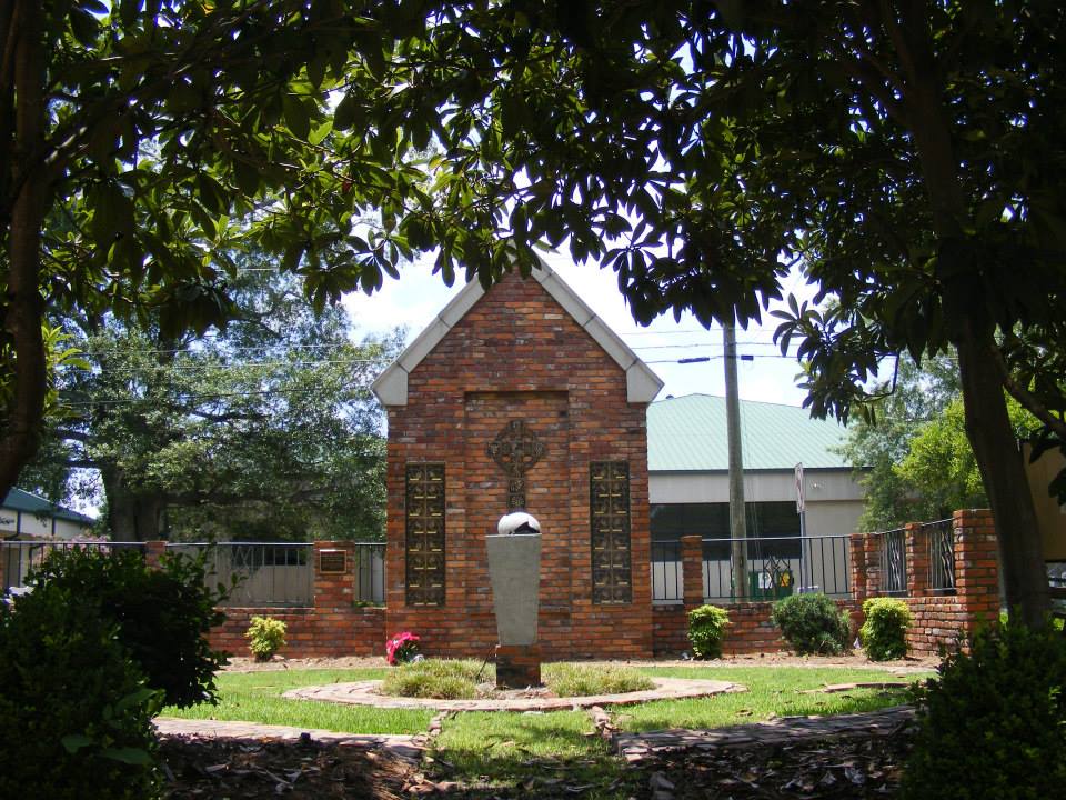
Where is Saint Andrew's Episcopal Church Columbarium?
Saint Andrew's Episcopal Church Columbarium is located at 204 South Coffee Avenue Douglas, Coffee County ,Georgia , 31533USA.
-
Saint Andrew's Episcopal Church Columbarium cemetery's updated grave count on graveviews.com?
0 memorials
-
Where are the coordinates of the Saint Andrew's Episcopal Church Columbarium?
Latitude: 31.5077000
Longitude: -82.8465300
Nearby Cemetories:
1. Merritt Family Cemetery
Douglas, Coffee County, USA
Coordinate: 31.5189300, -82.8262900
2. Douglas City Cemetery
Douglas, Coffee County, USA
Coordinate: 31.5280991, -82.8416977
3. Wayfare Cemetery
Douglas, Coffee County, USA
Coordinate: 31.4783001, -82.8253021
4. Franklin Cemetery
Douglas, Coffee County, USA
Coordinate: 31.4631004, -82.8518982
5. Grantham Cemetery
Coffee County, USA
Coordinate: 31.5400009, -82.8882980
6. Cumorah Cemetery
Douglas, Coffee County, USA
Coordinate: 31.4613991, -82.8289032
7. Ashley Yoemans Cemetery
Coffee County, USA
Coordinate: 31.4624996, -82.8703003
8. Spikes Cemetery
Douglas, Coffee County, USA
Coordinate: 31.4983210, -82.7886580
9. Upton Cemetery
Douglas, Coffee County, USA
Coordinate: 31.5263160, -82.9034370
10. McKinnon Family Cemetery
Douglas, Coffee County, USA
Coordinate: 31.4613310, -82.8835920
11. Bethel Missionary Baptist Church Cemetery
Coffee County, USA
Coordinate: 31.4608002, -82.8842010
12. Rocky Pond Cemetery
Coffee County, USA
Coordinate: 31.5438995, -82.8981018
13. Saint Paul Catholic Church Columbarium
Douglas, Coffee County, USA
Coordinate: 31.4492550, -82.8516340
14. McClelland Cemetery
Coffee County, USA
Coordinate: 31.4521999, -82.8719025
15. Peterson Cemetery
Coffee County, USA
Coordinate: 31.5044003, -82.9180984
16. Chaney Cemetery
Coffee County, USA
Coordinate: 31.5252991, -82.9214020
17. Salem Cemetery
Douglas, Coffee County, USA
Coordinate: 31.5324993, -82.9197006
18. Harrell Grove Cemetery
Douglas, Coffee County, USA
Coordinate: 31.4557991, -82.7925034
19. John Carver Cemetery
Coffee County, USA
Coordinate: 31.4549999, -82.9005966
20. Carver Baptist Church Cemetery
Douglas, Coffee County, USA
Coordinate: 31.4372005, -82.8657990
21. Satilla Memorial Gardens
Douglas, Coffee County, USA
Coordinate: 31.4226840, -82.8515320
22. Saint Illa Cemetery
Coffee County, USA
Coordinate: 31.4764004, -82.9393997
23. Pine Forests Memorial Gardens
Coffee County, USA
Coordinate: 31.4221992, -82.8514023
24. Sand Hill Cemetery
Douglas, Coffee County, USA
Coordinate: 31.5289001, -82.7431030