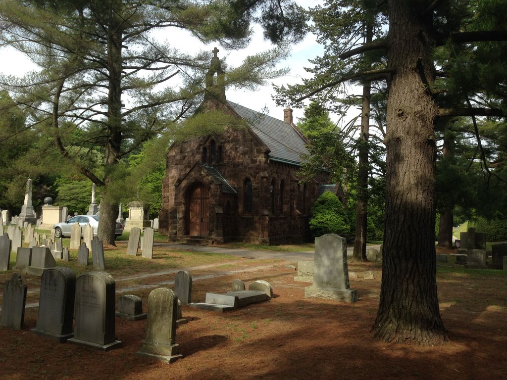
| Memorials | : | 4240 |
| Location | : | Mount Holly, Burlington County, USA |
| Coordinate | : | 39.9878006, -74.7853012 |
| Description | : | Established in 1742, St. Andrew's Graveyard received it's royal charter from King George III in 1765, while Benjamin Franklin's son, William, was Governer of New Jersey. The original Church of St. Andrew's was located on the land that is now the site of the cemetery. Also on this site was the Battle of Iron Works Hill (12/22-23/1776). It was between 600 American Militia (mainly boys and old men), under the command of Colonel Samuel Griffin, and a force of 2000 Hessian Mercenaries and British Army Regulars under the command of Carl von Donop. This action removed Donop and his troops from... Read More |
frequently asked questions (FAQ):
-
Where is Saint Andrew's Graveyard?
Saint Andrew's Graveyard is located at Pine Street Mount Holly, Burlington County ,New Jersey , 08060USA.
-
Saint Andrew's Graveyard cemetery's updated grave count on graveviews.com?
4238 memorials
-
Where are the coordinates of the Saint Andrew's Graveyard?
Latitude: 39.9878006
Longitude: -74.7853012
Nearby Cemetories:
1. Mount Holly Friends Cemetery
Mount Holly, Burlington County, USA
Coordinate: 39.9955600, -74.7869800
2. Mount Holly Cemetery
Mount Holly, Burlington County, USA
Coordinate: 40.0014000, -74.7863998
3. Brotherhood Cemetery
Hainesport, Burlington County, USA
Coordinate: 39.9880981, -74.8063965
4. Sacred Heart Cemetery
Hainesport, Burlington County, USA
Coordinate: 39.9887630, -74.8069080
5. Mount Moriah AME Church Cemetery
Hainesport, Burlington County, USA
Coordinate: 39.9878006, -74.8071976
6. Saint Pauls Lutheran Church Garden of Life
Hainesport, Burlington County, USA
Coordinate: 39.9865290, -74.8139710
7. Woodlane Graveyard
Mount Holly, Burlington County, USA
Coordinate: 40.0099983, -74.7901993
8. Saint Pauls Lutheran Church Cemetery
Hainesport, Burlington County, USA
Coordinate: 39.9863014, -74.8150024
9. Timbuctoo Civil War Memorial Cemetery
Westampton, Burlington County, USA
Coordinate: 39.9991000, -74.8126900
10. Old Lumberton Cemetery
Lumberton, Burlington County, USA
Coordinate: 39.9590988, -74.8058014
11. Saint Martin in the Fields Memorial Garden
Lumberton, Burlington County, USA
Coordinate: 39.9581480, -74.8081230
12. Evergreen Cemetery
Lumberton, Burlington County, USA
Coordinate: 39.9562988, -74.8094025
13. John Skene Gravesite
Burlington County, USA
Coordinate: 40.0371900, -74.8050200
14. Vincentown Baptist Cemetery
Vincentown, Burlington County, USA
Coordinate: 39.9395400, -74.7609690
15. Easton Union Cemetery
Hainesport, Burlington County, USA
Coordinate: 39.9658012, -74.8503036
16. Vincentown Methodist Cemetery
Vincentown, Burlington County, USA
Coordinate: 39.9370900, -74.7488600
17. Vincentown Friends Cemetery
Vincentown, Burlington County, USA
Coordinate: 39.9352400, -74.7495500
18. Jesus Bread of Life Catholic Cemetery
Mount Laurel, Burlington County, USA
Coordinate: 39.9773600, -74.8673100
19. Copany Meeting House Cemetery
Lower Springfield, Burlington County, USA
Coordinate: 40.0481186, -74.7539139
20. Haines Family Farm Cemetery
Medford, Burlington County, USA
Coordinate: 39.9235020, -74.8079980
21. Rancocas Quaker Burying Ground
Rancocas, Burlington County, USA
Coordinate: 40.0014000, -74.8705978
22. Park View Cemetery at Kirbys Mill
Medford, Burlington County, USA
Coordinate: 39.9222300, -74.8076800
23. Arneys Mount Friends Burying Ground
Juliustown, Burlington County, USA
Coordinate: 40.0098250, -74.6970240
24. Darnell Family Cemetery
Mount Laurel, Burlington County, USA
Coordinate: 39.9535520, -74.8728800


