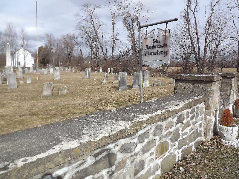
| Memorials | : | 1 |
| Location | : | Saint Andrew, Orange County, USA |
| Coordinate | : | 41.5695860, -74.1456610 |
| Description | : | North of intersection of Plains Road, St. Andrew's Road, and Lake Osiris Road The Log Church, a station of the Church of England, was built not long after 1744 in the hamlet of Wileman. It was located in the corner of the field at the fork in the roads leading from present-day St. Andrews to Walden and Wallkill. In a charter issued by King George III, dated July 30, 1770, the Log Church became incorporated as St. Andrews, and a new building was erected in the southeast corner of St. Andrews Cemetery, which began accepting burials at about that... Read More |
frequently asked questions (FAQ):
-
Where is Saint Andrews Cemetery?
Saint Andrews Cemetery is located at 2-4 Plains Road (County Road 85) Saint Andrew, Orange County ,New York , 12586USA.
-
Saint Andrews Cemetery cemetery's updated grave count on graveviews.com?
0 memorials
-
Where are the coordinates of the Saint Andrews Cemetery?
Latitude: 41.5695860
Longitude: -74.1456610
Nearby Cemetories:
1. Borden Estate Cemetery
Ulster County, USA
Coordinate: 41.5949329, -74.1716695
2. Coldenham Cemetery
Coldenham, Orange County, USA
Coordinate: 41.5279850, -74.1536810
3. Berea Cemetery
Montgomery, Orange County, USA
Coordinate: 41.5307999, -74.1763992
4. Colden Cemetery
Coldenham, Orange County, USA
Coordinate: 41.5213890, -74.1469421
5. Rossville Cemetery
Plattekill, Ulster County, USA
Coordinate: 41.5890000, -74.0687500
6. Rossville Cemetery
Rossville, Orange County, USA
Coordinate: 41.5888000, -74.0683000
7. Friends Cemetery
Plattekill, Ulster County, USA
Coordinate: 41.6050000, -74.0766600
8. Mulford Ground
Shawangunk, Ulster County, USA
Coordinate: 41.6299730, -74.1802210
9. Mulford Cemetery
New Hurley, Ulster County, USA
Coordinate: 41.6300011, -74.1806030
10. Gardnertown Cemetery
Gardnertown, Orange County, USA
Coordinate: 41.5349600, -74.0699500
11. Goodwill Presbyterian Church Cemetery
Montgomery, Orange County, USA
Coordinate: 41.5188904, -74.2072220
12. New Hurley Reformed Church Cemetery
New Hurley, Ulster County, USA
Coordinate: 41.6386100, -74.1427700
13. Bond Family Cemetery
Newburgh, Orange County, USA
Coordinate: 41.5263350, -74.0730373
14. Beth Hillel Cemetery
Pine Bush, Orange County, USA
Coordinate: 41.5884800, -74.2355200
15. Plattekill Valley Community Cemetery
Plattekill, Ulster County, USA
Coordinate: 41.6163800, -74.0750000
16. Fostertown Cemetery
Newburgh, Orange County, USA
Coordinate: 41.5547218, -74.0447235
17. Belknap Cemetery
Little Britain, Orange County, USA
Coordinate: 41.5069008, -74.0824966
18. Patton Family Burial Ground
Newburgh, Orange County, USA
Coordinate: 41.5059433, -74.0790939
19. Graham Cemetery
Pine Bush, Orange County, USA
Coordinate: 41.5775800, -74.2575200
20. Riverside Cemetery
Montgomery, Orange County, USA
Coordinate: 41.5289001, -74.2442017
21. Saint Marys Cemetery
Montgomery, Orange County, USA
Coordinate: 41.5208015, -74.2378006
22. Decker Cemetery
Maybrook, Orange County, USA
Coordinate: 41.4954380, -74.2084680
23. Brick Church Cemetery
Montgomery, Orange County, USA
Coordinate: 41.5313988, -74.2514038
24. Brick Church Cemetery New
Montgomery, Orange County, USA
Coordinate: 41.5314320, -74.2517460

