| Memorials | : | 0 |
| Location | : | Percé, Gaspesie-Iles-de-la-Madeleine Region, Canada |
| Coordinate | : | 48.4918400, -64.1732900 |
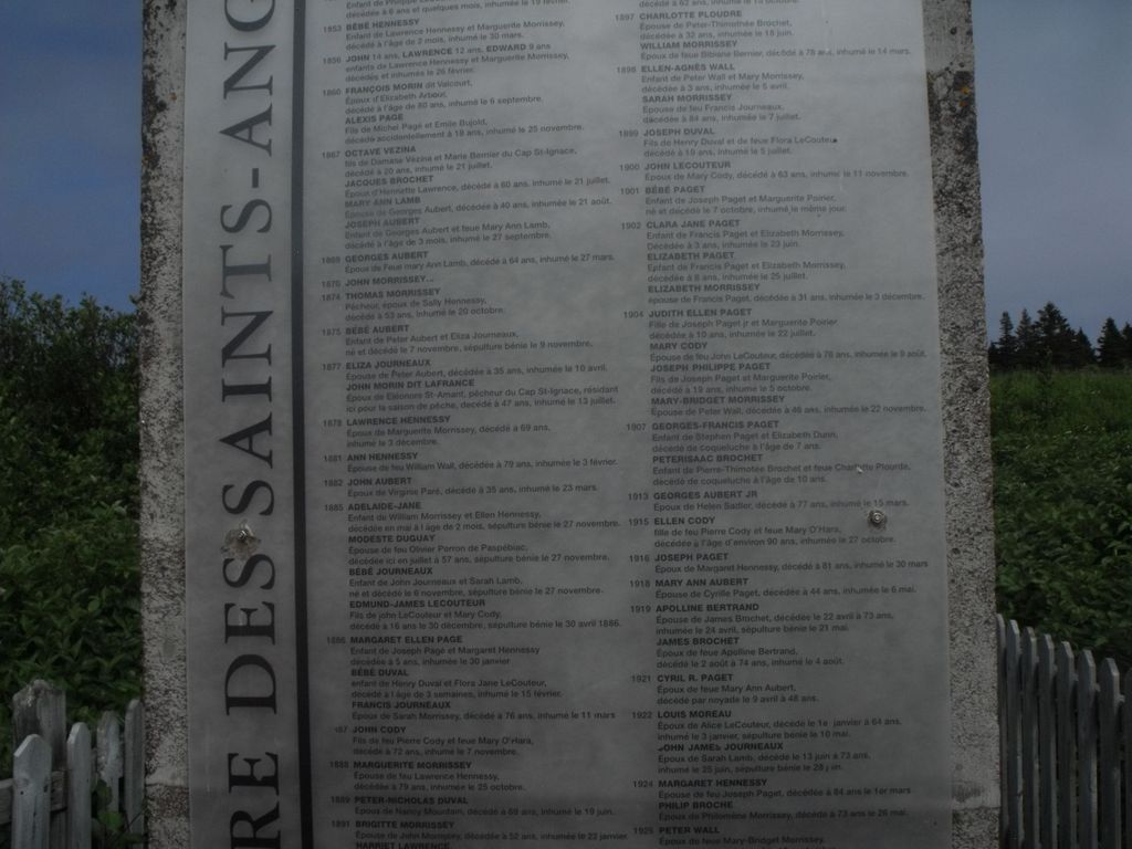
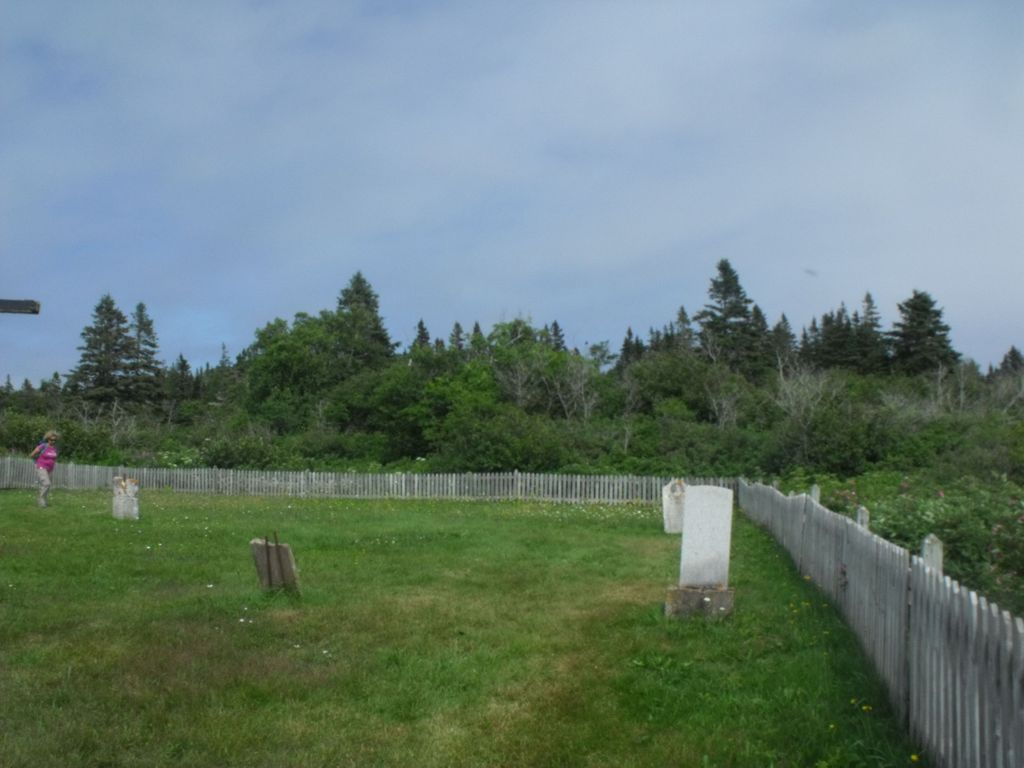
| Description | : | A Mission at Ile Bonaventure / Bonaventure Island dedicated to the Holy Guardian Angels operated 1857-1957 on land donated by George Aubert, native of Jersey. The chapel was erected by William Sheehan. The cemetery is located immediately east of the site of the former chapel, demolished in 1947. The oldest section of the cemetery is the northern side. Spouses wee buried together. A central cross was placed towards the centre of the cemetery to be viewed exiting from the chapel step.The small area of the cemetery was filled by 1925. The cemetery was augmented by a further enlargement to the... Read More |
frequently asked questions (FAQ):
-
Where is Saint Anges Ile Bonaventure?
Saint Anges Ile Bonaventure is located at clos Aubert, Ile Bonaventure Percé, Gaspesie-Iles-de-la-Madeleine Region ,Quebec ,Canada.
-
Saint Anges Ile Bonaventure cemetery's updated grave count on graveviews.com?
0 memorials
-
Where are the coordinates of the Saint Anges Ile Bonaventure?
Latitude: 48.4918400
Longitude: -64.1732900
Nearby Cemetories:
1. Sainte-Claire Ile Bonaventure
Percé, Gaspesie-Iles-de-la-Madeleine Region, Canada
Coordinate: 48.4977300, -64.1757800
2. Christ Church Hotel de Ville
Percé, Gaspesie-Iles-de-la-Madeleine Region, Canada
Coordinate: 48.5241900, -64.2095900
3. Saint-Michel Cemetery
Percé, Gaspesie-Iles-de-la-Madeleine Region, Canada
Coordinate: 48.5258170, -64.2173720
4. Saint-Georges-de-Malbaie
Saint-Georges, Gaspesie-Iles-de-la-Madeleine Region, Canada
Coordinate: 48.6555000, -64.2143500
5. Saint John's Anglican Cemetery
Sandy Beach, Gaspesie-Iles-de-la-Madeleine Region, Canada
Coordinate: 48.8119000, -64.4046400
6. Cimetiere St-Alban
Cap-des-Rosiers, Gaspesie-Iles-de-la-Madeleine Region, Canada
Coordinate: 48.8617834, -64.2095756
7. Cimetiere des Ancetres
Cap-des-Rosiers, Gaspesie-Iles-de-la-Madeleine Region, Canada
Coordinate: 48.8623937, -64.2069652
8. St-Coeur de Marie Cemetery
Chandler, Gaspesie-Iles-de-la-Madeleine Region, Canada
Coordinate: 48.3471500, -64.6951600
9. St. Paul's Anglican Church Cemetery
Gaspe, Gaspesie-Iles-de-la-Madeleine Region, Canada
Coordinate: 48.8255570, -64.4938610
10. Saint Albert de Gaspe
Gaspe, Gaspesie-Iles-de-la-Madeleine Region, Canada
Coordinate: 48.8389600, -64.4816800
11. St-Francois-d'Assise Cemetery
Pabos Mills, Gaspesie-Iles-de-la-Madeleine Region, Canada
Coordinate: 48.3184600, -64.7298900
12. St-James Anglican Church Cemetery Old Section
Wakeham, Gaspesie-Iles-de-la-Madeleine Region, Canada
Coordinate: 48.8262280, -64.5435331
13. St-James Anglican Church Cemetery New Section
Wakeham, Gaspesie-Iles-de-la-Madeleine Region, Canada
Coordinate: 48.8309728, -64.5428355
14. St. Dominique Cemetery
Newport Centre, Gaspesie-Iles-de-la-Madeleine Region, Canada
Coordinate: 48.2643410, -64.7456610
15. Cimetière Saint-Dominique
Chandler, Gaspesie-Iles-de-la-Madeleine Region, Canada
Coordinate: 48.2633200, -64.7457600
16. Cimetiere-des-Anges a /in St-Marjorique
Gaspesie-Iles-de-la-Madeleine Region, Canada
Coordinate: 48.8839129, -64.5371088
17. Miscou United Church & Cemetery
Miscou Centre, Gloucester County, Canada
Coordinate: 48.0150628, -64.5101353
18. Miscou Pentecostal Church & Cemetery
Miscou Plains, Gloucester County, Canada
Coordinate: 48.0088369, -64.5301700
19. Saint-Maurice de l'Échourie
Gaspe, Gaspesie-Iles-de-la-Madeleine Region, Canada
Coordinate: 49.0514100, -64.4750670
20. Saint Antoine de Padoue Roman Catholic Cemetery
Miscou Centre, Gloucester County, Canada
Coordinate: 47.9481720, -64.5628090
21. St. Andrew's United Cemetery
Port-Daniel, Gaspesie-Iles-de-la-Madeleine Region, Canada
Coordinate: 48.1891480, -65.0160040
22. Saint James Anglican Church Cemetery
Port-Daniel, Gaspesie-Iles-de-la-Madeleine Region, Canada
Coordinate: 48.1409000, -64.9901650
23. Saint Mark's United Cemetery
Miscou Plains, Gloucester County, Canada
Coordinate: 47.8991370, -64.5879250
24. Cimetière des Ancêtres et Premiers Colons
Petit-Shippegan, Gloucester County, Canada
Coordinate: 47.8815210, -64.5876830


