
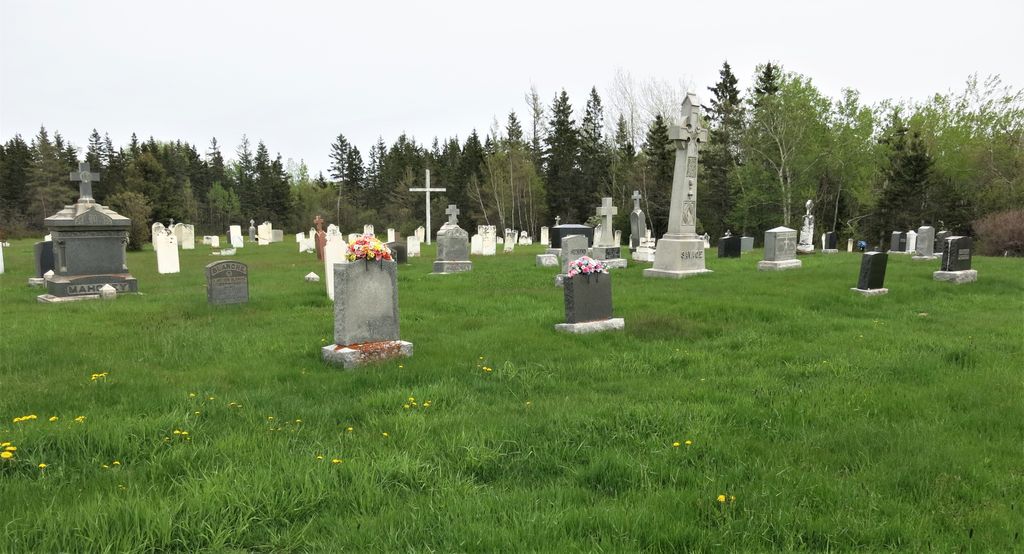
| Memorials | : | 1 |
| Location | : | Melrose, Westmorland County, Canada |
| Coordinate | : | 46.1016550, -63.9107330 |
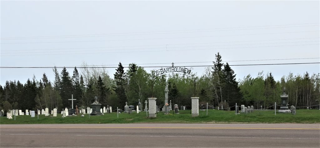
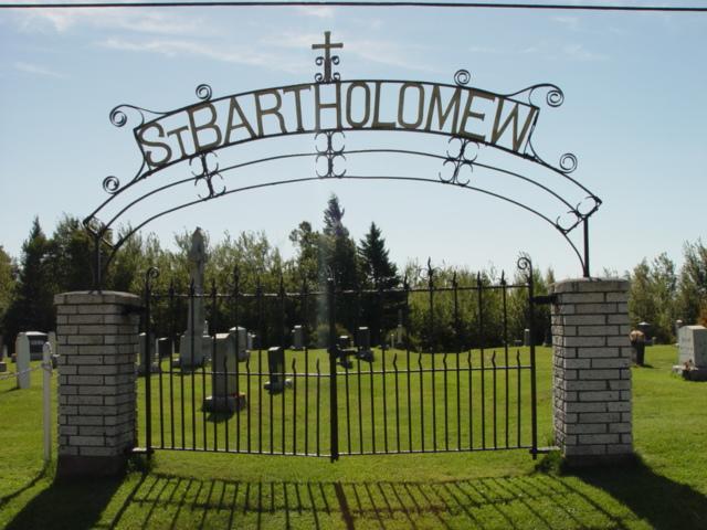
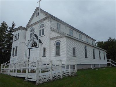
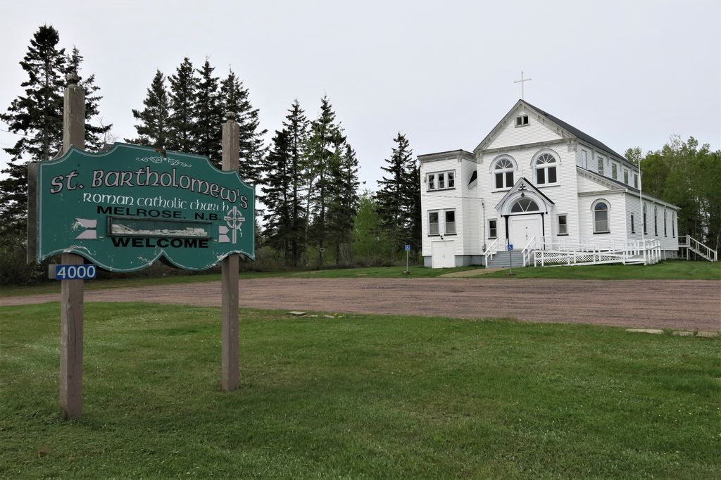
| Description | : | St. Bartholomew's Roman Catholic Church closed in 2018. It was founded in the 1820's when 60 families migrated to the area along what was then known as "Emigrant Road." The original church, a log cabin, was built on the farm of John Roach and was located at the site of the present cemetery. It was destroyed by fire and for 10 years the congregation met at the home of John Carroll. In 1902 the current church was built. Until 1907, the church was a mission of Cap-Pele, then after, Middle Sackville. In 2000, it... Read More |
frequently asked questions (FAQ):
-
Where is Saint Bartholomew's Cemetery?
Saint Bartholomew's Cemetery is located at 4000 Route 16 Melrose, Westmorland County ,New Brunswick ,Canada.
-
Saint Bartholomew's Cemetery cemetery's updated grave count on graveviews.com?
1 memorials
-
Where are the coordinates of the Saint Bartholomew's Cemetery?
Latitude: 46.1016550
Longitude: -63.9107330
Nearby Cemetories:
1. Pioneer Irish Cemetery
Melrose, Westmorland County, Canada
Coordinate: 46.1093300, -63.8812500
2. Upper Cape Cross Road Cemetery
Melrose, Westmorland County, Canada
Coordinate: 46.0893370, -63.9430440
3. Trenholm Cemetery
Spence Settlement, Westmorland County, Canada
Coordinate: 46.1423770, -63.8858410
4. Upper Cape Cemetery
Upper Cape, Westmorland County, Canada
Coordinate: 46.0584600, -63.9390600
5. Murray Cemetery
Little Shemogue, Westmorland County, Canada
Coordinate: 46.1468786, -63.9711233
6. Bayfield Cemetery
Bayfield, Westmorland County, Canada
Coordinate: 46.1381480, -63.8199890
7. Reade Cemetery
Bayside, Westmorland County, Canada
Coordinate: 46.0574170, -64.0156311
8. Pioneer Cemetery
Murray Corner, Westmorland County, Canada
Coordinate: 46.1782000, -63.9831300
9. Lorneville Cemetery
Lorneville, Cumberland County, Canada
Coordinate: 45.9841110, -63.9347650
10. Baxter's Cemetery
Lorneville, Cumberland County, Canada
Coordinate: 45.9800083, -63.9213889
11. Fort Gaspareaux
Port Elgin, Westmorland County, Canada
Coordinate: 46.0432400, -64.0706000
12. Amherst Shore Baptist Cemetery
Amherst Shore, Cumberland County, Canada
Coordinate: 45.9746626, -63.9016351
13. Oxley Cemetery
Tidnish Cross Roads, Cumberland County, Canada
Coordinate: 45.9934670, -64.0099350
14. Fernwood Cemetery
Port Elgin, Westmorland County, Canada
Coordinate: 46.0637300, -64.0908500
15. Saint Clement Cemetery
Port Elgin, Westmorland County, Canada
Coordinate: 46.0602220, -64.0894170
16. Saint James Presbyterian Church Cemetery Old
Port Elgin, Westmorland County, Canada
Coordinate: 46.0466900, -64.0889800
17. Chapman Settlement Cemetery
Chapman Settlement, Cumberland County, Canada
Coordinate: 45.9492150, -63.9182950
18. Tidnish Bridge Cemetery
Tidnish Bridge, Cumberland County, Canada
Coordinate: 45.9797300, -64.0478900
19. Baie Verte Cemetery
Baie-Verte, Westmorland County, Canada
Coordinate: 46.0270050, -64.1060830
20. Northport Hillside Cemetery
Northport, Cumberland County, Canada
Coordinate: 45.9427900, -63.8726200
21. Shemogue Cemetery
Shemogue, Westmorland County, Canada
Coordinate: 46.1431443, -64.1464963
22. Shemogue Presbyterian Cemetery
Shemogue, Westmorland County, Canada
Coordinate: 46.1484340, -64.1712680
23. Angus Cemetery
Northport, Cumberland County, Canada
Coordinate: 45.9155493, -63.8315635
24. Saint Timothee Cemetery
Shemogue, Westmorland County, Canada
Coordinate: 46.1547500, -64.1843600