
| Memorials | : | 0 |
| Location | : | Gierstädt, Landkreis Gotha, Germany |
| Coordinate | : | 51.0408740, 10.8230250 |
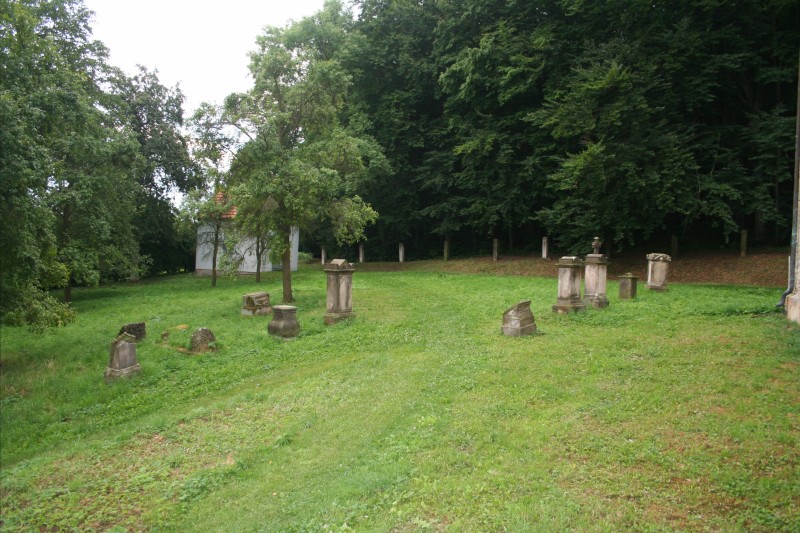
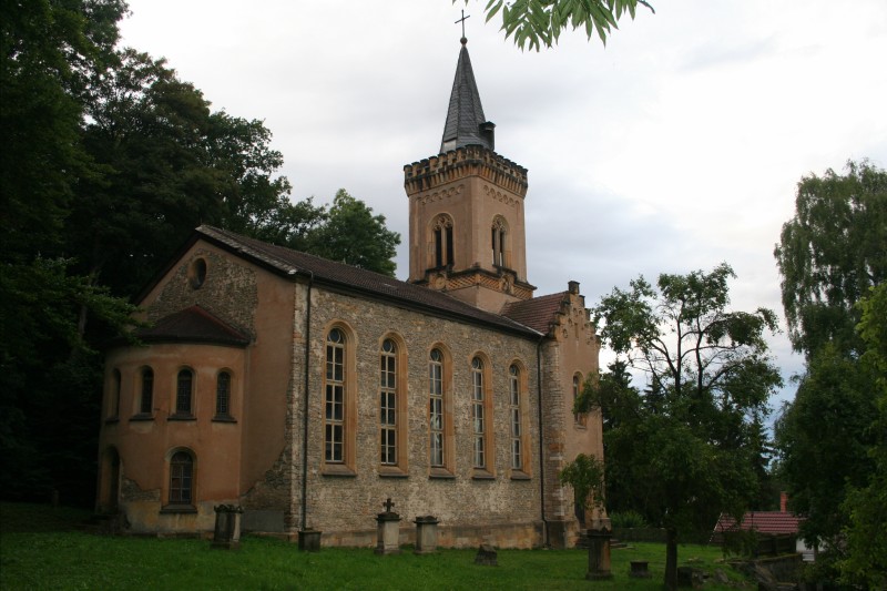
| Description | : | Remnants of the former cemetery by St. Bonifatius Church (the new cemetery is a few hundred meters to the east). This cemetery is no longer used for burials and many of the the remaining markers are worn or heavily damaged. |
frequently asked questions (FAQ):
-
Where is Saint Bonifatius Church Cemetery?
Saint Bonifatius Church Cemetery is located at Gierstädt, Landkreis Gotha ,Thüringen ,Germany.
-
Saint Bonifatius Church Cemetery cemetery's updated grave count on graveviews.com?
0 memorials
-
Where are the coordinates of the Saint Bonifatius Church Cemetery?
Latitude: 51.0408740
Longitude: 10.8230250
Nearby Cemetories:
1. Friedhof Gierstaedt
Gierstädt, Landkreis Gotha, Germany
Coordinate: 51.0405100, 10.8245910
2. Sankt Peter und Paul Friedhof
Grossfahner, Landkreis Gotha, Germany
Coordinate: 51.0567450, 10.8275980
3. Hauptfriedhof
Gotha, Landkreis Gotha, Germany
Coordinate: 50.9643730, 10.7093100
4. Siebleben Friedhof
Siebleben, Landkreis Gotha, Germany
Coordinate: 50.9431230, 10.7434460
5. Margarethenkirche
Gotha, Landkreis Gotha, Germany
Coordinate: 50.9502500, 10.7050000
6. Schlosskirche Friedenstein
Gotha, Landkreis Gotha, Germany
Coordinate: 50.9462680, 10.7045350
7. Hauptfriedhof
Erfurt, Stadtkreis Erfurt, Germany
Coordinate: 50.9699750, 10.9893130
8. Marktkirche St. Bonifacius
Bad Tennstedt, Unstrut-Hainich-Kreis, Germany
Coordinate: 51.1077780, 10.6477780
9. St. Stephan-Kirche
Unstrut-Hainich-Kreis, Germany
Coordinate: 51.1080560, 10.6466670
10. Friedhof Bad Langensalza
Bad Langensalza, Unstrut-Hainich-Kreis, Germany
Coordinate: 51.1181017, 10.6440989
11. Erfurter Dom
Erfurt, Stadtkreis Erfurt, Germany
Coordinate: 50.9758100, 11.0233400
12. Evangelelischer friedof kornhochheim
Neudietendorf, Landkreis Gotha, Germany
Coordinate: 50.9085125, 10.9096778
13. Augustinerkirche
Erfurt, Stadtkreis Erfurt, Germany
Coordinate: 50.9814580, 11.0301280
14. Predigerkirche
Erfurt, Stadtkreis Erfurt, Germany
Coordinate: 50.9766670, 11.0291670
15. Schottenkirche St. Nicolai und St. Jacobi
Erfurt, Stadtkreis Erfurt, Germany
Coordinate: 50.9797220, 11.0327780
16. Barfüßerkirche
Erfurt, Stadtkreis Erfurt, Germany
Coordinate: 50.9755560, 11.0300000
17. Franciscan Friary
Erfurt, Stadtkreis Erfurt, Germany
Coordinate: 50.9755480, 11.0302310
18. Friedhof Vehra
Vehra, Landkreis Sömmerda, Germany
Coordinate: 51.1489305, 10.9874960
19. Evangelischer Friedhof Kornhochheim
Kornhochheim, Landkreis Gotha, Germany
Coordinate: 50.9010121, 10.9158001
20. Straußfurt Cemetery
Straussfurt, Landkreis Sömmerda, Germany
Coordinate: 51.1720900, 10.9925320
21. Friedhof Schönstedt
Schonstedt, Unstrut-Hainich-Kreis, Germany
Coordinate: 51.1232232, 10.5766971
22. Friedhof Hörselgau
Horselgau, Landkreis Gotha, Germany
Coordinate: 50.9220793, 10.5794644
23. Mechterstädt Cemetery
Mechterstadt, Landkreis Gotha, Germany
Coordinate: 50.9500000, 10.5333300
24. Städtischer Friedhof Greußen
Greussen, Kyffhäuserkreis, Germany
Coordinate: 51.2308745, 10.9506411