
| Memorials | : | 80 |
| Location | : | Vine Grove, Hardin County, USA |
| Phone | : | 270-877-2461 |
| Coordinate | : | 37.7999992, -85.9875031 |
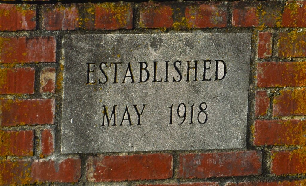
| Description | : | Saint Brigid Catholic Church was established in 1907 as a mission of Saint Patrick Catholic Church in Stithton, because a church was needed in the small rural town of Vine Grove. A building was purchased in 1908 from the Northern Methodist congregation. It served the little Catholic parish two Sundays of each month. The parish grew rapidly when the federal government acquired the community of Stithton and displaced the parishioners of Saint Patrick Church. In 1918, Saint Brigid was raised from a mission to a parish. The church was built in 1929. Saint Brigid operated a school from 1938 to... Read More |
frequently asked questions (FAQ):
-
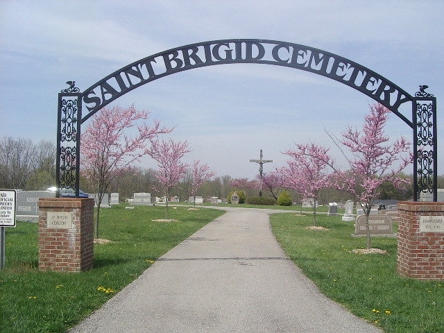
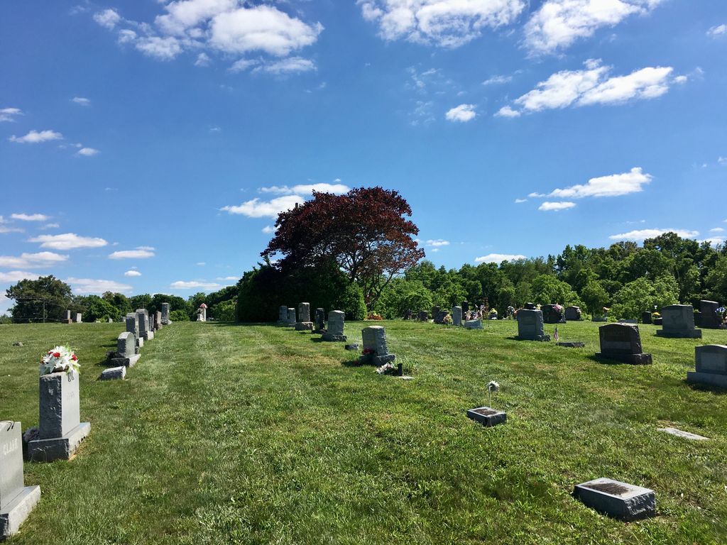
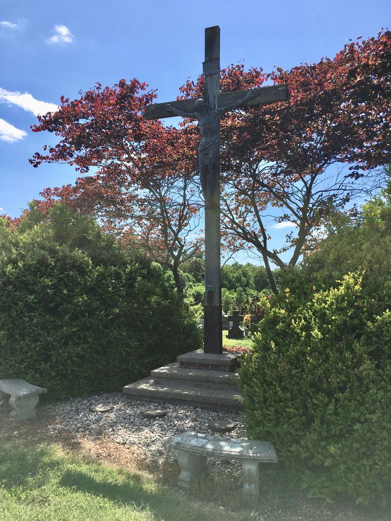
Where is Saint Brigid Cemetery?
Saint Brigid Cemetery is located at Vine Grove, Hardin County ,Kentucky ,USA.
-
Saint Brigid Cemetery cemetery's updated grave count on graveviews.com?
76 memorials
-
Where are the coordinates of the Saint Brigid Cemetery?
Latitude: 37.7999992
Longitude: -85.9875031
Nearby Cemetories:
1. Forks of Otter Creek Cemetery
Vine Grove, Hardin County, USA
Coordinate: 37.8072014, -86.0010986
2. Vine Grove Cemetery
Vine Grove, Hardin County, USA
Coordinate: 37.8126900, -85.9828300
3. Vine Grove Cemetery East
Vine Grove, Hardin County, USA
Coordinate: 37.8079450, -85.9718800
4. Stith-Branham Family Cemetery
Vine Grove, Hardin County, USA
Coordinate: 37.8157501, -85.9726486
5. Howell Methodist Church Cemetery
Vine Grove, Hardin County, USA
Coordinate: 37.7785988, -86.0093994
6. Tarpley Cemetery
Hardin County, USA
Coordinate: 37.7708015, -86.0147018
7. Stovall United Methodist Church Cemetery
Hardin County, USA
Coordinate: 37.8172360, -85.9452240
8. North Hardin Memorial Gardens
Radcliff, Hardin County, USA
Coordinate: 37.8191986, -85.9460983
9. Rineyville Memorial Cemetery
Hardin County, USA
Coordinate: 37.7550011, -85.9805984
10. Swan Cemetery
Meade County, USA
Coordinate: 37.8244019, -86.0569000
11. Hynes Cemetery
Meade County, USA
Coordinate: 37.8588982, -86.0021973
12. Shelton Cemetery #2
Hardin County, USA
Coordinate: 37.8356018, -85.9250031
13. Mill Creek Baptist Church Cemetery
Hardin County, USA
Coordinate: 37.8292470, -85.9178010
14. Shelton Cemetery #1
Fort Knox, Hardin County, USA
Coordinate: 37.8128014, -85.9068985
15. New Salem Baptist Church Cemetery
Vine Grove, Hardin County, USA
Coordinate: 37.7968900, -86.0704700
16. Ridge Spring United Methodist Church Cemetery
Hardin County, USA
Coordinate: 37.7381140, -86.0248030
17. Gunning Cemetery
Fort Knox, Hardin County, USA
Coordinate: 37.8036003, -85.9005966
18. Arms Cemetery
Hardin County, USA
Coordinate: 37.7705994, -86.0697021
19. Kentucky Veterans Cemetery Central
Radcliff, Hardin County, USA
Coordinate: 37.8683472, -85.9611511
20. Lewis Cemetery
Hardin County, USA
Coordinate: 37.7386017, -86.0385971
21. Stithon Cemetery
Hardin County, USA
Coordinate: 37.8669014, -85.9449997
22. Tarpley Cemetery
Fort Knox, Hardin County, USA
Coordinate: 37.8672060, -85.9454330
23. Saint Martin of Tours Cemetery
Flaherty, Meade County, USA
Coordinate: 37.8336280, -86.0749980
24. Fort Knox Cemetery #101
Fort Knox, Hardin County, USA
Coordinate: 37.8761280, -85.9688740