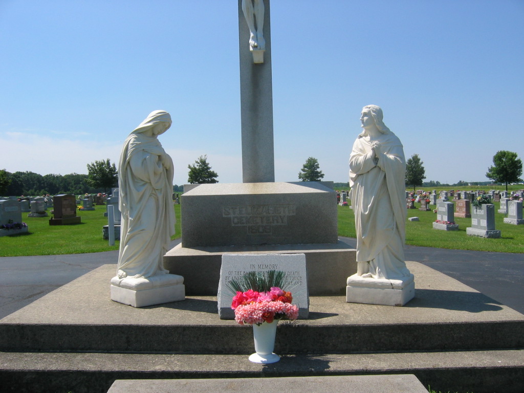
| Memorials | : | 158 |
| Location | : | Coldwater, Mercer County, USA |
| Coordinate | : | 40.4785995, -84.6166992 |
| Description | : | The cemetery is located on the south side of Ohio State Route 219 about 0.4 miles west of its intersection with Fleetfoot Road. There used to be a Holy Trinity Church Cemetery, but all burials were moved to this cemetery. The old site is now a parking lot. The cemetery is located in Butler Township, Mercer County, Ohio, and is # 7810 (Saint Elizabeth Catholic Cemetery / Saint Elizabeth Cemetery) in “Ohio Cemeteries 1803-2003”, compiled by the Ohio Genealogical Society. The U.S. Geological Survey (USGS) Geographic Names Information System (GNIS) feature ID for the cemetery is 1045455 (Saint... Read More |
frequently asked questions (FAQ):
-
Where is Saint Elizabeth Cemetery?
Saint Elizabeth Cemetery is located at 4812 Ohio State Route 219 Coldwater, Mercer County ,Ohio , 45828USA.
-
Saint Elizabeth Cemetery cemetery's updated grave count on graveviews.com?
114 memorials
-
Where are the coordinates of the Saint Elizabeth Cemetery?
Latitude: 40.4785995
Longitude: -84.6166992
Nearby Cemetories:
1. Frank-Bone Cemetery
Coldwater, Mercer County, USA
Coordinate: 40.4814750, -84.6192390
2. Holy Trinity Cemetery (Defunct)
Coldwater, Mercer County, USA
Coordinate: 40.4807530, -84.6278920
3. Young Cemetery
Coldwater, Mercer County, USA
Coordinate: 40.4580060, -84.6262800
4. Burntwood Cemetery
Mercer, Mercer County, USA
Coordinate: 40.4949989, -84.5899963
5. Saint Marys Cemetery
Coldwater, Mercer County, USA
Coordinate: 40.4536018, -84.6544037
6. Marion Township Colored Cemetery
Carthagena, Mercer County, USA
Coordinate: 40.4427681, -84.5714645
7. Carthagena Black Cemetery
Carthagena, Mercer County, USA
Coordinate: 40.4361260, -84.5712370
8. Saint Aloysius Cemetery
Carthagena, Mercer County, USA
Coordinate: 40.4364967, -84.5703506
9. Burdge Cemetery
Montezuma, Mercer County, USA
Coordinate: 40.4860992, -84.5402985
10. Missionaries of the Precious Blood Cemetery
Carthagena, Mercer County, USA
Coordinate: 40.4314010, -84.5644270
11. Swamp College Cemetery
Celina, Mercer County, USA
Coordinate: 40.5372009, -84.6585999
12. Saint Henry Church Cemetery
Saint Henry, Mercer County, USA
Coordinate: 40.4133797, -84.6382904
13. Petrie Cemetery
Celina, Mercer County, USA
Coordinate: 40.5424995, -84.5843964
14. Ellis Cemetery
Montezuma, Mercer County, USA
Coordinate: 40.4795341, -84.5259781
15. Our Lady of Guadalupe Cemetery
Montezuma, Mercer County, USA
Coordinate: 40.4797120, -84.5245800
16. Mercer Memory Gardens
Celina, Mercer County, USA
Coordinate: 40.5517120, -84.6055145
17. Saint Marys Catholic Cemetery
Celina, Mercer County, USA
Coordinate: 40.5522690, -84.5730133
18. Long Cemetery
Mercer County, USA
Coordinate: 40.4660988, -84.5117035
19. Saint Sebastian Cemetery
Sebastian, Mercer County, USA
Coordinate: 40.4437740, -84.5163440
20. Simison Cemetery
Mercer County, USA
Coordinate: 40.3952940, -84.5893190
21. Hottel Cemetery
Celina, Mercer County, USA
Coordinate: 40.5310560, -84.7084520
22. Cassella Cemetery
Cassella, Mercer County, USA
Coordinate: 40.4061584, -84.5521774
23. Lauber Cemetery
Wendelin, Mercer County, USA
Coordinate: 40.4074821, -84.6865616
24. Saint Francis Catholic Church Cemetery
Cranberry Prairie, Mercer County, USA
Coordinate: 40.3932991, -84.5816803


