
| Memorials | : | 26 |
| Location | : | Longhorsley, Northumberland Unitary Authority, England |
| Coordinate | : | 55.2432500, -1.7588200 |
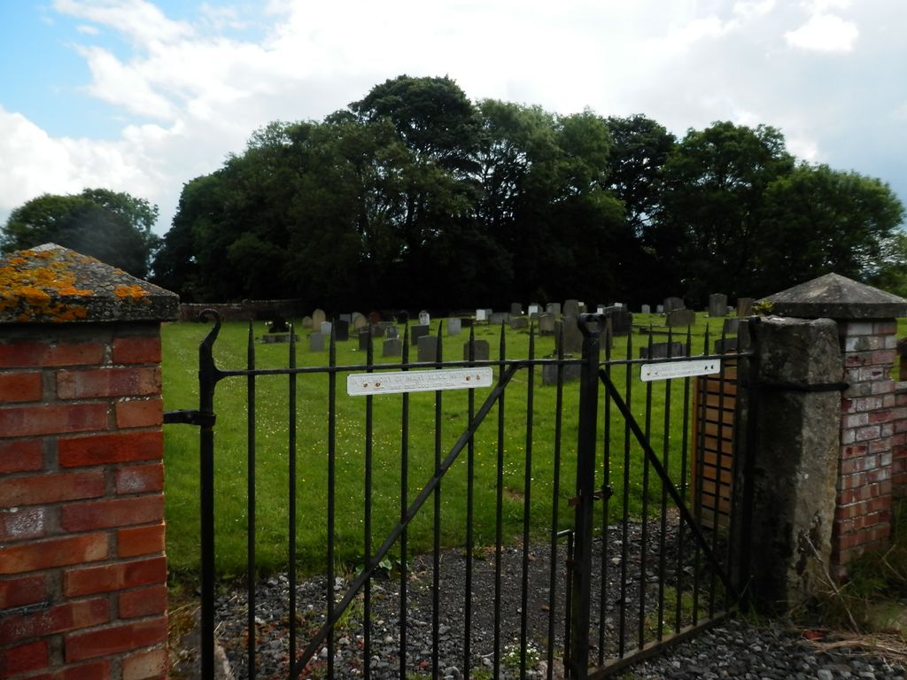
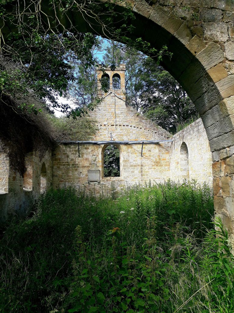
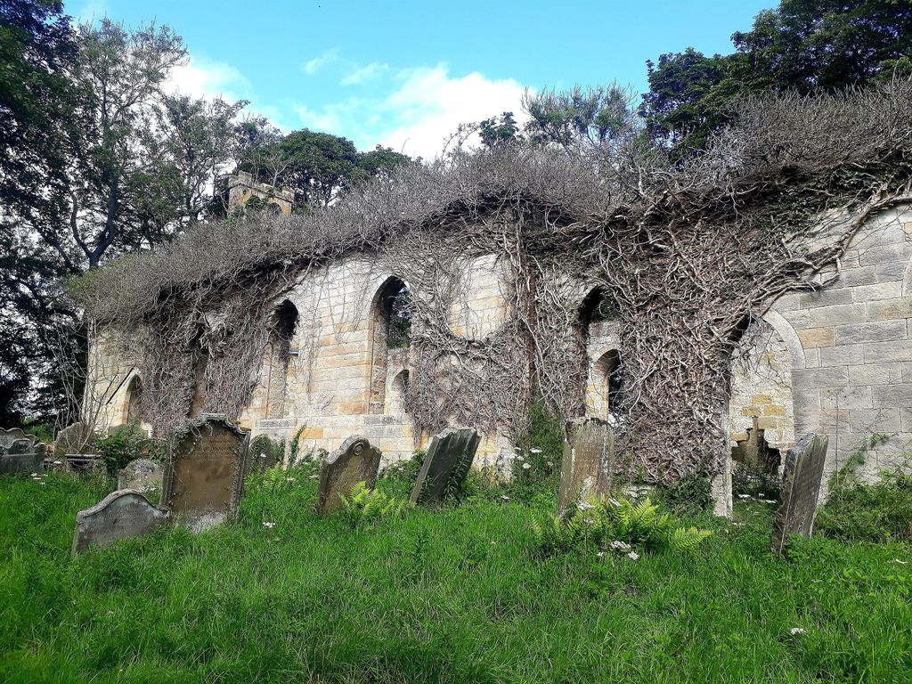
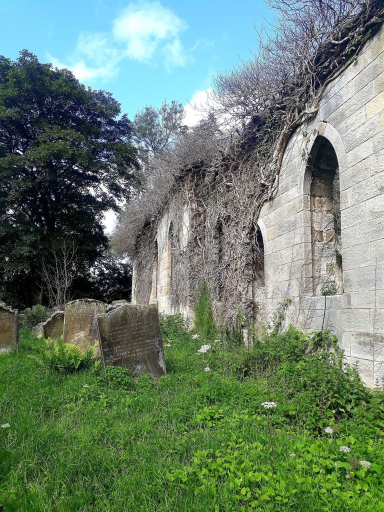
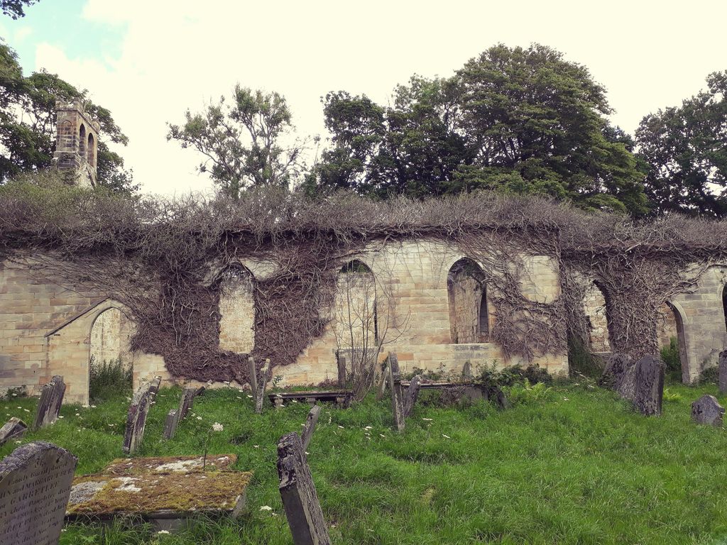
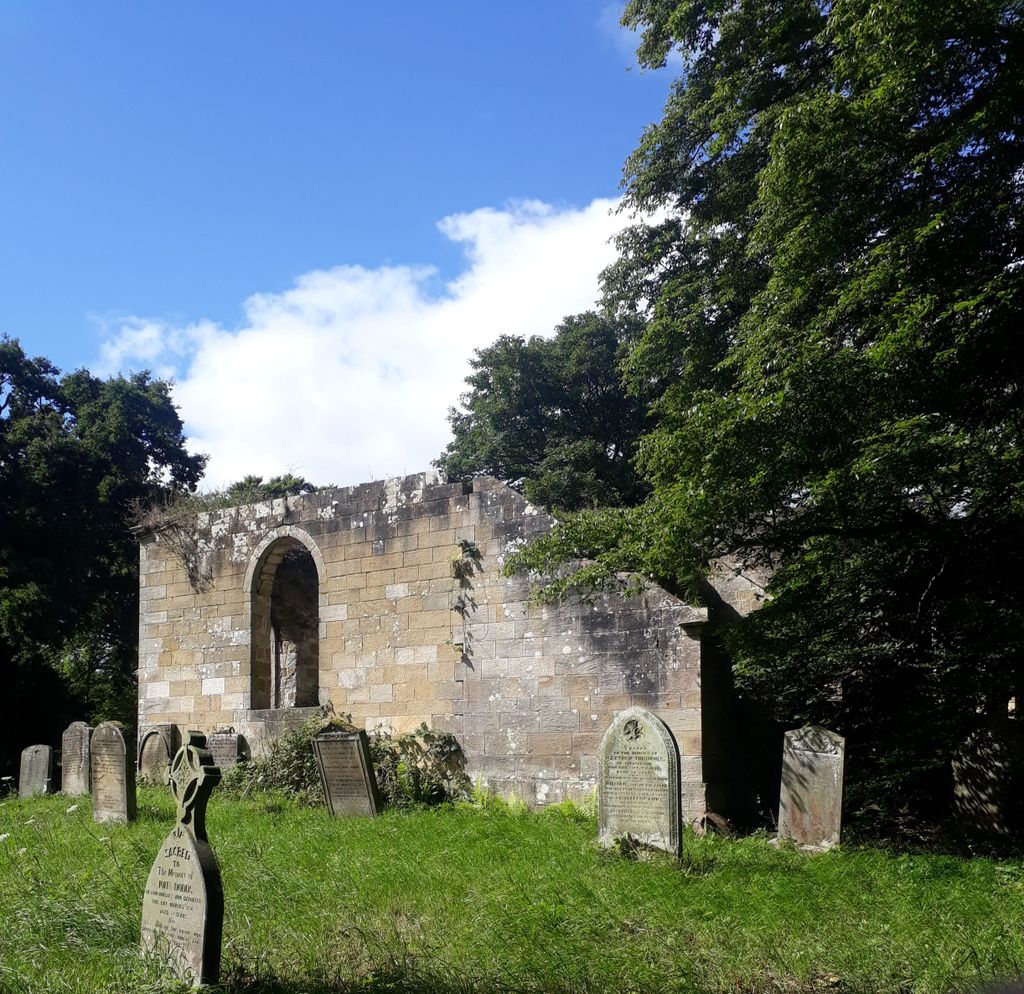
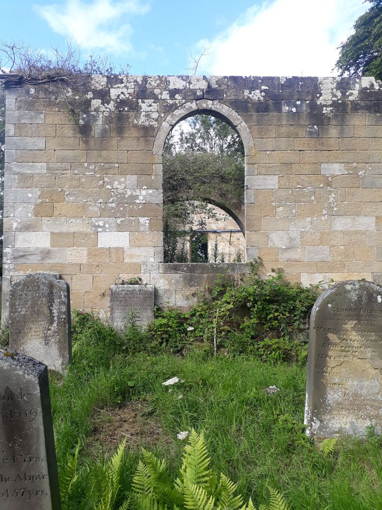
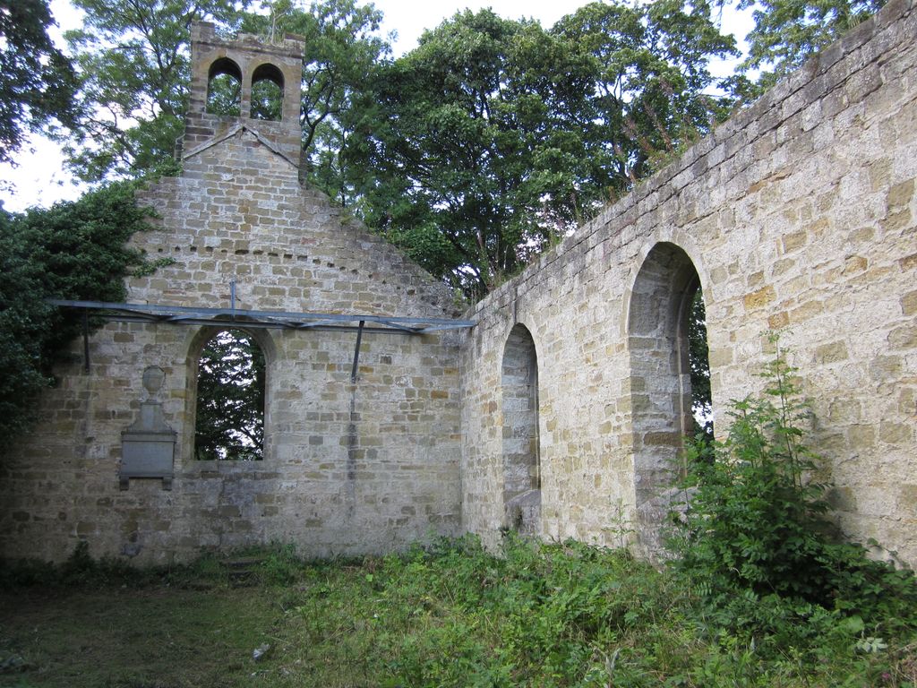
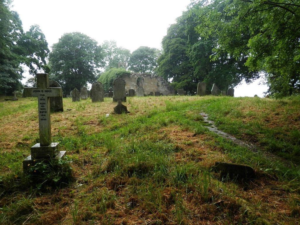
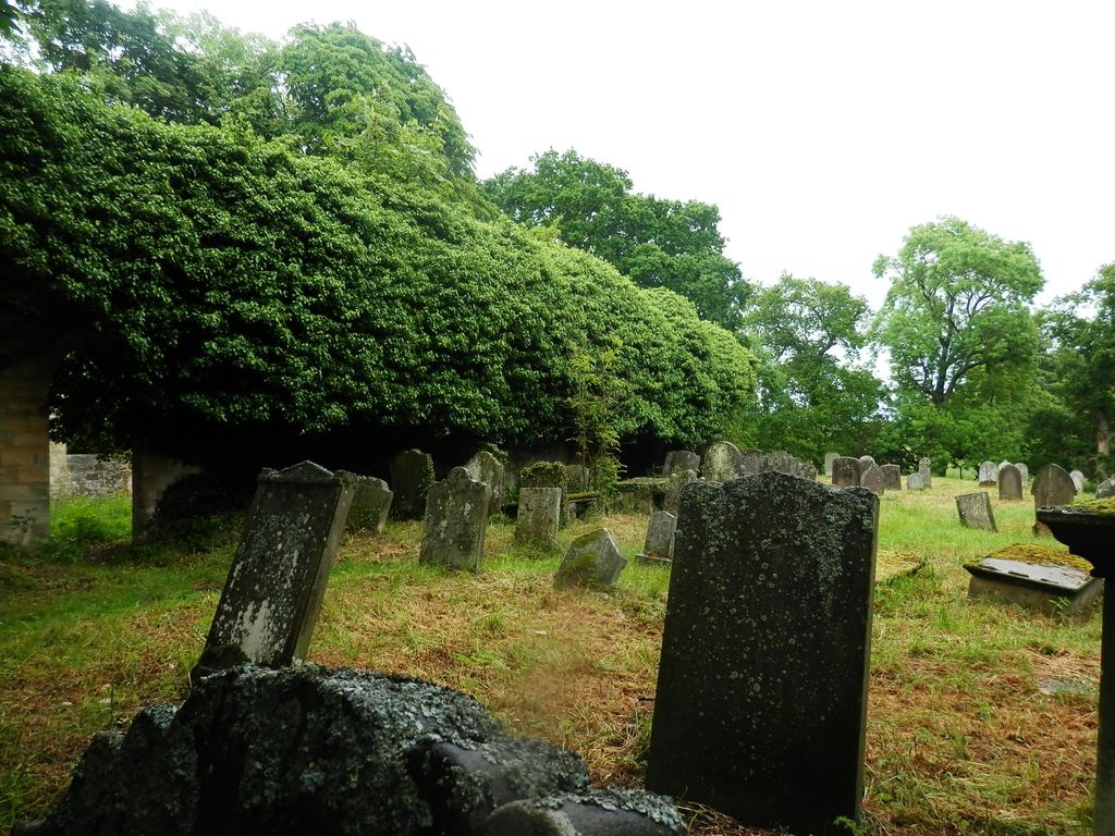
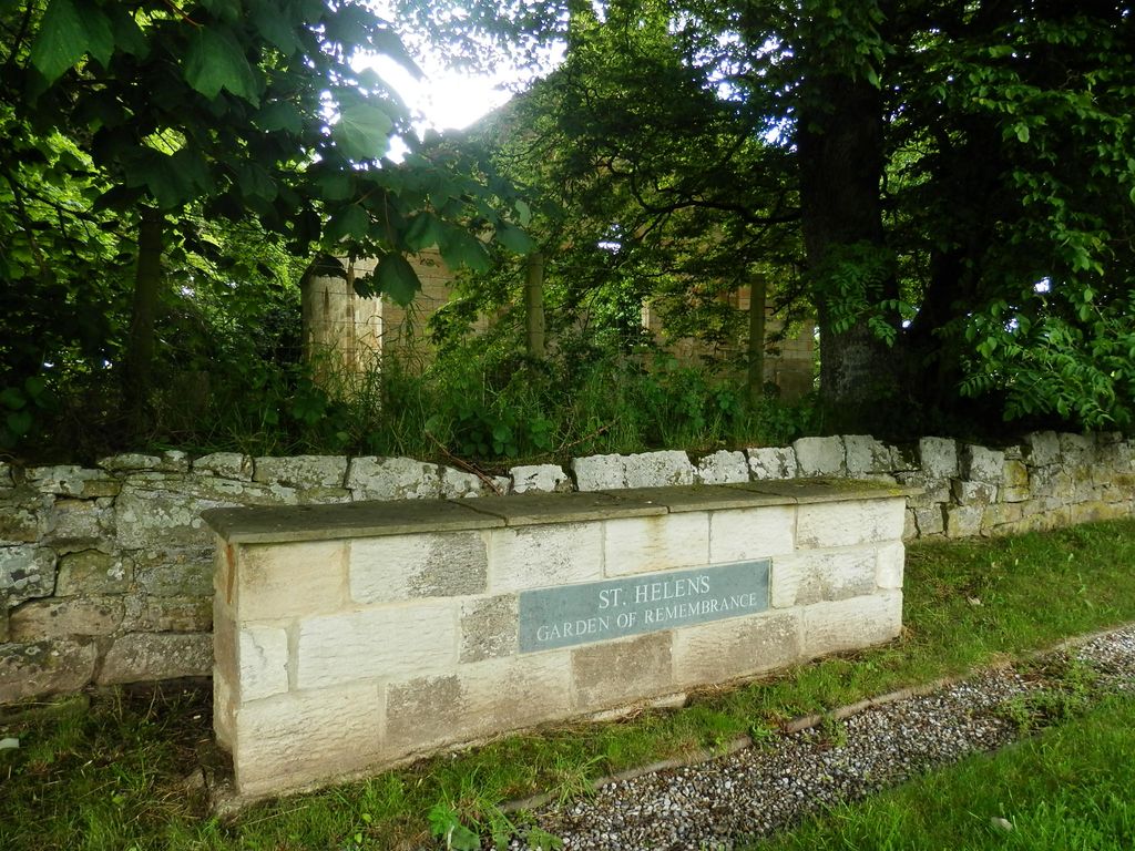
| Description | : | The churchyard, still in use, is half a mile south of Longhorsley village. The ruined Norman church of St Helen’s possibly replaced a wooden Saxon building. The earliest record of a vicar here is from 1299. In 1783 the church was entirely rebuilt on the old foundations. It was a plain structure, the main feature being an attractive trefoil chancel arch. Lack of facilities and the need for extensive renovation made it necessary to abandon it in 1966. When the old church was closed, the old school building in the village was converted into the parish church, also named St Helen’s.... Read More |
frequently asked questions (FAQ):
-
Where is Saint Helen’s Churchyard?
Saint Helen’s Churchyard is located at Longhorsley, Northumberland Unitary Authority ,Northumberland ,England.
-
Saint Helen’s Churchyard cemetery's updated grave count on graveviews.com?
21 memorials
-
Where are the coordinates of the Saint Helen’s Churchyard?
Latitude: 55.2432500
Longitude: -1.7588200
Nearby Cemetories:
1. Brinkburn Priory
Brinkburn, Northumberland Unitary Authority, England
Coordinate: 55.2788120, -1.8191170
2. Brinkburn Priory and Manor House
Longframlington, Northumberland Unitary Authority, England
Coordinate: 55.2789620, -1.8194090
3. St Cuthbert Churchyard
Hebron, Northumberland Unitary Authority, England
Coordinate: 55.2023450, -1.6963700
4. Longframlington Church Cemetery Extension
Longframlington, Northumberland Unitary Authority, England
Coordinate: 55.3014700, -1.7950600
5. Fairmoor Cemetery
Morpeth, Northumberland Unitary Authority, England
Coordinate: 55.1861980, -1.7163260
6. St Mary the Virgin Churchyard
Longframlington, Northumberland Unitary Authority, England
Coordinate: 55.3028950, -1.7952920
7. Felton Cemetery
Felton, Northumberland Unitary Authority, England
Coordinate: 55.3020920, -1.7118410
8. Longframlington Cemetery
Longframlington, Northumberland Unitary Authority, England
Coordinate: 55.3085440, -1.8003926
9. Saint Mary Magdalene Churchyard
Mitford, Northumberland Unitary Authority, England
Coordinate: 55.1645410, -1.7363020
10. Saint John's Churchyard
Longhirst, Northumberland Unitary Authority, England
Coordinate: 55.1936200, -1.6474840
11. Newminster Abbey
Morpeth, Northumberland Unitary Authority, England
Coordinate: 55.1664000, -1.7044070
12. St. Mary the Virgin Church
Morpeth, Northumberland Unitary Authority, England
Coordinate: 55.1598990, -1.6917760
13. St. Mary the Virgin Churchyard
Morpeth, Northumberland Unitary Authority, England
Coordinate: 55.1597110, -1.6921530
14. St. John the Divine Churchyard
Acklington, Northumberland Unitary Authority, England
Coordinate: 55.3106000, -1.6435000
15. Saint Andrews Churchyard
Hartburn, Northumberland Unitary Authority, England
Coordinate: 55.1683350, -1.8596667
16. Chevington Cemetery
Alnwick, Northumberland Unitary Authority, England
Coordinate: 55.2905270, -1.6148670
17. St. John Churchyard
Meldon, Northumberland Unitary Authority, England
Coordinate: 55.1489650, -1.8144770
18. St Andrew's Churchyard
Bothal, Northumberland Unitary Authority, England
Coordinate: 55.1731340, -1.6205890
19. St Andrew Churchyard
Bolam, Northumberland Unitary Authority, England
Coordinate: 55.1376680, -1.8565600
20. Saint Aidens Churchyard
Ashington, Northumberland Unitary Authority, England
Coordinate: 55.1826900, -1.5781400
21. Saint Bartholomew’s Churchyard
Cresswell, Northumberland Unitary Authority, England
Coordinate: 55.2331200, -1.5444900
22. Amble West Cemetery
Amble, Northumberland Unitary Authority, England
Coordinate: 55.3311820, -1.5922950
23. St. Paul's Churchyard
Choppington, Northumberland Unitary Authority, England
Coordinate: 55.1494290, -1.6009780
24. Lynemouth Cemetery
Lynemouth, Northumberland Unitary Authority, England
Coordinate: 55.2031759, -1.5361996