| Memorials | : | 115 |
| Location | : | Seattle, King County, USA |
| Phone | : | 206-937-4545 |
| Coordinate | : | 47.5759560, -122.3866190 |
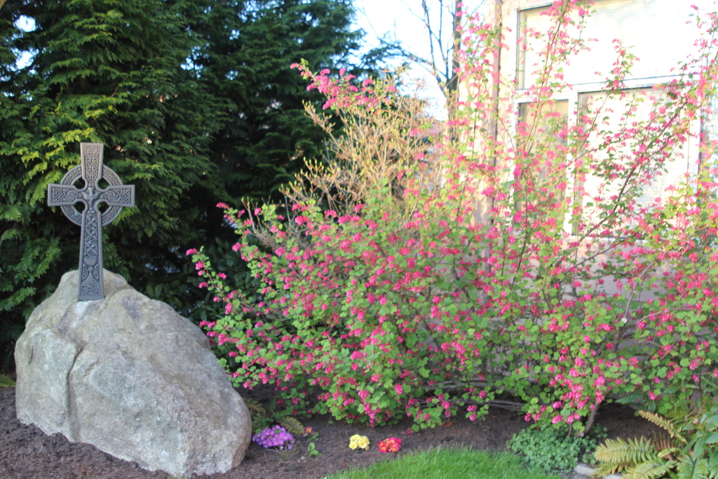
| Description | : | Memorial garden known as "The Churchyard" located on the grounds of Saint John the Baptist Episcopal Church in West Seattle. As per Episcopal tradition, ashes are interred directly into the ground in designated plots. Each plot may hold two individuals, at varying depths of burial. Markers with names of interred individuals line the edge of the garden. Interments began in 1984 when The Churchyard was established. (There are seven individuals who passed prior to 1984 that were either not previously buried or were re-located here in 1984.) Contact the church office for a map of plot locations. |
frequently asked questions (FAQ):
-
Where is Saint John the Baptist Episcopal Churchyard?
Saint John the Baptist Episcopal Churchyard is located at 3050 California Avenue SW Seattle, King County ,Washington , 98116USA.
-
Saint John the Baptist Episcopal Churchyard cemetery's updated grave count on graveviews.com?
115 memorials
-
Where are the coordinates of the Saint John the Baptist Episcopal Churchyard?
Latitude: 47.5759560
Longitude: -122.3866190
Nearby Cemetories:
1. First Lutheran Church of West Seattle Columbarium
West Seattle, King County, USA
Coordinate: 47.5663000, -122.3870000
2. Forest Lawn Cemetery
Seattle, King County, USA
Coordinate: 47.5421982, -122.3666992
3. Trinity Episcopal Parish Memorial Courtyard
Seattle, King County, USA
Coordinate: 47.6053220, -122.3263560
4. Saint James Roman Catholic Cathedral Crypt
Seattle, King County, USA
Coordinate: 47.6075000, -122.3262000
5. Beacon Hill Presbyterian Church Memorial Garden
Seattle, King County, USA
Coordinate: 47.5621990, -122.3120440
6. Seattle Cemetery (Defunct)
Seattle, King County, USA
Coordinate: 47.6191530, -122.3409240
7. Saint Pauls Episcopal Church Memorial Garden
Seattle, King County, USA
Coordinate: 47.6254120, -122.3558890
8. Seattle First Baptist Church Columbarium
Seattle, King County, USA
Coordinate: 47.6124610, -122.3221970
9. Comet Lodge Cemetery
Seattle, King County, USA
Coordinate: 47.5469370, -122.3051580
10. Church of the Ascension Episcopal Columbarium
Seattle, King County, USA
Coordinate: 47.6391740, -122.4012910
11. Magnolia Lutheran Church Columbarium
Seattle, King County, USA
Coordinate: 47.6399755, -122.3973688
12. Mount Pleasant Cemetery
Seattle, King County, USA
Coordinate: 47.6432800, -122.3662643
13. Queen Anne Columbarium
Seattle, King County, USA
Coordinate: 47.6432000, -122.3644000
14. Hills of Eternity Reform Cemetery
Seattle, King County, USA
Coordinate: 47.6441994, -122.3643036
15. King County International Airport Memorial
Seattle, King County, USA
Coordinate: 47.5359001, -122.3014984
16. Saint Mark's Episcopal Cathedral Columbarium
Seattle, King County, USA
Coordinate: 47.6319000, -122.3208000
17. Lake View Cemetery
Seattle, King County, USA
Coordinate: 47.6342010, -122.3143997
18. Grand Army of the Republic Cemetery
Seattle, King County, USA
Coordinate: 47.6363602, -122.3162994
19. Fort Lawton Cemetery
Seattle, King County, USA
Coordinate: 47.6601181, -122.4055252
20. Port Blakely Cemetery
Bainbridge Island, Kitsap County, USA
Coordinate: 47.6011140, -122.5199390
21. Hillcrest Cemetery
Bainbridge Island, Kitsap County, USA
Coordinate: 47.6131570, -122.5332960
22. Mercer Island Congregational Church Memorial Garde
Mercer Island, King County, USA
Coordinate: 47.5639670, -122.2255330
23. Phinney Ridge Lutheran Church Columbarium
Seattle, King County, USA
Coordinate: 47.6837900, -122.3549100
24. Emmanuel Episcopal Church Columbarium
Mercer Island, King County, USA
Coordinate: 47.5668590, -122.2237860

